weather.gov
National Oceanic and Atmospheric Administration's
National Weather Service
Site Map
News
Organization
Search
NWS
All NOAA
Home
> GFS MOS Guidance > CONUS Area
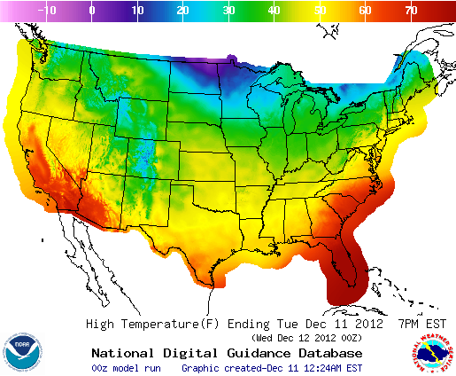
This map shows
GFS MOS Guidance
for the United States. This is a product of the National Digital Guidance Database, produced by NOAA's National Weather Service. Public
comments and suggestions
are encouraged.
GFS-MOS - CONUS Area
Daily View
Weekly View
Loops
Image List
|
Help
|
Metric Units
|
Compare
Go to Region
Click On Map Below To Zoom In
Mouse over the table below to change the forecast image.
Max/Min Temperature
6Hr Prob. of Precipitation
12Hr Prob. of Precipitation
6Hr Amount of Precip.
12Hr Amount of Precip.
24Hr Snow Amount
Temperature
Dewpoint
Sky Cover
Relative Humidity
Wind Speed & Direction
Wind Gust
3Hr Prob. of Thunderstorm
6Hr Prob. of Thunderstorm
12Hr Prob. of Thunderstorm
Next Image
Table MouseOver Effect On
Table MouseOver Effect Off
|
About NDFD Graphics
|
FAQ
|
Product Description Document
|
Survey/Comments
|
Details
|
US Dept of Commerce
National Oceanic and Atmospheric Administration
National Weather Service
1325 East West Highway
Silver Spring, MD 20910
Page Author:
NWS Internet Services Team
Disclaimer
Information Quality
Credits
Glossary
Privacy Policy
Freedom of Information Act (FOIA)
About Us
Career Opportunities