A seagull flies over the California Coastal National Monument which stretches along the entire coast of California and extends 12 miles into the Pacific Ocean.  The Monument includes 20,000 rocks, islands, pinnacles and reefs.
BLM
U.S. DEPARTMENT OF THE INTERIOR
BUREAU OF LAND MANAGEMENT
Headwaters Forest Reserve King Range National Conservation Area Kayaker enjoying the California Coastal National Monument Bighorn Sheep King Range National Conservation Area
California
BLM>California>Arcata
Print Page
Arcata Field Office

Arcata Field Office


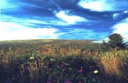
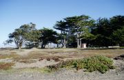
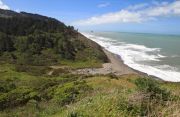
The Arcata Field Office is responsible for the administration of natural resources, lands, and mineral programs on approximately 200,000 acres of public land in Northwestern California. The Area includes the 60,000 acre King Range National Conservation Area and the 7,472 acre Headwaters Forest Reserve. We welcome you to BLM Arcata - Enjoy Your Visit!!


Headwaters Redwood Forest in the fog with understory in the foreground.People standing on a bluff overlooking the King Range and Lost Coast.Trinidad beach with the rocks and islands of Trinidad Bay and harbor from a beach perspective.Dune vegetation and dunes with trees on top of the sand dune in the distance.

Headwaters Forest Reserve

King Range National Conservation Area

Trinidad Gateway to the California Coastal National Monument

Ma-le'l Dunes Cooperative Management Area

Forested mountains and a blue sky in Lacks Creek watershed.Bright blue sky with clouds and dune vegetation of Mike Thompson Wildlife Area South Spit Humboldt Bay.Cypress trees and dunes at the Samoa Dunes Recreation Area.Beach, Pacific Ocean and bottom portion of Fleener Creek Watershed from the bluffs of the Lost Coast Headlands.

Lacks Creek Management Area

Mike Thompson Wildlife Area, South Spit Humboldt Bay

Samoa Dunes Recreation Area

Lost Coast Headlands

Little Darby Nature Trail


News

California Coastal National Monument, National Public Lands Day, September 29, 2012

BLM Announces Fire Restrictions for Lands Managed by Arcata Field Office

Fortuna's East High School Receives National BLM Recognition

Agencies Will Loan Tools to Defeat Scotch and French Broom.

Snowy Plover Protection Measures Now in Place at South Spit.

The King Range Wilderness and Rocks and Islands Wilderness Management Plan and associated environmental assessment (EA) are now available online. 

Travis Ranch Right-of-Way Environmental Assessment is now available. To obtain a copy please contact the Arcata Field Office at, (707) 825-2300 or dfuller@blm.gov, or stop by our office at 1695 Heindon Road, Arcata. All comments on the EA must be received by May 9, 2012.

March 20th, Story of Headwaters Forest to be Featured in Upcoming Free Lectures, 7 p.m. in the Healy Senior Center, 456 Briceland Rd., Redway

Students learning, building at Little Darby News.bytes Extra, issue 522 

King Range Wilderness and Rocks and Islands Wilderness Draft Management Plan available for public review and comment.

Top 10 points of interest


Important Information

Lacks Creek Management Area Management Plan Update
Lacks Creek Management Area Management Plan  Environmental Assessment 
King Range National Conservation Area Approved Resource Management Plan and Record of Decision (ROD)
King Range National Conservation Area Proposed Management Plan and Final EIS 


Lynda J. Roush, Field Manager
Bureau of Land Management
Arcata Field Office
1695 Heindon Road
Arcata, CA 95521-4573
Phone: (707) 825-2300
Fax: (707) 825-2301
Office Hours: 7:45 a.m. - 4:30 p.m., M-F
Contact us by Email