


Mapping the Response to BP Oil Spill in the Gulf of Mexico
The dynamic nature of the BP oil spill has been a challenge for a range of communities – from hotel operators to fishermen to local community leaders. We know the American people have questions about how the federal government is responding to this crisis, and we are committed to providing the answers with clarity and transparency. The site you’re viewing right now is a symbol of that commitment.
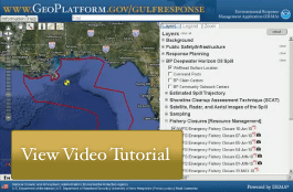
GeoPlatform.gov/gulfresponse is a new online tool that provides you with near-real time information about the response effort. Developed by NOAA with the EPA, U.S. Coast Guard, and the Department of Interior, the site offers you a “one-stop shop” for spill response information.
The site integrates the latest data the federal responders have about the oil spill’s trajectory with fishery area closures, wildlife data and place-based Gulf Coast resources — such as pinpointed locations of oiled shoreline and current positions of deployed research ships — into one customizable interactive map.
GeoPlatform.gov/gulfresponse employs the Environmental Response Management Application (ERMA®) a web-based GIS platform developed by NOAA and the University of New Hampshire’s Coastal Response Research Center. ERMA was designed to facilitate communication and coordination among a variety of users — from federal, state and local responders to local community leaders and the public. The site was designed to be fast and user-friendly, and we plan to keep it constantly updated.
Click the map below to use the tool yourself and see the latest information about the oil spill’s trajectory, shipping information, fishery closures and where responders are taking action.

Using this tool
- After clicking the map below, you’ll see the latest information about the oil spill’s trajectory, the position of NOAA’s research ships, spilled oil’s coastal location and the areas closed to shipping.
- To see other popular collections of information, click on the “Bookmarks” tab in the upper right-hand corner of the site. These are popular views of the data in the system.
- You can see other information displayed on the map, by clicking other layer check boxes in the area to the right of the map.
- Want to know more about what’s being displayed on the map? Click the “Legends” Tab to see the legend information for the currently active layers.
- Click the “Help” Tab to find out more about the tools.
Want more information about the data you’re seeing in the tool?
Take a look at this document describing each of the currently available data layers [pdf].
Information Quality
This site was constructed for the purpose of presenting response-relevant data in the affected region of the Gulf of Mexico relative to the Mississippi Canyon 252/ Deepwater Horizon BP Oil Spill.
For the purpose of timely release, data contained within this site have undergone a limited Quality Assurance review; however, the data have not yet undergone final verification. Users of these data should refer to the original sources to review the limitations of the data from individual studies and to check for accuracy.
The data provided through this tool has been cleared for release through the Incident Command Structure's Joint Information Command.