Science Features
The tropics are undergoing profound, rapid landscape change. Humid tropical regions occupy about a quarter of Earth’s land surface, yet they contribute a substantially higher fraction of the water, solutes, and sediment discharged to the world’s oceans. Nearly half of Earth’s population lives in the tropics where development stresses can potentially harm soil resources, water quality, water supply, and increase landslide and flood hazards.

El Yunque Peak as seen across the Mameyes River valley. El Yunque National Forest, Puerto Rico.
“As our influence on Earth’s lands and waters grows more substantial, we need to understand and quantify these effects to preserve our well-being,” said Matt Larsen, USGS Associate Director for Climate and Land Use Change. “Earth sciences are central to meeting this need because they guide the monitoring, assessment, and modeling of natural processes that help us to understand our interaction with the environment.”
Puerto Rico is representative of rapid, ongoing change in the tropics. Many agricultural lands are undergoing reforestation, while coastal areas are becoming heavily urbanized. The area is also changing because of the introduction of nonnative species, water supply projects, and the construction of roads and other kinds of infrastructure. Slower, larger scale factors are also at work in environmental change, such as the deposition of airborne pollutants and natural and human-induced climate change.
In eastern Puerto Rico, four humid-tropical watersheds exhibit varying types of underlying geology while their waters flow through or near the mature forest of the Luquillo Experimental Forest (also known as the El Yunque National Forest). Lying within a relatively small geographic footprint, the four watersheds provide a natural laboratory that allows scientists to quantify and characterize landscape change in this region.
In recognition of this opportunity, scientists from the USGS have conducted research in eastern Puerto Rico for several decades, in collaboration with scientists from the U.S. Forest Service. The scientists’ aim is to study hydrologic, geologic, geomorphic (Earth-shaping), and anthropogenic (human-driven) processes in the area with the goal of generalizing their investigation to the broader tropical world.
These findings have recently been published by the USGS. Because eastern Puerto Rico resembles many tropical regions in terms of geology and patterns of development, implications from this study are transferable to other tropical regions facing deforestation, rapid land-use change, and climate change.
Location, location — and precipitation
Focusing on four small watersheds in eastern Puerto Rico allowed the scientists to integrate studies of hydrologic and chemical processes. Two watersheds are located on coarse-grained granitic rocks; two are located on fine-grained volcanic rocks. For each bedrock type, one watershed is covered with mature rainforest. The other two watersheds, like most of the rest of Puerto Rico, were subjected to intensive agriculture in the 19th and early 20thcentury, but they have been undergoing reforestation as a result of a shift from an agricultural economy to an industrial one and the related human migration to urban areas.

The long term study focused on four watersheds that have varied geology and land cover characteristics.
Owing to the island’s steep topography, low water-storage capacity, and dependence on trade-wind precipitation, Puerto Rico’s people, ecosystems, and water supply are vulnerable to extreme weather such as hurricanes, floods, and droughts. At the same time, rainfall varies greatly over small distances in eastern Puerto Rico, based on differences in elevation, topographic position and aspect, and proximity to the ocean.
Puerto Rico lies directly in the path of the easterly trade winds, which deliver steady rainfall to the mountains and steer weather systems called tropical waves toward the island. Hurricanes and tropical storms derived from these systems typically deliver the majority of yearly rainfall, but northern cold fronts can also deliver heavy rainfall for several days at a time, usually from December through February.
These rain events vary greatly in frequency and intensity, contributing to substantial differences in annual precipitation. A unique aspect of this study is that USGS scientists sampled and chemically analyzed river water during major storms using automated equipment. Such intense storms had never before been studied in this manner.
The largest storms can have profound geomorphic consequences, such as landslides, debris flows, and deep gullying on deforested lands. Past deforestation and agricultural activities in the developed watersheds led to greatly accelerated erosion and soil loss. Rates of erosion in two forested watersheds were considerably higher than expected, presenting a new area for future study.
Regional weather patterns and the sources of air masses influence the type and timing of atmospheric contributions to the land. Eastern Puerto Rico receives marine salts and Saharan Desert dust in rainfall, while nitrogen loads in precipitation have roughly doubled since measurements began in 1985.
A matrix of factors in landscape change
The 15-year Water, Energy, and Biogeochemical Budget dataset, including data on stream discharge, field parameters, suspended sediment, and nutrients, is available from the USGS National Water Information System (NWIS). The dataset provides a baseline for characterizing future environmental change in eastern Puerto Rico and will improve our understanding of the interdependencies of land, water, and biological resources and their responses to changes in climate and land use.
Publication Citation

A sampling of historic hurricanes that have hit Puerto Rico. Large storms can have profound geomorphic (land changing) consequences.
Links and resources
USGS Caribbean Water Science Center
USGS Water Data for Puerto Rico

The majority of the nation is still experiencing abnormally dry conditions, even after soaking rains from Isaac. Read more

While Hurricane Isaac has passed, scientific work to understand the storm’s impact on Gulf Coast states continues. Read more

Real-time map showing the extent of flooding (black dots) and drought (red dots) in the U.S. Read more

USGS scientists, engineers, and technicians are working along the Gulf coast in response to Hurricane Isaac. Read more

The U.S. Geological Survey is keeping careful watch as Tropical Storm Isaac continues to track northwest toward the west coast of Florida and the Gulf of Mexico. Read more

USGS scientists look to see if water quality is improving. Read more

The majority of the nation is facing dry conditions; in most areas drought conditions are expected to persist or intensify. Read more
Kati is a USGS student employee studying water and traveling the California coast. Read more

This year, a large dead zone again threatens the Gulf of Mexico. Read more

Please comment on the USGS’ draft science strategies! Read more

Are you surprised the water bubbles look so small? Read more

USGS Details how climate change could affect water availability in 14 U.S. Basins. Read more

Travis Gibson shares insight into the life a USGS hydrologic technician for one of the USGS water science centers out west. Read more

The USGS plays an integral role in the new U.S. Water Partnership, which will bring together public and private resources to address water challenges around the world.

Timing is everything! Consider helping track changes in spring’s arrival

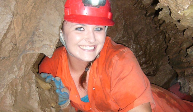
Meet one of the next generation of USGS physical scientists.

Flood Safety Awareness Week is March. 12-16. What can you do to prepare?

National Groundwater Awareness Week is Mar. 11-17, 2012. See how USGS science is connecting groundwater and surface water.

Since Japan’s March 11, 2011, Tohoku earthquake and subsequent tsunami, scientists at the USGS have learned much to help better prepare for a large earthquake in the United States.

Five USGS employees honored with Distinguished Service Awards for their service to the nation

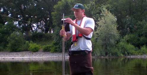
Meet a member of the next generation of USGS hydrologic technicians.
Meet a member of the next generation of USGS hydrologic technicians.
It’s National Invasive Species Awareness Week. Did you know invasive species cost our country more than 100 billion dollars each year? Get to know America’s ten top invaders this week.

Groundwater in aquifers on the East Coast and in the Central U.S. has the highest risk of contamination from radium, a naturally occurring radioactive element and known carcinogen.

The proposed USGS budget reflects research priorities to respond to nationally relevant issues, including water quantity and quality, ecosystem restoration, hydraulic fracturing, natural disasters such as floods and earthquakes, and support for the National Ocean Policy, and has a large R&D component.

Four new reports examine the contaminants polycyclic aromatic hydrocarbons (PAHs) found in house dust, streams, lakes, soil, and air.

Exploding lakes in Cameroon, Africa, have killed people and livestock. Find out how USGS science is helping prevent such an event from occurring again.
A summer intern turned permanent employee discusses his career path. Most memorable moment

Oct. 9-15, 2011, is Earth Science Week, themed "Our-Ever Changing Earth," and Oct. 12, 2011, is International Day for Natural Disaster Reduction. Answers to questions posed by a changing world

As the team of responders struggled to end the worst oil spill in our Nation’s history, USGS scientist Paul Hsieh provided the critical scientific information needed to make a crucial decision.

After years of planning, the Department of the Interior has begun removing two dams on the Elwha River in Washington. But how will the removal of these dams impact the river’s sediments, waters, and fish?

As a nation, we use more than 75 billion gallons of groundwater each day. September 13 is the National Groundwater Association’s “Protect Your Groundwater Day.” What we can do to ensure we continue to have enough of it?
USGS scientists are working to characterize the contaminants and habitats for a number of aquatic species along the lower Columbia River.
The effects of drought are felt throughout the United States and the world, and USGS science has a prominent role in understanding the causes and consequences of this hydrological phenomenon.
USGS crews continue to measure streamflow and collect water quality and sediment samples in the Ohio and Mississippi River basins using state-of-art instruments.
Many communities in South Dakota, North Dakota, Montana, Colorado, Wyoming and Iowa are dealing with record floodwaters and bracing for more flooding in the upcoming weeks.

The most recent earthquake in Japan affected water levels in groundwater wells all over the country. Water level fluctuations were recorded as far away as Illinois, Virginia, Missouri and Florida.

Groundwater is one of our most vital natural resources. The USGS studies the quantity and quality of the nation's groundwater. Learn about USGS research in an aquifer near you.
Learn how 3-D modeling is used to examine groundwater and how this cutting edge science is used to solve tomorrow's problems today.
The Great Lakes are the largest freshwater system on Earth. However the basin has the potential for local shortages, according to a new basin-wide water availability assessment by the USGS.
The Department of the Interior has established a new website to find and share websites that provide water conservation and sustainability information.
The USGS is providing information on arsenic levels at the town level in Maine to protect human health and further promote citizen participation in State well-testing programs.
Water Security is the protection of adequate water supplies for food, fiber, industrial, and residential needs for expanding populations, which requires maximizing water-use efficiency, developing new supplies, and protecting water reserves in event of scarcity due to natural, manmade, or technological hazards.
Decreases in stream flow, which are often caused by human activities, affect the integrity of aquatic life in streams, according to a new USGS study.
The USGS and the National Weather Service have developed a new flood inundation map tool that enables management officials and residents to see where the potential threat of flooding is the highest along the Flint River near Albany, Georgia.
Looking for information on natural resources, natural hazards, geospatial data, and more? The USGS Education site provides great resources, including lessons, data, maps, and more, to support teaching, learning, K-12 education, and university-level inquiry and research.
The Chesapeake Bay has long been an R&R destination for DC residents. However, the watershed’s overpopulation contributes to its decline. Join us when USGS’s Scott Phillips and Peter Claggett discuss new science efforts applied to restoring the Nation's largest estuary on October 6th.
The "Flood and high flow" map shows the location of streamgages where the water level is currently above or near flood stage. Find out what rivers and creeks near you are doing.
Nutrient sources in both agricultural and urban areas contribute to elevated nutrient concentrations in streams and groundwater across the Nation.
USGS is playing a critical role in the federal government's coordinated Deepwater Horizon response efforts.
Population growth in the Kabul Basin, Afghanistan, due in part to returning refugees, is estimated to lead to a six-fold increase in drinking water needs by 2057. The USGS has worked in partnership with the Afghanistan Geological Survey to address questions of future water availability.
Flash flooding is one of the major causes of natural hazard-related deaths in the United States and is hard to predict, but data collected by the USGS is crucial to formulating better predictive models.
Did you know that contaminant-ridden dust from Africa may be harming coral reefs in the Caribbean? Scientists at the USGS are examining the air in Africa and in the Caribbean to determine what kinds of nutrients, microbes, and contaminants are traveling across the ocean.
Pharmaceutical manufacturing facilities can be a significant source of pharmaceuticals in surface water. The USGS is working with water utilities to try to reduce the release of pharmaceuticals and other emerging contaminants to the environment.
The United States Group on Earth Observations (USGEO) is working to connect Earth observations with public health, agriculture, climate, and data management and dissemination.
The USGS Science Strategy is a comprehensive report to critically examine the USGS's major science goals and priorities for the coming decade. The USGS is moving forward with these strategic science directions in response to the challenges that our Nation's future faces and for the stewards of our Federal lands.

In response to Hurricane Isaac, USGS has deployed several hundred storm surge sensors to collect information about the effects of Isaac on the Gulf Coast.

7 p.m.—Public lecture (also live-streamed over the Internet)

Join us on August 1 to learn more about the anatomy of flooding: What are the different causes of these extreme events, and how is USGS science helping prepare residents for future foods.

Join us in Menlo Park for our Evening Lecture on Scanning the Seafloor with Sound!

Stressed agricultural lands may be releasing less of the moisture needed to protect the breadbasket of a continent.

The U.S. Geological Survey had a very busy 2011 — below are a few of our highlights from last year.

Over the next 10 years, the USGS plans to conduct a new assessment of water availability and use. This national Water Census will address critical aspects of recent Federal legislation, including the need to establish a national water assessment program.

Recent USGS research shows that climate, vegetation, groundwater recharge rate, and proximity of the contaminants to the water table can all affect and control natural removal rates.
USGS scientists will join thousands of scientists, managers, and decision makers in Boston this week to present new findings on toxics at the Society for Environmental Toxicology and Chemistry (SETAC) conference in the Hynes Convention Center, Nov. 13-17.

On Nov. 3, USGS scientists Patrick Barnard and William Ellsworth will present a public lecture in Menlo Park, CA, providing Bay Area residents information about USGS research in the San Francisco Bay Area, including recent discoveries beneath San Francisco Bay and ongoing studies to better understand earthquake probabilities and the potential hazards associated with strong ground shaking.

Rivers and streams in the United States are releasing substantially more carbon dioxide into the atmosphere than previously thought.

Meet the R/V Muskie and the R/V Kaho, the USGS Great Lakes Science Center's two newest additions to its Great Lakes research fleet!

![]() U.S. Department of the Interior |
U.S. Geological Survey
U.S. Department of the Interior |
U.S. Geological Survey
URL: www.usgs.gov/blogs/features/usgs_top_story/an-island-in-time-a-15-year-study-of-land-and-water-in-puerto-rico/?from=textlink
Page Contact Information: Ask USGS
Page Last Modified: September 14, 2011


