Yellowstone Volcano Observatory
= Yellowstone National Park
= Caldera
Yellowstone Monthly Update
Friday, August 31, 2012 6:32 PM MDT
Current Volcano Alert Level: NORMAL
Current Aviation Color Code: GREEN
Friday, August 31, 2012 6:32 PM MDT
Current Volcano Alert Level: NORMAL
Current Aviation Color Code: GREEN


The Yellowstone Volcano Observatory provides timely monitoring and hazard assessment of volcanic, hydrothermal, and earthquake activity in the Yellowstone Plateau region.
Features
(archive)
Quick Links
YVO Webcam Has a New Home!
June 15, 2012
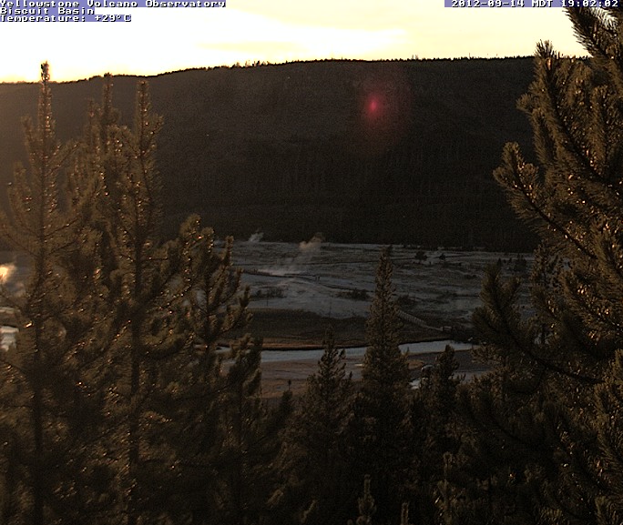 The YVO webcam has been moved from its old location at Lake Butte to a new vista above Biscuit Basin, at the north end of Upper Geyser Basin in Yellowstone National Park. The new camera offers a view of an area that has historically hosted a variety of rock-hurling hydrothermal (steam) eruptions. With this vantage point, it is possible that the camera will capture a similar event in the future.
Taking the Temperature of Yellowstone from Space
June 08, 2012
We all know Yellowstone is hot… but how hot? And how can we detect park- or basin-wide changes in geothermal areas (regions that let off Earth’s internal heat) that may take place over months, or years? USGS geologist Greg Vaughan and other YVO colleagues recently studied Yellowstone’s thermal areas by looking at satellite-based remote sensing data from two NASA satellites. Using satellites that orbit around Earth to measure heat released from Yellowstone's hottest regions produced results that are similar ground-based measurements. Therefore, these space-based remote sensing methods can save time and assist in determining changes in thermal areas that may be too remote to access on foot. Vaughan and others published their findings in the July 2012 issue of the Journal of Volcanology and Geothermal Research. For more information, read the web article Taking the Temperature of Yellowstone from Space.
Yellowstone Region Internet Mapping Service Now Available
March 27, 2012
The USGS now hosts a new geology information internet map service for the Yellowstone Plateau area. This useful tool was created by the Wyoming State Geological Survey (WSGS), with funding from the USGS through an American Recovery and Reinvestment Act cooperative agreement. The internet map service and accompanying geological data server can be used by scientists, land managers and anyone wishing to learn more about the geology of Yellowstone. Based around the 2001 Geological Map of the Yellowstone Plateau Area by Robert Christiansen (USGS) the ARC GIS service delivers geologic maps, topographic bases, and information on trails, roads, thermal areas, and a variety of other features. It also lists monitoring infrastructure and can take the user to the relevant real-time seismic or deformation data. The map server is also available via the Wyoming State Geological Survey, and most of the related data can be obtained through their website.
Here are some questions you can answer with the Yellowstone IMS:
Surface Displacements in Yellowstone Catalogued
March 26, 2012
USGS geologist Dan Dzurisin and coauthors recently completed a long-term compilation of geodetic data from Yellowstone, summarizing data campaigns to constrain uplift and subsidence cycles in the Yellowstone Caldera with techniques including leveling surveys, GPS stations and InSAR. Dzurisin and colleagues discuss various models to explain the remarkable dynamism of the caldera with its frequent alternating cycles of movement. They conclude that uplift and subsidence are controlled by a complex interplay of deep input of basaltic magma, degassing and crystallization of the overlying rhyolite, and fluid transport out of the caldera toward the north. The entire report is available online, which includes a web-based archive of geodetic benchmarks used for the GPS and leveling studies.
June 15, 2012
The YVO webcam has been moved from its old location at Lake Butte to a new vista above Biscuit Basin, at the north end of Upper Geyser Basin in Yellowstone National Park. The new camera offers a view of an area that has historically hosted a variety of rock-hurling hydrothermal (steam) eruptions. With this vantage point, it is possible that the camera will capture a similar event in the future.
Taking the Temperature of Yellowstone from Space
June 08, 2012
We all know Yellowstone is hot… but how hot? And how can we detect park- or basin-wide changes in geothermal areas (regions that let off Earth’s internal heat) that may take place over months, or years? USGS geologist Greg Vaughan and other YVO colleagues recently studied Yellowstone’s thermal areas by looking at satellite-based remote sensing data from two NASA satellites. Using satellites that orbit around Earth to measure heat released from Yellowstone's hottest regions produced results that are similar ground-based measurements. Therefore, these space-based remote sensing methods can save time and assist in determining changes in thermal areas that may be too remote to access on foot. Vaughan and others published their findings in the July 2012 issue of the Journal of Volcanology and Geothermal Research. For more information, read the web article Taking the Temperature of Yellowstone from Space.
Yellowstone Region Internet Mapping Service Now Available
March 27, 2012
The USGS now hosts a new geology information internet map service for the Yellowstone Plateau area. This useful tool was created by the Wyoming State Geological Survey (WSGS), with funding from the USGS through an American Recovery and Reinvestment Act cooperative agreement. The internet map service and accompanying geological data server can be used by scientists, land managers and anyone wishing to learn more about the geology of Yellowstone. Based around the 2001 Geological Map of the Yellowstone Plateau Area by Robert Christiansen (USGS) the ARC GIS service delivers geologic maps, topographic bases, and information on trails, roads, thermal areas, and a variety of other features. It also lists monitoring infrastructure and can take the user to the relevant real-time seismic or deformation data. The map server is also available via the Wyoming State Geological Survey, and most of the related data can be obtained through their website.
Here are some questions you can answer with the Yellowstone IMS:
- What geological units will my hike pass through?
- How many earthquakes have occurred at Yellowstone so far this year?
- Was the latest earthquake located near the caldera boundary?
- Where are thermal areas found in the Central Plateau?
- Where does high resolution topographic data (LiDAR) exist at Yellowstone?
- What is the closest seismometer to my hotel/home/campsite?
Surface Displacements in Yellowstone Catalogued
March 26, 2012
USGS geologist Dan Dzurisin and coauthors recently completed a long-term compilation of geodetic data from Yellowstone, summarizing data campaigns to constrain uplift and subsidence cycles in the Yellowstone Caldera with techniques including leveling surveys, GPS stations and InSAR. Dzurisin and colleagues discuss various models to explain the remarkable dynamism of the caldera with its frequent alternating cycles of movement. They conclude that uplift and subsidence are controlled by a complex interplay of deep input of basaltic magma, degassing and crystallization of the overlying rhyolite, and fluid transport out of the caldera toward the north. The entire report is available online, which includes a web-based archive of geodetic benchmarks used for the GPS and leveling studies.
Publications
Featured Articles
Internet Mapping Service
Yellowstone Volcanic History
Yellowstone Hazards
University of Utah Seismographs
University of Utah Research Group
Images, Podcasts, Videos, and Webcams
Frequently Asked Questions
Quick Facts
Location: Wyoming and Montana
Latitude: 44.615° N
Longitude: 110.6° W
Elevation: 2,805 (m) 9,203 (f)
Volcano type: Caldera
Composition: basalt to rhyolite
Most recent eruption: 70,000 years ago—lava, current—hydrothermal explosions