Top News of the Day
Recently Issued: Public Information   
Watches &
Warnings
Observations Forecast Graphics Rivers &
Lakes
 Climate  Fire Weather
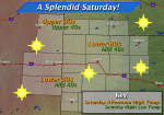
Click on the map below for the latest forecast.
Last map update: Sat, Sep. 15, 2012 at 10:41:34 am CDT
Weather Story
Weather Story of the Day - Click to enlarge
Radar
Local Radar for Goodland, KS - Click to enlarge
Satellite
Regional Infrared Satellite Image - Click to enlarge
Weather Map
National Weather Map - Click to enlarge
Current Weather Observations
Location Time
(mdt)
Weather Vsby.
(Mi.)
Temp.
Dewpt.
Hum.
(%)
Wind
(mph)
Heat
Index (ºF)
Pres.
(in)
Goodland, KS08:53Fair10+663734SW 9NA30.26
Hill City, KS08:53Fair10+584562CalmNA30.25
McCook, NE08:53Fair10+603844SW 3NA30.23
Burlington, CO08:53Fair10+663734SW 12NA30.28
Click on the Station Location for 3 days of observations


Frequently Requested Pages:
Current Local Forecast...   Current Conditions...
 
Text Weather Index...    Past Weather Information...
   Precipitation Analysis...
 1935 Republican River Flood...    WRF Model Data...
 Daily Temp and Precip Graphics...    Local Drought Information

Seasonal Information:
 Current Road Conditions...    Watches-Warnings-Advisories...


Snow Digging Out Fog Frost


USA.gov is the U.S. government's official web portal to all federal, state and local government web resources and services.