
Magnitude 7.4 - OAXACA, MEXICO
2012 March 20 18:02:48 UTC
Earthquake Details
- This event has been reviewed by a seismologist.
| Magnitude | 7.4 |
|---|---|
| Date-Time |
|
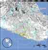
| Location | 16.662°N, 98.188°W |
| Depth | 20 km (12.4 miles) |
| Region | OAXACA, MEXICO |
| Distances | 136 km (84 miles) SSW of Huajuapan de Leon, Oaxaca, Mexico 162 km (100 miles) WSW of Oaxaca, Oaxaca, Mexico 170 km (105 miles) SE of Chilpancingo, Guerrero, Mexico 322 km (200 miles) SSE of MEXICO CITY, D.F., Mexico |
| Location Uncertainty | horizontal +/- 15.8 km (9.8 miles); depth +/- 6.5 km (4.0 miles) |
| Parameters | NST=438, Nph=440, Dmin=312.8 km, Rmss=0.88 sec, Gp= 79°, M-type=teleseismic moment magnitude (Mw), Version=9 |
| Source |
|
| Event ID | usc0008m6h |
- Did you feel it? Report shaking and damage at your location. You can also view a map displaying accumulated data from your report and others.
Earthquake Summary


Felt Reports
At least two people killed in Guerrero, 11 people injured in Oaxaca and two injured at Mexico. At least 800 houses collapsed at Igualapa, Guerrero. Felt (VIII) at Pinotepa Nacional; (VI) at Acatzingo, Chilpancingo and Nezahualcoyotl; (V) at Acapulco, Coatzacoalcos, Mexico, Minatitlan, Ometpec, Tehuacan and Tlaxcala. Felt widely in central and southern Mexico as far as Campeche, Ciudad Madero, Puerto Vallarta and San Luis Potosi. Felt (III) at Antigua Guatemala and Guatemala, Guatemala. Felt in much of western Guatemala. A seiche was observed in a swimming pool at Santa Fe, New Mexico, USA.
Tectonic Summary
The March 20, 2012 earthquake occurred as a result of thrust-faulting on or near the plate boundary interface between the Cocos and North America plates. The focal mechanism and depth of the earthquake are consistent with its occurrence on the subduction zone interface between these plates, approximately 100 km northeast of the Middle America Trench, where the Cocos plate begins its descent into the mantle beneath Mexico. In the region of this earthquake, the Cocos plate moves approximately northeastwards at a rate of 60 mm/yr.
Historically, there have been several significant earthquakes along the southern coast of Mexico. In 1932, a magnitude 8.4 thrust earthquake struck in the region of Jalisco, several hundred kilometers to the northwest of today's event. On October 9, 1995 a magnitude 8.0 earthquake struck in the Colima-Jalisco region, killing at least 49 people and leaving 1,000 homeless. The deadliest nearby earthquake occurred in the Michoacan region 470 km to the northwest of today's event, on September 19, 1985. This magnitude 8.0 earthquake killed at least 9,500 people, injured about 30,000, and left 100,000 people homeless. More recently, a 2003 magnitude 7.6 Colima, Mexico earthquake 640 km to the northwest of today's event killed 29 people, destroyed more than 2,000 homes and left more than 10,000 homeless.
Earthquake Maps


Scientific & Technical Information

- Preliminary Earthquake Report
- U.S. Geological Survey, National Earthquake Information Center:
World Data Center for Seismology, Denver
