Science Features
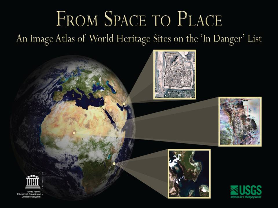
The U.S. Geological Survey and the United Nations Educational, Scientific and Cultural Organization (UNESCO) have produced a book that gives us a new way to look at our shared global heritage. From Space to Place: An Image Atlas of World Heritage Sites on the ‘In Danger’ List demonstrates an important scientific tool — remote sensing by Earth observing satellites — that helps us understand and manage the physical world we live in.
It is also a visually stunning book that depicts some of the most world’s most notable places.
Mario Hernandez of UNESCO, one of the book’s authors, says the atlas is the result of a fruitful collaboration between the two organizations. “UNESCO and USGS have been working closely to advance the idea of Space for Heritage – the use of space technologies and satellite imagery for the assessment and management of World Heritage sites. The From Space to Place atlas is a beautiful and useful product from that collaboration.”
In 1972, UNESCO adopted a treaty that calls on the international community to recognize and protect specific places designated as “World Heritage Sites.” These sites, chosen for their outstanding universal value, may be masterpieces of human creative genius; testimony to cultural tradition or civilizations both living and disappeared; they may contain superlative natural phenomena or exceptional natural beauty and aesthetic importance; or they may house important natural habitats for conservation of biological diversity.
Roger Sayre, the book’s lead author and a senior scientist in the USGS Climate and Land-Use Change Program, says World Heritage sites “are some of the most globally important natural and cultural treasures on Earth,” and adds that “satellite imagery is a valuable data resource that researchers and managers can use to understand threats to these areas, and improve their management.”
Using Satellites to Aid World Heritage
From Space to Place uses satellite imagery to create an atlas depicting the 31 sites on the List of World Heritage in Danger, which are threatened by both human and natural factors. Because not all threats can be seen with satellite images, the editors offer more detailed photos showing a specific feature or species.
“This book shows the many ways satellite imagery helps us assess our environment,” says Anne Castle, Assistant Secretary for Water and Science at the Department of the Interior. “There is considerable scientific value in the Landsat imagery we have amassed for this project, which we are hopeful will be of great value to the managers and governmental owners of these critical and unbelievably beautiful places.”
Place and History
Much of human history is made up of intangible elements like human actions and activities, philosophical and academic theories, and events both big and small that cannot be recaptured. But many of these ephemeral pieces of our collective memory are embodied by tangible structures and physical features that endure after a moment has passed. These sites may be political monuments like Independence Hall in the United States, or great architectural or artistic achievements like Spain’s Works of Antoni Gaudi or France’s Chartres Cathedral. They may be places that witnessed history both tragic and triumphant like Auschwitz Birkenau or Athens’ Acropolis. They may simply stun us with their natural beauty and scale, like Sumatra’s tropical rainforest or Australia’s Great Barrier Reef. These places – all on UNESCO’s list of World Heritage Sites — are touchstones that we inherit and leave behind; they help us map our universal history.
But not just one type of satellite could tell the full visual story of these places. In the atlas, Landsat imagery combines with other higher resolution images from the Quickbird, Ikonos, Corona and Worldview satellites to show a bird’s eye view of the sites in context with their surrounding environment, giving us a broader perspective on how to understand, protect and manage these treasures. Other imagery from the Terra and Aqua satellites show coarser pictures, but have a higher temporal frequency, providing imagery of the same location every other day, as opposed to every 16 days for Landsat.
Here are some key examples of those places in From Space to Place.
Garamba National Park
A Landsat image of Garamba National Park in the Democratic Republic of the Congo shows a diverse mosaic of colors representing the many types of habitat that give charismatic animals like the African elephant, giraffe, and hippopotamus a home in the park. Shades of green show different types of forest, while red and brown areas depict savannah grasslands. UNESCO put the park, one of Africa’s oldest protected areas, on the “In Danger” list” in 1996. Threats include limited management, poaching, civil unrest and species decline.

Two moderate resolution (30 m) Landsat 7 ETM+ satellite images taken in 2002 show the extent of Garamba National Park in the Democratic Republic of the Congo and indicate the variety of multicolor habitats it contains.
Abu Mena Archaeological Area
Egypt’s Abu Mena Archaeological Area, which contains remains of an early Christian holy settlement. Built over Menas of Alexandria’s tomb, a martyr who died in AD 296, the site was added to the list in 2001. The view from the Landsat satellite shows the former pilgrimage center in context of its modern surroundings marked by human settlement and agricultural production. Irrigation has transformed the landscape and changed the region’s long-term hydrology, making soil soft and unstable and dissolving the clay that supports the site’s buildings, which now are in risk of collapse.

A pair of moderate resolution (30 m) natural color Landsat images of the area around Abu Mena, in Egypt, from 1984 and 2001 show how the landscape around the site changed in that 17-year period. The site has become completely surrounded by irrigated agricultural development.
In the United States
The United States is home to 21 World Heritage sites, none of which are on the “In Danger” list. Still, this atlas provides an example of how satellite imagery improves our way of looking at the places that define our country. From the Statue of Liberty to the Grand Canyon, and from the Everglades to the Hawaii Volcanoes National Park, we can use space technology and scientific understanding to manage our shared national treasures.

Please comment on the USGS’ draft science strategies! Read more

Meet Marnelli Taasin, a student trainee working in Administrative Management with the USGS in Hawaii. Read more

Timing is everything! Consider helping track changes in spring’s arrival

Need a historical map for your genealogy research? You are in luck. We’ve got what you need! Download and view USGS historical maps from the comfort of your own home.

Flood Safety Awareness Week is March. 12-16. What can you do to prepare?
National Groundwater Awareness Week is Mar. 11-17, 2012. See how USGS science is connecting groundwater and surface water.

Since Japan’s March 11, 2011, Tohoku earthquake and subsequent tsunami, scientists at the USGS have learned much to help better prepare for a large earthquake in the United States.

Five USGS employees honored with Distinguished Service Awards for their service to the nation

It’s National Invasive Species Awareness Week. Did you know invasive species cost our country more than 100 billion dollars each year? Get to know America’s ten top invaders this week.

The proposed USGS budget reflects research priorities to respond to nationally relevant issues, including water quantity and quality, ecosystem restoration, hydraulic fracturing, natural disasters such as floods and earthquakes, and support for the National Ocean Policy, and has a large R&D component.

A student geographer shares her experiences and career path with the USGS. Most memorable moment

Everyone is familiar with weather systems on earth like rain, wind and snow. But space weather – variable conditions in the space surrounding Earth – has important consequences for our lives inside Earth’s atmosphere.
USGS crews continue to measure streamflow and collect water quality and sediment samples in the Ohio and Mississippi River basins using state-of-art instruments.
Science earns prominent focus in the new Department of the Interior Five-Year Strategic Plan.
http://www.facebook.com/USGeologicalSurvey

The world's longest-running Earth-observing satellite program.

Dust storms July 21-22 blinded motorists, grounded flights and knocked out electricity. What’s causing the dust storms?

The majority of the nation is facing dry conditions; in most areas drought conditions are expected to persist or intensify. Read more

A contest to celebrate 40 years of Landsat. Read more
Please comment on the USGS’ draft science strategies! Read more
Timing is everything! Consider helping track changes in spring’s arrival
Need a historical map for your genealogy research? You are in luck. We’ve got what you need! Download and view USGS historical maps from the comfort of your own home.
Flood Safety Awareness Week is March. 12-16. What can you do to prepare?
National Groundwater Awareness Week is Mar. 11-17, 2012. See how USGS science is connecting groundwater and surface water.
Since Japan’s March 11, 2011, Tohoku earthquake and subsequent tsunami, scientists at the USGS have learned much to help better prepare for a large earthquake in the United States.
Five USGS employees honored with Distinguished Service Awards for their service to the nation

Groundwater in aquifers on the East Coast and in the Central U.S. has the highest risk of contamination from radium, a naturally occurring radioactive element and known carcinogen.
The proposed USGS budget reflects research priorities to respond to nationally relevant issues, including water quantity and quality, ecosystem restoration, hydraulic fracturing, natural disasters such as floods and earthquakes, and support for the National Ocean Policy, and has a large R&D component.
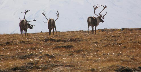
Caribou expert Layne Adams discusses the lives of reindeer — apart from their famous role on Christmas Eve. How they survive the cold.

Climate science is helping to predict food shortages, identify impacts on human health, and prepare for future conditions.
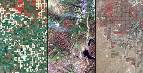
As demand grows, Landsat data can help us track trends in key resources. Remote-sensing satellites help scientists to observe our world, monitor changes, and detect critical trends in forestry, water, crops, and urban landscapes. Learn more.
A new study provides crucial information for difficult decisions regarding conservation, economic interests, and food and water security. Projected changes for 2010-2099

It's only the beginning of their careers, but these 3 young scientists have forged ahead with innovative research at the frontiers of science. How they've transformed their fields

Oct. 9-15, 2011, is Earth Science Week, themed "Our-Ever Changing Earth," and Oct. 12, 2011, is International Day for Natural Disaster Reduction. Answers to questions posed by a changing world

By 1936, devastating losses of wildlife populations were threatening the Nation’s natural resource heritage. America's first wildlife research center
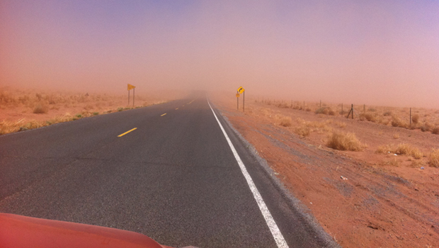
A dust storm on Tuesday, October 4, blinded motorists and caused a large string of motor vehicle crashes, multiple injuries, and at least one death. What’s causing the dust storms?
USGS scientists study walruses off the northwestern Alaska coast in August as part of their ongoing study of how the Pacific walrus are responding to reduced sea ice conditions in late summer and fall.
USGS scientists are collecting water samples and other data to determine trends in ocean acidification from the least explored ocean in the world.
In support of the Famine Early Warning Systems Network, USGS scientists use satellite remote sensing to assess agricultural conditions that foretell famine.
New USGS research shows that rice could become adapted to climate change and some catastrophic events by colonizing its seeds or plants with the spores of tiny naturally occurring fungi. The DNA of the rice plant itself is not changed; instead, researchers are re-creating what normally happens in nature.
Now that field work has wrapped up at the Ice Age "Snowmastodon" fossil site near Snowmass Village, Colo., USGS and other scientists will begin work on unraveling the climate and environmental history of the area.
USGS scientists are studying the Earth’s conditions 3 million years ago to gain insight into the impacts of future climate. Join us Aug. 3 in Reston, Va., to learn how this information is used to better understand the magnitude of changes forecast for the end of this century.
USGS crews continue to measure streamflow and collect water quality and sediment samples in the Ohio and Mississippi River basins using state-of-art instruments.
Over the past four decades, about 14% of the ice and permanent snow of Washington's Mount Rainier has melted due to combined recent warming and reduced precipitation.
USGS science supports management, conservation, and restoration of imperiled, at-risk, and endangered species.
In a unique application of data, this year's report provides the nation's first assessment of birds on public lands and waters.
The USGS, NASA, and other organizations and Federal agencies are studying how climate change affects wildlife and ecosystems.

Using coral growth records and measurements of changing ocean chemistry from increased atmospheric CO2, USGS scientists are providing a foundation for predicting future impacts of ocean acidification and sea-level rise to coral reefs.
Increased dust storm activity may result from enhanced aridity in the Southwest, according to a USGS study.
Provide your input on the draft USGS Global Change Science Strategy by April 8, 2011.
Sea-ice habitats essential to polar bears would likely respond positively should more curbs be placed on global greenhouse gas emissions, according to a new modeling study published today in the journal, Nature.
Landscape photos taken in the same place but many years apart reveal dramatic changes due to human and natural factors. The USGS Desert Laboratory Repeat Photography Collection, the largest archive of its kind in the world, is 50 years old.
Decreasing pH and warming temperatures are changing ocean conditions and affecting coral and algal growth in South Florida. USGS scientists are conducting field measurements to learn more.
Many coastal wetlands worldwide including several on the U.S. Atlantic coast may be more sensitive than previously thought to climate change and sea-level rise in the this century.
USGS findings support recent predictions that climate change will stress ecosystems at lower elevations more than higher elevations. This information may guide future conservation efforts in helping decision makers develop regional landscape predictions about biological responses to climate changes.
The Earth as Art 3 collection, the latest set of Landsat satellite images selected for their artistic quality, reveals an intricate beauty in Earth’s natural patterns.
USGS scientists are investigating sea turtles and their habitats in Dry Tortugas National Park to provide insight that will be used as decision-support tools for managing coral ecosystems.
Looking for information on natural resources, natural hazards, geospatial data, and more? The USGS Education site provides great resources, including lessons, data, maps, and more, to support teaching, learning, K-12 education, and university-level inquiry and research.
The timing of animal migration and reproduction, and observing when plants send out new leaves and bear fruit, is increasingly important in understanding how climate change affects biological and hydrologic systems. Photo credit Copyright C Brandon Cole.
The United States Group on Earth Observations (USGEO) is working to connect Earth observations with public health, agriculture, climate, and data management and dissemination.
USGS studies the relationships among earth surface processes, ecological systems, understanding current changes in the context of prehistoric and recent earth processes, distinguishing between natural and human-influenced changes, and recognizing ecological and physical responses to changes in climate.
The USGS Science Strategy is a comprehensive report to critically examine the USGS's major science goals and priorities for the coming decade. The USGS is moving forward with these strategic science directions in response to the challenges that our Nation's future faces and for the stewards of our Federal lands.

7 p.m.—Public lecture (also live-streamed over the Internet)

There are now over 60,000 maps and publications for sale for only a dollar now through May 7!

The U.S. Geological Survey had a very busy 2011 — below are a few of our highlights from last year.
7 p.m.—Public lecture (also live-streamed over the Internet)

USGS-led survey finds that national wildlife refuges rate highly with visitors.

As the climate has warmed, many plants are starting to grow leaves and bloom flowers earlier. A new study published in the journal, Nature, suggests that most field experiments may underestimate the degree to which the timing of leafing and flowering changes with global warming.

Stressed agricultural lands may be releasing less of the moisture needed to protect the breadbasket of a continent.

Spring rains in the eastern Horn of Africa are projected to begin late this year and be substantially lower than normal.

In recognition of World Forestry Day, let’s take a glimpse at USGS science to understand the fate of forests from climate change.

A new study concludes that fossil fuel emissions are likely contributors to a substantial amount of organic carbon found on glaciers in Alaska. Fossil fuel emissions, which contain organic carbon, can speed up the rate of glacier melt when deposited on glacier surfaces. In addition, the organic molecules associated with these deposits can be transportedContinue Reading
The U.S. Geological Survey had a very busy 2011 — below are a few of our highlights from last year.

Despite news articles warning of large-scale releases of methane due to climate change, recent research indicates that most of the world’s gas hydrate deposits should remain stable for the next few thousand years.
Join us on February 1 to view the Earth from space, and discuss the profound impact Landsat has on many facets of our economy, safety, and environment.

Scientists have discovered an outbreak of coral disease called Montipora White Syndrome in Kāneohe Bay, Oahu. The affected coral are of the species Montipora capitata, also known as rice coral.
USGS scientists will join thousands of scientists, managers, and decision makers in Boston this week to present new findings on toxics at the Society for Environmental Toxicology and Chemistry (SETAC) conference in the Hynes Convention Center, Nov. 13-17.

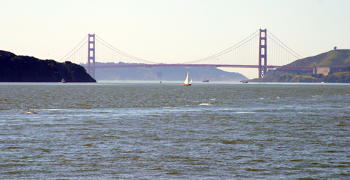
On Nov. 3, USGS scientists Patrick Barnard and William Ellsworth will present a public lecture in Menlo Park, CA, providing Bay Area residents information about USGS research in the San Francisco Bay Area, including recent discoveries beneath San Francisco Bay and ongoing studies to better understand earthquake probabilities and the potential hazards associated with strong ground shaking.

Rivers and streams in the United States are releasing substantially more carbon dioxide into the atmosphere than previously thought.

Climate Change Impacts to Tribal Communities The USGS is working with Native American communities and organizations to understand climate change impacts to their land and neighborhoods. Projects include interviews with indigenous Alaskans to understand their personal observations of climate change, as well as studying how climate change is impacting sand dunes and posing risksContinue Reading

As climate changes, it affects the timing of when leaves emerge, the amount of foliage that grows as well as the timeframe when leaves begin to fall.

How will accelerated glacial melting over the next 50 years as a result of climate change affect the unique Gulf of Alaska and Copper River coastal ecosystems? USGS scientists are studying these processes and impacts.

USGS scientists are assessing the potential to remove CO2 from the atmosphere for storage in other Earth systems through a process called carbon sequestration.

![]() U.S. Department of the Interior |
U.S. Geological Survey
U.S. Department of the Interior |
U.S. Geological Survey
URL: www.usgs.gov/blogs/features/usgs_top_story/from-space-to-place-mapping-our-universal-history-through-satellites/
Page Contact Information: Ask USGS
Page Last Modified: September 14, 2011


