SW Ecodistrict

The SW Ecodistrict Initiative
The SW Ecodistrict Initiative is a comprehensive effort to transform a 15-block federal precinct just south of the National Mall into a showcase of sustainable urban development. In addition to accommodating the future space needs of the federal government, the Ecodistrict will extend the civic qualities of the National Mall, create new places to live, and promote a vibrant, open, and walkable neighborhood. The Initiative involves 17 federal and district agencies and is being led by the National Capital Planning Commission.
Goals
- A revitalized neighborhood and cultural destination
- A well-connected community
- A high performance environmental showcase
- An economically successful partnership
The SW Ecodistrict Plan
The first major effort of the Initiative is the SW Ecodistrict Plan, which will provide the general development guidelines and roadmap for the prioritization and logical phasing of projects to realize our objectives:
- Reduce carbon emissions, conserve resources, and reduce operating costs;
- Protect the National Mall from overuse and expand the number of cultural opportunities beyond the Mall;
- Establish a diverse mix of uses, including cultural, housing, retail and open space;
- Remove visual and physical barriers between the National Mall and waterfront;
- Improve walkability and animate streets;
- Expand transit capacity; and
- Use limited financial resources effectively to improve buildings and infrastructure.
Maryland Avenue, SW Small Area Plan
A component of the SW Ecodistrict Initiative is the Maryland Avenue, SW Plan. The District of Columbia Office of Planning (DCOP) prepared the Maryland Avenue, SW Small Area Plan with input from the public and an Advisory Committee of private property owners, transit and rail operators, and nearby residents. The plan focuses on how to deck Maryland Avenue within the Ecodistrict, improve land use through zoning changes, improve transit capacity and enhance the public spaces along the corridor. For more information on the Maryland Avenue, SW Plan, visit DCOP’s website.
The Study Area
Today the study area is a 110-acre precinct of the city that is dominated by large federal office buildings and transportation infrastructure. Independence Avenue serves as its northern boundary. This area includes the 10th Street, SW and Maryland Avenue, SW corridors, and is bisected by the Southwest Freeway and CSX railroads.
Draft Plan Schedule
July 12, 2012
SW Ecodistrict Plan released for public comment
September 10, 2012
Public comment period ends
January 2013
Anticipated Commission approval
Submitting Comments
or send a letter to:
SW Ecodistrict Initiative
National Capital Planning Commission
401 9th Street, NW, Suite 500
Washington, DC 20004
To be notified of upcoming meetings:
Sign up online or please call (202) 482-7200
Planning Steps and Public Process
To develop the SW Ecodistrict Plan, the Task Force provided several ways for the community stakeholders and the general public to provide their input at the major steps of the planning process:
- Identify the scope of work
- Identify challenges and initial findings
- Develop concepts
- Develop preliminary recommendations
Community meetings were held in the Southwest Washington neighborhood to allow for early consultation with the public in accordance with the requirements for public scoping meetings of the National Environmental Policy Act and the National Historic Preservation Act. The public also provided their input through e-mails, letters, and web-based media.
Past Public Events:

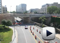
Learn more about the physical challenges of these two corridors and how the study area will be transformed by the proposed plans in the following videos.


