In the 2012 President's Budget Request, the National Biological Information Infrastructure (NBII) is terminated. As a result, all resources, databases, tools, and applications within this web site will be removed on January 15, 2012. For more information, please refer to the NBII Program Termination page.
The Western Soundscape Archive is a searchable web-based audio archive with a focus on the natural sounds of the western United States. Housed at the University of Utah's J. Willard Marriott Library, the recordings include representative sounds of more than 90% of the West's bird species, all of the region's frogs and toads, and more than 100 different types of mammals and reptiles, as well as ambient soundscapes and interviews.
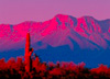
Welcome to the Southwest!
Image:
SWIN Geographic Coverage [Image: NBII]
The Southwest Information Node (SWIN) includes Arizona, Colorado, Nevada, New Mexico, and Utah. The southwest is home to an incredibly diverse natural and political environment and the rapidly growing population interacts with complex natural features such as deserts, plateaus, rivers, and mountain ranges.
About the Node Read about the history of this regional NBII node and goals for the future.
Animals and Plants of the Region Learn about the region's native biodiversity, including amphibians, birds, fishes, invertebrates, mammals, plants, reptiles, and species in need of conservation.
Great Basin Access the Great Basin Information Project site, with information and resources about the Great Basin and the Columbia Plateau.
Live Maps and Data Find maps and geospatial data related to the Southwest, including the GAP Analysis Program, Karst Aquifers, and PJ-WOOD.
Regional Ecosystems Discover the diverse ecosystems and ecoregions of the Southwest.
Regional News Read news articles related to regional natural resource issues.
Regional Themes Explore regionally-significant topics such as fire, invasive species, water, and wildlife disease.
States Browse data and information organized by state.
US-Mexico Border Find out more about the border between the southwestern US and Mexico, including additional resources.
Featured Project
[Image: Southwest Regional GAP Project]
The Southwest Regional Gap Analysis Project (SWReGAP) is an update of the Gap Analysis Program's mapping and assessment of biodiversity for the five-state region encompassing Arizona, Colorado, Nevada, New Mexico, and Utah. It is a multi-institutional cooperative effort coordinated by the U.S. Geological Survey's Gap Analysis Program. Data sets are made available to the public by the SWReGAP consortium of institutions responsible for their development, including the Southwest Node of the NBII.
Featured Project
BLM Pinyon-Juniper Treatments, Colorado Plateau [Photo: US Bureau of Land Management]
PJ-WOOD is a research database that archives Pinyon-Juniper manipulations on Bureau of Land Management lands across the Colorado Plateau. Researchers and managers may publicly access the treatment data including photos or link to downloadable GIS data and a dynamic map search.
The Great Basin Information Project provides consolidated and efficient access to information about the Great Basin and the Columbia Plateau Regions of eastern Washington and Oregon, southern Idaho, northern Nevada and Utah, and portions of northeastern California. Three major plant communities grow in the Great Basin and Columbia Plateau: sagebrush, salt desert shrub, and pinyon-juniper woodlands. The Great Basin and Columbia Plateau regions comprise a large area of the western United States, approximately 225,674 sq. miles in size.
The NBII Program is administered by the Biological Informatics Program of the U.S. Geological Survey


![[Image: Southwest Regional GAP Project]](https://webarchive.library.unt.edu/web/20120110082225im_/http://www.nbii.gov/portal/server.pt/gateway/PTARGS_0_2_25504_246_961_43/http%3B/cbi-lap7.cbi.cr.usgs.gov%3B7097/publishedcontent/publish/geographic/southwest/swin_swregap_highlight/swin_swregap_highlight_2.jpg)
![BLM Pinyon-Juniper Treatments, Colorado Plateau [Photo: US Bureau of Land Management]](https://webarchive.library.unt.edu/web/20120110082225im_/http://www.nbii.gov/portal/server.pt/gateway/PTARGS_0_2_25506_246_961_43/http%3B/cbi-lap7.cbi.cr.usgs.gov%3B7097/publishedcontent/publish/geographic/southwest/swin_pjwood_highlight/swin_pjwood_highlight__wide__2.jpg)
