The Minerals Management Service (MMS) has announced
its intent to prepare a PEIS to evaluate potential environmental effects of
multiple G&G activities on the Atlantic Outer Continental Shelf (OCS). On April 2,
2010 MMS published an announcement in the Federal Register reopening the
public comment for 45 days to accept comments related to future industry G&G
activity on the Atlantic OCS, and listing the schedule for public scoping
meetings. The public comment period will close on May 17, 2010. The purpose of
the scoping meetings will be to receive comments on the scope of the PEIS,
identify significant resources and issues to be analyzed in the PEIS, and
identify possible alternatives to the proposed action. These activities are
associated with Atlantic OCS siting for renewable energy projects, marine
minerals extraction, and oil and gas exploration; these activities could take
place over a period of several years. The Atlantic OCS areas that will be
analyzed within the Atlantic G&G PEIS are the Mid-Atlantic Planning Area and the
South Atlantic Planning Area (refer to figure below).
PowerPoint presentation for
Atlantic G&G PEIS scoping meetings

The proposed PEIS will evaluate the environmental
impacts of multiple G&G activities in OCS waters of the Atlantic. The proposed
PEIS will be the first National Environmental Policy Act (NEPA) programmatic
document performed for G&G activities in the Atlantic OCS. The PEIS is proposed
for the Atlantic in light of multiple applications for permits received by MMS
and industry’s expressed interest in expanding activities into the Atlantic
offshore waters. This PEIS will also review advances in G&G technology and
improved knowledge of acoustic impacts on marine life. This PEIS will determine
whether significant impacts to Atlantic resources could occur as a result of G&G
activities, and where needed, outline mitigation and monitoring measures that
will reduce or eliminate the potential for impacts to the environment.
Federal Register notice
announcing Atlantic G&G scoping meetings and comment period
Applications received for Atlantic OCS seismic activities:
CGGVeritas
Map of proposed survey area
GX
Technology
Map of proposed
survey area
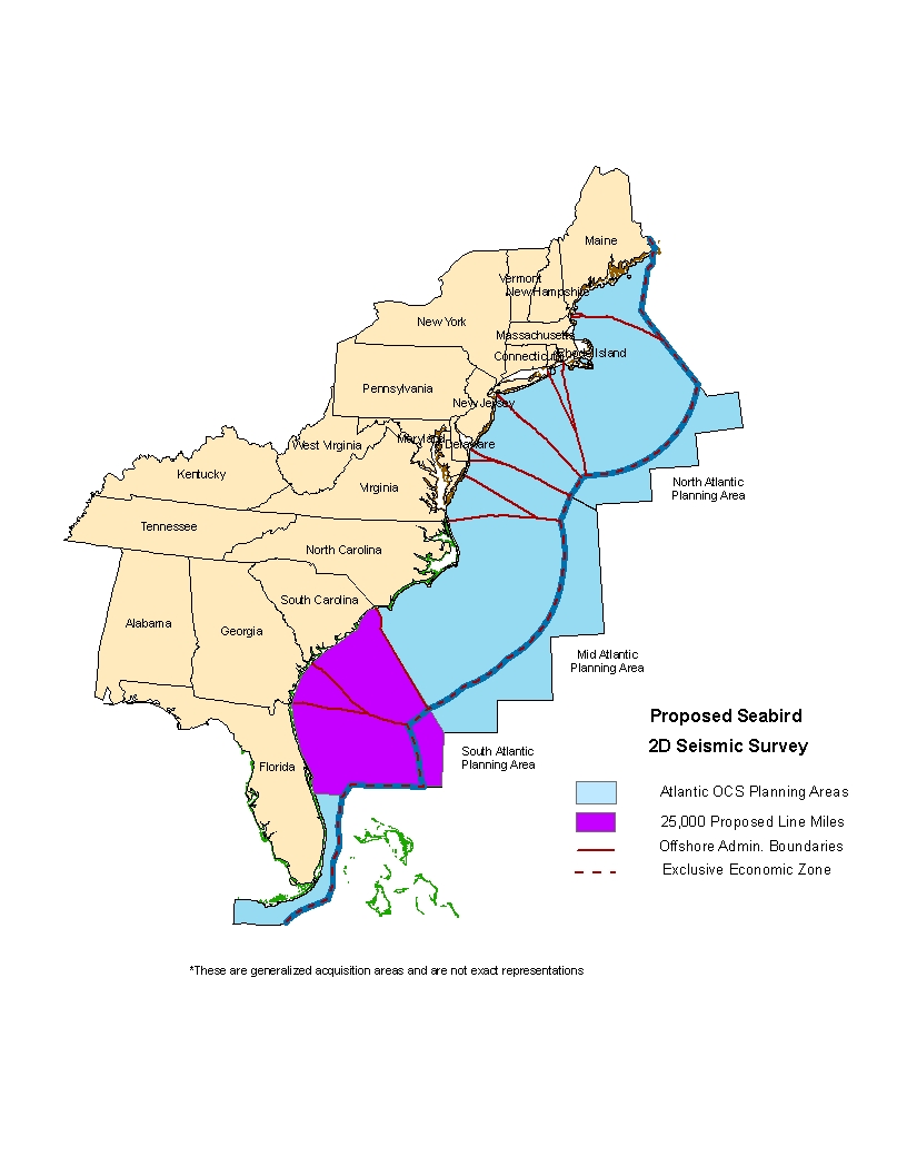
SeaBird
Exploration Americas, Inc.
Map of proposed
survey area
Spectrum Geo,
Inc.
Map of proposed
survey area
Spectrum GGS (formerly Global
Geo Services)
Map of proposed
survey area
TGS-NOPEC
Map of proposed
survey area
WesternGeco
Map of proposed
survey area
Additional resources:
Mid- and South Atlantic OCS Geological and
Geophysical Programmatic Environmental Impact Statement
Descriptions of Geological and
Geophysical Activities
Uses of Geological and Geophysical
Survey Data
Compliance with the Endangered Species Act
and Marine Mammal Protection Act for Geological
and Geophysical Activities on the Atlantic OCS
Atlantic Geological and
Geophysical Survey Regulatory Authority
Geological and Geophysical Exploration Regulations
Geological and Geophysical Data Acquisition - Outer
Continental Shelf Through 2003
Final Programmatic Environmental Assessment for Geological
and Geophysical Exploration for Mineral Resources on the Gulf of Mexico
Outer Continental Shelf (OCS
EIS/EA MMS 2004-054)
A brief history of the use of sound in ocean exploration:
http://woodshole.er.usgs.gov/operations/sfmapping/soundhist.htm
A brief tutorial on seismic technology and how it is used:
http://woodshole.er.usgs.gov/operations/sfmapping/seismic.htm


