|
|
Aquifer by rock type |
|
Aquifers on National Atlas Map Browser
Aquifers' Data
USGS links Site links
|
Carbonate-rock aquifers
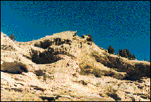
The principal water-yielding aquifers of North America can be grouped into five types: unconsolidated and semiconsolidated sand and gravel aquifers, sandstone aquifers, carbonate-rock aquifers, aquifers in interbedded sandstone and carbonate rocks, and aquifers in igneous and metamorphic rocks. Aquifers in carbonate rocks are most extensive in the eastern United States. Most of the carbonate-rock aquifers consist of limestone, but dolomite and marble locally yield water. The water-yielding properties of carbonate rocks vary widely; some yield almost no water and are considered to be confining units, whereas others are among the most productive aquifers known. Most carbonate rocks originate as sedimentary deposits in marine environments. Compaction, cementation, and dolomitization processes might act on the deposits as they lithify and greatly change their porosity and permeability. However, the principal postdepositional change in carbonate rocks is the dissolution of part of the rock by circulating, slightly acidic groundwater. Solution openings in carbonate rocks range from small tubes and widened joints to caverns that may be tens of meters wide and hundreds to thousands of meters in length. Where they are saturated, carbonate rocks with well-connected networks of solution openings yield large amounts of water to wells that penetrate the openings, although the undissolved rock between the large openings may be almost impermeable. This map of carbonate-rock aquifers in the United States shows the shallowest principal aquifer. In some places, other, sometimes more productive, aquifers underlie those mapped. Only small areas of some aquifers may be shown on the map because they are covered in many places by other aquifers closer to the land surface. In other places, local aquifers, such as those along stream valleys, might overlie the aquifers mapped. Local aquifers are not shown because of the scale of the map. Some aquifers in carbonate rocks are overlain by confining units, and the aquifers extend into the subsurface beyond the areas shown on the map.
Where carbonate rocks are exposed at land surface, solution features create karst topography, characterized by little surface drainage as well as by sinkholes, blind valleys, sinking streams, and mogotes. Because water enters the carbonate rocks rapidly through sinkholes and other large openings, any contaminants in the water can rapidly enter and spread through the aquifers. Carbonate rock aquifers in Paleozoic rocks are flatlying to gently folded in places. Folded and faulted carbonate-rock aquifers are in the Appalachian and Rocky Mountain chains. The carbonate-rock aquifers that underlie Florida and adjacent states are called platform carbonates, and have intergranular porosity as well as large solution openings. The submarine springs off the coasts of Florida issue from solution openings in platform carbonate rocks. Large springs also issue from these rocks on land. Some of the platform carbonates are highly productive aquifers. For instance, the Floridan aquifer system, in the southeastern United States, has regional, intermediate, and local groundwater flow systems; but most near-surface carbonate-rock aquifers have only local and intermediate flow. Carbonate-rock aquifers include:
See also: Sandstone and carbonate-rock aquifers Publication source
|