 |
|
|
||||
| Earth Resources Observation and Science (EROS) |
|
Continue with Tour |

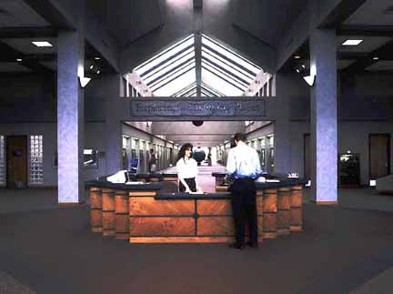
Welcome to the United States Geological Survey's (USGS) Earth Resources Observation Systems (EROS) Data Center, or EDC. The EDC was established in 1971 to receive, process, and distribute data from NASA Landsat satellites, as well as aerial photographs gathered for the USGS and other agencies. The original 115,000-square-foot building was completed in 1973 for $6 million. In March 1996, the Center completed a 65,000-square-foot addition for $9 million to house equipment and people for NASA's Earth Observing System Program and Landsat 7 data handling. Elements of our work here potentially affect millions of lives. We supply data--the raw material of science--to a worldwide community of users. Scholars, engineers, and land managers use our data to study a growing list of environmental issues such as resource development, global change, and land use planning. In addition to maintaining earth science data, EROS scientists constantly work to discover new ways to use this information. |
| Inside EROS |
| Previous | Continue |
 Unlike most other Federal institutions, the EDC's staff is primarily private contractors. Of the 600 or so employees, about 10 percent are Federal civil servants. EDC employees manage an archive of more than 4 million satellite images covering the globe and more than 8 million aerial photos covering the U.S.
 |
| Inside EROS |
| Previous | Continue |
  EDC employees give land managers, planners, Earth scientists, and private industry access to a national archive of remotely sensed land data, scientific information that is needed to help in wisely managing energy, mineral, and water resources. The EDC also handles sales of all the digital cartographic data produced by its parent organization, the USGS's National Mapping Division. EDC staff receive, process, distribute, and study many types of land science information from many sources, including:
|
| Atrium |
| Previous | Continue |
|
The Large Format Camera, housed in the EDC's long, skylit atrium, is a remote sensing system used aboard the Space Shuttle
Challenger mission of 5-14, 1984. |
| Computer Room I |
| Previous | Continue |

The EDC operates two of the largest computer complexes within the Department of the Interior. In a computer room that supports USGS projects and activities, a robotic mass storage system holding approximately 6,000 cartridges, or 15,000 separate images, makes much of the EDC's satellite information immediately available to scientists at desktop workstations. Online access to the EDC's Earth science data bases and other centers worldwide is available through Earth Explorer. The USGS uses the resources of the EDC to put ever greater amounts of earth science data online. This work is forming the foundation of a national spatial data infrastructure, an immense electronic library of information on the land surface, the processes acting on it, and their effects. The computer equipment in the middle of the room is used by the EDC to transfer earth Science data, including satellite images, aerial photographs, and derivative products, to compact discs and other magnetic and optical media for distribution to customers. During the first 5 months of 1998, the EDC copied data to 30,000 compact discs. The room is staffed 24 hours a day, 5 days a week. |
| Computer Room II |
| Previous | Continue |
|
This computer room was associated with NASA's Earth Science Enterprise initative. The robotic mass storage systems hold approximately 5,500 cartridges, or 920,000 separate images. These units also make much of the EDC's NASA satellite information immediately available to scientists working at desktop workstations here and around the world. One robotic mass storage system holds 5 years of Landsat data. A major part of NASA's Earth Science Enterprise initative is the Earth Observing System, or EOS, which will collect data required to measure changes in the Earth system. Beginning in 1999, and running for at least the next 15 years, the EOS will collect data through a series of satellites and field experiements to observe the Earth. In the back part of this room are computer systems associated with Landsat 7 -- the latest in a series of Earth observation satellites first launched in the early 1970's. Launching early in 1999, Landsat 7 records improved images of the Earth's land surface on the order of 250 scenes per day. |
| The Greenness Map |
| Previous | Continue |

The Advanced Very High Resolution Radiometer (AVHRR) sensor flown aboard NOAA weather satellites has a resolution of 1,100 meters. The most common product from AVHRR data are 10-day global area coverage composites that show the density and health of vegetation on the Earth's surface. Every day the AVHRR sensor measures the amount of energy reflected by plants, soil, and water on the Earth's surface. By merging data over a period of several days, 10 in this case, it is possible to acquire a nearly cloud-free observation of North America. Analysis of the amount of reflected energy enables scientists to measure the condition, or "greenness," of the vegetation. The vegetation condition is computed as an index value ranging from zero to one. |
| Photographic Laboratory |
| Previous | Continue |

The EDC's Photographic Laboratory processes pictures 18 hours a day, 5 days a week. Annually, the lab produces more than 350,000 products.
These products range from 16 mm film to 40-inch-black-and-white and 50-inch color prints. The lab uses vertical and horizontal enlargers, autododging contact printers, and roll-to-roll printers, along with digital high-resolution film, and paper printers. The lab uses approximately 20,000 gallons of water each day. In accordance with Environmental Protection Agency standards, safe photographic processing chemicals that cannot be recycled are piped to recess ponds behind the Center. Four ponds filter the water before it is released into Lake EROS. By the time it reaches the lake, the water is purified. Ninety-nine percent of the silver in the waste photo chemistry is reclaimed and sold to the highest bidder. |
| Dissemination |
| Previous | Continue |

Packaging and Shipping
About 25 percent of the products are shipped outside the country. Data managed at the EDC are sold for the cost of reproduction, and distribution. |
| Digital Data Production |
| Previous | Continue |

Analysts at the USGS EROS Data Center take traditional map information and combine it with images acquired by
sensors on satellites or aircraft to produce image maps. These products give
scientists and decision makers a sense of what things are (for example, vegetation
types ) and how they relate to one another.
|
| Pixel Display |
| Previous | Continue |

A digital satellite image is made up of picture elements called pixels. Arranged horizontally and vertically, each pixel represents the minimum size of an area on the ground that is detectable by a remote sensing device. The spatial resolution of a Landsat multispectral scanner image is approximately 80 meters, while the spatial resolution of a Landsat Thematic Mapper (TM) image is 30 meters. The TM image above is of southeastern South Dakota with both the city of Sioux Falls and its airport enlarged. Each pixel is represented by a number that indicates the amount of reflected light encoded by the satellite sensor. The higher the number, the greater the amount of reflected light recorded.
This shows how a pixel of Landsat TM data would fit on a football field. |
| Chemical Lab |
| Previous | Continue |

Photographic chemicals may be reused after the silver has been removed (approximately 250 Troy ounces of silver are collected each month) and after the chemicals have been treated for reuse. Recycling photographic chemicals extends their life, reduces the amount of chemicals discharged through the Center's waste management system, and saves on chemical costs. Photographic chemicals are broken down before they are finally released to the Data Center's holding ponds. The chemical management system has more than saved $1 million in chemical costs. This figure includes the funds put back into the system through the sale of recovered silver. |
| Hallway Displays |
| Previous | Continue |

Image mapping combines satellite images with traditional map information to form a product that is visually appealing and informative as well as geographically accurate. This TM image map covers Florida from the Orlando area south to Key West. Vegetation is green and dormant vegetation and harvested croplands are reddish-brown; water varies from blue to black; cities are identified by purple tones and rectangular street patterns. |
| Hallway Displays |
| Previous | Continue |
|
These two TM scenes of South Dakota cover the James River Valley from Mitchell to
just below Aberdeen. Ipswich is in the northwest, while to the northeast are Watertown and
the glacial lakes region. To the southeast are Lake Thompson and Vermillion River
drainage, and in the southwest are Fort Thompson and the Missouri River. The May 25,
1993, image shows a normal spring, where unplanted fields are reddish tones. Growing
vegetation is green and water is black. In contrast, the May 15, 1995, image shows a
wet spring. Note the dramatic increase in the amount of water in the region. The
James River is flooding, every pothole is full, and many of the fields are
saturated. Image data such as these are provided to the State of South Dakota and the
Federal Emergency Management Agency to support natural disaster declarations
for the affected counties.
This three-scene TM montage shows extensive loss of farmlands
in the floodplain of the Missouri River during the record flooding of 1993.
The September 1991 image shows field patterns that indicate almost total use of
the floodplain for agriculture. The July 1993 image shows the inundation of the
floodplain. By October 1993, the waters have receded, but fertile soil has
been washed away, replaced by sandbars and gravel deposits. The EDC
housed the interagency Scientific Assessment and Strategy Team following the 1993 flooding. The
scientists and engineers gave advice to policy
makers and officials responsible for flood recovery and river basin management in the
Upper Mississippi River Basin. |
| Digital Tape Archive |
| Previous | Continue |
|
Types of Media Available at EROS The EDC has been archiving, managing, and distributing land remote sensing data and other Earth surface data for more than 25 years. Stored in environmentally controlled areas, the digital archives contain collections, including data from Multispectral Scanner (MS) and Thematic Mapper (TM) sensors carried aboard the Landsat satellite series and data from the advanced very high resolution radiometer (AVHRR) sensor carried aboard NOAA weather satellites. By the year 2005, the EDC's holdings, including both its film and digital archive, will expand exponentially with additions of several data types. |
| Film Archive |
| Previous | Continue |

EDC employees manage an archive of 4 million frames of worldwide satellite images and 8 million high-altitude aerial photographs. This massive and ever-expanding collection includes more than 30 years of satellite data and 50 years of photographs. |
| GRID Office |
| Previous | Continue |


 Click to View Enlarged Photo. The EDC is home to an office affiliated with the United Nations Environment Programme Global Resources Information Database, known as GRID-Sioux Falls. Since 1991, GRID-Sioux Falls has functioned as a partnership among UNEP, the USGS, and NASA. GRID-Sioux Falls makes environmental data available to developing countries and so frequently is host to scientists from these countries. The extensive archive of satellite images and other data housed at the Center, GRID Sioux Falls helps other countries achieve sustainable development. |
| Don Lee Kulow Memorial Library |
| Previous | Continue |

The Don Lee Kulow Memorial Library is a technical reference source for EDC scientists, students, engineers, and professional staff to help perform their work and keep up to date in their disciplines. The library also is a source for other people around the world of information on land remote sensing and global environmental change. |
| Thank You For Visiting |
| Previous |
 Thank you for taking the time to tour the USGS EROS Data Center. Back to the EROS Home Page |
| Accessibility FOIA Privacy Policies and Notices | |
 |
|
 The USGS EROS Data Center purchased this rotating globe in the early 1980's.
One inch on this model represents about 100 miles.
The USGS EROS Data Center purchased this rotating globe in the early 1980's.
One inch on this model represents about 100 miles.


