‘BOLD - Winter 2009’ Category

Subscribe to this category's feed

On Board the OSV BOLD: Change in Weather

Thursday, March 12th, 2009
For more than a month, EPA’s Ocean Survey Vessel (OSV) Bold is studying the health of the waters around Puerto Rico and the U.S. Virgin Islands. EPA scientists and non-scientists will blog about their research and what it’s like to live and work at sea.

About the author: About the author: Charles LoBue serves as the chief scientist and diver for the US Virgin Island leg of the OSV BOLD voyage. He is an environmental scientist in EPA Region 2 in New York City.

March 6, 2009 (Day 26)

For most of our trip so far, the weather has been very good to us, and we’ve been able to keep to our itinerary. But when the weather doesn’t cooperate, all of our plans are thrown off. Unfortunately, that’s the current situation that we’ve found ourselves in as a strong, low pressure front is upon us and the weather is quickly becoming a problem. Rain is now pelting down, and winds are howling out of the northwest with gusts up to 39 knots (about 45 mph).

iimage of scuba flag in windThis will prevent us from working at our remaining stations on the northwest of St. Thomas. It’s not the rain that concerns us, but the sustained high winds that are creating rough sea conditions and will make it virtually impossible to be able to put our small diving boats out into the water. It is what it is, and we all have to keep in mind that this is beyond our control. We go back to the drawing board to figure out what is in our control. We decide to cast off from our dockage in Charlotte Amalie, cruise east, and anchor in Coral Bay in St. John. We’re hoping that the stations in this embayment on southwest St. John, are protected enough to allow diving.

We are so grateful for the assistance of The Virgin Islands Department of Planning and Natural Resource in helping us transport some of our divers, using their fast monitoring boat, the Vigilant. She’s been docked in St. Thomas, so crossing Pillsbury Sound to rendezvous with us could be a difficult task if the seas are rough. But as the BOLD bounds into 4 to 6-foot seas before turning into Coral Bay, we anchor and it seems calmer, and we’re delighted to see the Vigilant anchored at our meeting point. It’s time to get to work.

We’re able to safely load the Vigilant and two BOLD rigid-hulled, inflatable boats on the leeside of the massive BOLD hull. Although stiff winds prevail, the sea surface tucked behind these mountains seems to be staying down enough to allow diving. We’ll find out as divers return and have a chance to report back to us.

image of inflatable boat with people

As the boats return, the sun is now shining and we learn of success; the waters are workable. Being a glass-half-full kind of guy, I’m confident that we’ll have success in our next two days here on the south side, and we’ll ultimately get the weather to allow us to return to complete our stations on the north sides of St. Thomas and St. John.

On Board the OSV BOLD: A Tree Falling in the Ocean

Wednesday, March 11th, 2009
For more than a month, EPA’s Ocean Survey Vessel (OSV) Bold is studying the health of the waters around Puerto Rico and the U.S. Virgin Islands. EPA scientists and non-scientists will blog about their research and what it’s like to live and work at sea.

March 6, 2009 - 2:00 p.m. (Day 26)

About the author: John Senn is a press officer in Region 2, New York City. He covers water issues, including water permits, wetlands, coastal water and beaches, oceans and lakes, as well as RCRA, and Voluntary Programs. John’s been with EPA for 2.5 years.

Everyone’s heard the riddle about whether a tree falling in the woods when no one’s around actually makes a sound. A similar analogy can be made for the work being one right now on the OSV BOLD; if no one sees what we do, just how valuable is our work?

images of school children listening to a presentation be given by a diverYesterday, some 200 people—about half of them students from local middle and high schools—got a close up look at EPA’s coral reef survey and the BOLD’s inner workings through an open house at Charlotte Amalie in St. Thomas. EPA scientists, the ship’s crew and members of the U.S. Virgin Islands Department of Planning and Natural Resources served as tour guides, and demonstrated the coral reef survey techniques and diving operations currently underway.

Apart from seeing all the cool gadgets and gizmos that make the ship run, as well as our dining hall and living quarters, visitors heard about the importance of studying, protecting and enhancing the health
of coral reefs around the Virgin Islands. Bill Fisher, an EPA scientist from Florida who’s been contributing to this blog, told the visitors about how the Virgin Islands, like many small islands around the globe, are specially vulnerable to the potential impacts of global climate change and human activity.

Rising sea levels affect how close people can live to the coast. Elevated ocean temperatures can alter marine habitat and change how some animals, plants and fish function, including coral reefs. The reefs, Bill explained, benefit islands like the Virgin Islands by acting as a natural (and free) barrier to destructive storm surges; man-made barriers cost millions of dollars to construct.

Coral are also particularly sensitive to even the slightest changes in the water around them, so they’re good indicators of looming water quality problems. Bill was clear to explain how almost everything we do on land affects what goes on in and under the sea. He emphasized to our visitors, especially to the students, that lowering one’s carbon footprint can have a demonstrable benefit in their backyard.

Many of the students who came aboard seemed excited to see and hear about what we were up to. Hopefully we inspired them to take action to protect this beautiful and ecologically-significant place. Maybe a few will even become environmental scientists and carry on our work someday.

On Board the OSV BOLD: A Day in the Life

Tuesday, March 10th, 2009
For more than a month, EPA’s Ocean Survey Vessel (OSV) Bold is studying the health of the waters around Puerto Rico and the U.S. Virgin Islands. EPA scientists and non-scientists will blog about their research and what it’s like to live and work at sea.

About the author: About the author: Charles LoBue serves as the chief scientist and diver for the US Virgin Island leg of the OSV BOLD voyage. He is an environmental scientist in EPA Region 2 in New York City.

image of man with lots of air tanksWe’re at anchor in St. James Bay on the eastern corner of St. Thomas, giving us access to both St. Thomas and St. John stations. Our daily routine has already been well established, and with three dive teams making three dives each a day, filling scuba tanks is an essential task. The breathing gas that we use is Nitrox, which is air spiked with extra oxygen. Increasing the amount of oxygen decreases the nitrogen breathed in while diving, which in turn allows for longer dives without saturating our bodies with nitrogen levels that could cause decompression sickness or the “bends.” Nitrox is specially blended daily on board, with factory efficiency, by the BOLD technicians.

Planning for each day always starts the night before, when after dinner, the survey coordinators and BOLD captain meet to finalize dive plans that start the next morning. Dive team assignments are posted in the ship’s laboratory, which serves as a survey operations center. Divers are responsible for checking the oxygen content of the Nitrox in their tanks, and before retiring each night, they must analyze the air in his or her tanks assigned for the next day.

image of scuba diverIn the morning, divers check the assignment board to see which boat they’re in and the order of boat deployment. The teams stage their gear for loading onto the boats, with care to include all of the dive gear, survey and sampling equipment, drinking water, and oxygen kit. The gear is methodically loaded; missing one piece of equipment or gear would abort a survey and require a return trip to the BOLD. Once the boats are loaded, divers are on their way to start their work. GPS units are used to locate the station, and a snorkeler confirms that the site is appropriate to “count.” If it’s a go, two divers gear up and splash in to begin the survey; in about 10 minutes, two more divers descend to fill out the survey team. The observations are performed and recorded according to our protocol.

When the divers are finished, they return to the BOLD where samples are logged and refrigerated, data sheets are rinsed and dried, and dive gear is rinsed and hung to dry. Data is then entered into computer spreadsheets by the statisticians, with rigid review by the diver. Water samples are filter-processed for various analyses. Logged data for each diver is entered into the dive officer’s spreadsheet to track each diver’s activity and to ensure that no one has built up too much nitrogen in his or her system after several days of diving. After a long day of being the water, the whole process begins again for the next morning.

image of two women hanging papers to dry

On Board the OSV BOLD: A BOLD Beginning

Monday, March 9th, 2009
For more than a month, EPA’s Ocean Survey Vessel (OSV) Bold is studying the health of the waters around Puerto Rico and the U.S. Virgin Islands. EPA scientists and non-scientists will blog about their research and what it’s like to live and work at sea.

March 3, 2009 - 7:30 p.m. (Day 23)

About the author: John Senn is a press officer in Region 2, New York City.  He covers water issues, including water permits, wetlands, coastal water and beaches, oceans and lakes, as well as RCRA, and Voluntary Programs.  John’s been with EPA for 2.5 years.

I’ve spent plenty of time on sailboats and in canoes and kayaks, but just boarding and getting acclimated to the OSV BOLD in St. Thomas was an experience unlike any I’ve ever had on a watercraft.

The ship is like a living organism. Even the smallest pieces of equipment and supplies have their proper place. And no matter where you may be on the ship, if She’s moving, so are you (your stomach included). That means newcomers like myself had better find or re-discover their sea legs pretty quickly or endure seasickness.

In the case of choppy seas most everything is attached to the floor or secured in some other way. All the drawers on my dresser and desk have locks, for example, so they won’t slide out if we hit an unexpected patch of rough water. Safety always comes first regardless of what type of boat you’re on, but on the BOLD, it comes first and second, partly because the ship is so big–224 feet long and 45 feet wide–and partly because of the complexity of what She’s expected to do on a daily basis.

image of ship at dock

After Her days as a Navy ship, the BOLD was transformed into a state-of-the-art research lab, complete with side scan sonar, biological sampling and analysis tools, and powerful computers to help process all the data that’s collected.

But the BOLD would just be a fancy boat without all the people who make Her work. The 18-person crew knows the ship inside and out, and there’s a chef on board who makes sure we all get three square meals each day.

The team of EPA scientists, who hail from every corner of the country, is nothing short of world class. The coral reefs they’re mapping right now have never been surveyed in such a comprehensive way. People often think that we’ve studied every inch of the planet, but this effort is showing that there are things we still don’t know, especially when the land and water are changing beneath our feet.

Well, we’re cruising back to port at a pretty good clip and the ship’s starting to rock a bit, so I think I’ll go catch up on sleep.

On Board the OSV BOLD: Experimenting Under Pressure…Puerto Rico Highlights Continued

Sunday, March 8th, 2009
For more than a month, EPA’s Ocean Survey Vessel (OSV) Bold is studying the health of the waters around Puerto Rico and the U.S. Virgin Islands. EPA scientists and non-scientists will blog about their research and what it’s like to live and work at sea.

About the author: Mark Reiss is a marine environmental scientist with the dredging, sediments and oceans team in EPA Region 2, comprising New Jersey, New York, Puerto Rico and the U.S. Virgin Islands. He is one of the principal investigators on the OSV BOLD’s Puerto Rico voyage.

As I had talked about in yesterday’s post, we wanted to have a little fun after all the hard work the crew and science members had put in to complete our surveys. So, we decided to see what would happen if we securely attached foam cups, signed by students from three science classes at a Manhattan middle school and by three teachers from Puerto Rico that joined us on the OSV BOLD, and drop them down on the CTD to 2,500 meters. The weight of all that water produces incredible pressure, just over 3,600 pounds per square inch (PSI). Our instruments are built to withstand this pressure, but foam coffee cups aren’t. The pressure causes the cups to shrink to miniature versions of themselves, as it forces the air in the foam out and sticks the plastic together.

 image of styrofoam cups, soda can, an egg, and an orange on a table
Various items prior to being sent into the depths of the sea.

The crew had seen that before on other cruises so they knew what would happen to the cup. But this time we also sent down an uncooked egg, an unopened can of soda, an orange, a waffle, and a few floating key chains—basically anything that wasn’t tied down! Everyone on the boat made predictions about what would happen to the items, and they were hotly debated for the three hours it took to make the cast. We all gathered on deck waiting to see what happened.

I got mostly firm predictions about what would happen to the soda and the egg we sent down when I polled the boat and scientific crew (though a few people admitted that they just were guessing). And I got a lot of good theories to back those predictions up.

image of crushed styrofoam cups, soda can, an egg, and an orange on a table
Various items after exposure to the incredible pressure of the sea.

Some confidently predicted that that the egg and soda can would be “toast.” Some people thought that only one would make it or that the egg would break if it went down lying on its side, but would be okay if it went down on its end. Some said that the items would explode. The best one came from our captain who pointed out that the shell of the egg is an engineering marvel of nature so it would withstand the pressure, but the soda can has a weak spot built in and that would make it explode.

Well, maybe the captain did predict the egg would come back fine, but then why did the soda can make it okay, too?

An egg shell is indeed a natural engineering masterpiece, but that’s not why it survived. The reason the soda can, egg and orange did not crush is pretty simple. (By the way, things do not explode under pressure). They are mostly filled with fluid, and fluids do not compress or squeeze together like air does. The fluid inside pushed against the can and the shell from the inside and kept them from collapsing while the pressure outside tried to crush it. If the egg were hollow, even the engineering properties of its shell would not have saved it. The results of our little experiment definitely surprised most of us.

On Board the OSV BOLD: Just Dropping a Line…Puerto Rico Highlights

Saturday, March 7th, 2009

About the author: Mark Reiss is a marine environmental scientist with the dredging, sediments and oceans team in EPA Region 2, comprising New Jersey, New York, Puerto Rico and the U.S. Virgin Islands. He is one of the principal investigators on the OSV BOLD’s Puerto Rico voyage

image of two men standing on ship deck near columnar instrumentAnother component of the work we do on the OSV BOLD is lowering an instrument called a Conductivity, Temperature and Depth recorder—we just call it a CTD—through the water column down to 1,000 meters (3,280 feet) about every two hours. It takes about 40 minutes to get the CTD down to that depth and then back up on deck, but it’s important to use the CTD because it tells us about the structure of the ocean.

People tend to think of the ocean as all the same but there is actually a lot of structure in the ocean, and our CTD casts showed that structure. The structure of the water is based on density. Less dense water floats on top of denser water; warm water is less dense than cold water, and less salty water is less dense than saltier water. So, a river that runs into the sea does not mix with the seawater, but rather floats on top of it because it has less salt—it’s less dense. Our software calculates the density using the temperature and salt content measured by the CTD.

We completed all of the Conductivity, Temperature and Depth Recorder drops to 1,000 meters (3,280 feet), and on our last cast we sent the CTD down to 2,500 meters or 8,200 feet. That’s pretty deep—picture it as eight Empire State Buildings stacked on top of each other. As you can imagine, it took a long time to go all that distance and back up. You might think that after all the waiting, everybody onboard would have been pretty bored, but everyone was eagerly waiting for the CTD to come back onboard. We’d decided to have a little fun with the test by adding a simple experiment to demonstrate depth pressure. Make sure to check in tomorrow to see what kind of fun experiment we did with the CTD Recorder!

On Board the OSV BOLD: Mobilization

Friday, March 6th, 2009
For more than a month, EPA’s Ocean Survey Vessel (OSV) Bold is studying the health of the waters around Puerto Rico and the U.S. Virgin Islands. EPA scientists and non-scientists will blog about their research and what it’s like to live and work at sea

February 24, 2008 - 3 p.m. (Day 16)

About the author: Charles LoBue serves as the chief scientist and diver for the US Virgin Island leg of the OSV BOLD voyage. He is an environmental scientist in EPA Region 2 in New York City.

We arrived at our dock in Charlotte Amalie, St. Thomas after a steaming all night from San Juan, Puerto Rico. Fair cruising conditions during the crossing allowed most of us to get a good night’s sleep. We tied up at 6:30 this morning in the Crown Bay Marina, a popular cruise ship port.

image of three people donning gumby-like suitsToday we begin our acclimation to living and working at sea for the next few weeks on the BOLD. A drill had us all assembled on the upper deck prepared to abandon ship. The ship’s crew briefed us in life boat and emergency procedures, including the emergency exposure suit. They’re called “Gumby suits,” and when you see somebody dressed in one, no explanation is needed for that moniker. Those uninitiated to the pleasures of donning a Gumby suit had the privilege of being our Gumby models.

The morning was fast paced, with a series of meetings to discuss daily operations and scientific strategies. It’s very important that we’re all on the same page when coordinating loading 12 scientists and their equipment our three small boats several times a day in a heaving sea. It’s also important that each dive team is performing all the field assessment procedures in a consistent manner.

In the afternoon, we finally got in the water for our first dives. We deployed two boats to a nearby site to stage a series of rehearsal dives to practice the various survey and observation procedures.

underwater image of two divers studying coral reef

All went well, and the day ended with a one-hour science meeting to discuss the trial runs, and to come to consensus on certain details of documenting the observations. Now we’re ready to observe and measure the condition of these coral reefs around St. Thomas and St. John.

On Board the OSV BOLD: Sunset on the Puerto Rico Survey

Friday, February 27th, 2009
For more than a month, EPA’s Ocean Survey Vessel (OSV) Bold is studying the health of the waters around Puerto Rico and the U.S. Virgin Islands. EPA scientists and non-scientists will blog about their research and what it’s like to live and work at sea.

Feb. 21, 2009 - 6 p.m. (Day 13)

About the Author: Doug Pabst is the chief scientist for the OSV BOLD’s Puerto Rico voyage. He leads the dredging, sediments and oceans team in EPA Region 2, comprising New Jersey, New York, Puerto Rico and the U.S. Virgin Islands.

We left Mayaguez yesterday at 6:00 a.m. and headed back to La Parguera to finish the sediment sampling, but the weather was too rough for small boat operations. The combination of the Trade Winds (Trades) and local thermal winds was producing rough seas and winds in excess of 25 knots (29 miles per hour).

The Trades are easterly flowing winds found in the tropics and get their name because of their importance to18th century England’s trade route crossing the Atlantic Ocean. Thermal winds are caused by the sun heating the air causing it to move fast and in some cases furiously. The combination of Trades and thermals made our sampling very difficult as we can only sample during the day with our small boats. Weather was our main obstacle for the survey and seemed to challenge us at every turn.

By 7:30 a.m. today, the Trades and thermal winds had diminished down to less than 10 knots (12 miles per hour). Our two small boats continued working until 9:30 a.m., when the winds picked up to 25 knots (29 miles per hour). Conditions were difficult and we were only able to collect a few more samples. We returned to the OSV BOLD to retrieve the small boats. We left anchor at noon and headed back to the “barn” (the home port of operations) in San Juan. As we left, winds were gusting over 40 knots (46 miles per hour). It’s frustrating when we are unable to achieve all our objectives, but the weather is one variable that is well beyond our control.

Our attention now focuses on de-mobilizing from our two week mission. We’re packing up our sampling equipment, supplies, and samples so they can be shipped back to our base of operations in New Jersey. It’s time to process the information we collected. We achieved most of our objectives, formed new partnerships, and return with high quality data. As the sun sets on our mission, it will rise over the next phase of the OSV BOLD’s Caribbean Mission with a new survey team beginning on February 23 in the Virgin Islands.

image of sunset over water
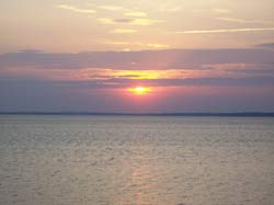
It’s hard to say goodbye to paradise, but I leave with the satisfaction that we have collected information that will provide for the further protection of Puerto Rico’s environment for many more sunrises and sunsets.


Science Wednesday: Underwater Science

Wednesday, February 25th, 2009

Each week we write about the science behind environmental protection. Previous Science Wednesdays.

About the author: Bill Fisher has worked with EPA’s Office of Research and Development for 18 years. His academic research included environmental studies of several marine invertebrates, including lobsters, crabs, squid and oysters. For the last five years he has worked to improve environmental protection of U.S. coral reefs.

This will be our third survey of coral reefs in the U.S. Virgin Islands (USVI). The first was in St. Croix where we verified that a new EPA bioassessment method could identify adverse effects of human activity on coral reefs. The next year we applied an Environmental Monitoring and Assessment Program (EMAP) ‘probability-survey’ method to determine the condition of reefs island-wide. And now, another year later, we will perform the same survey at St. Thomas and St. John.

It may seem a long time to complete a study, but coral reef research has many challenges—not the least of which is a suitable ship to work from. EPA has a well-equipped research ship, the Ocean Survey Vessel BOLD. She not only provides us berth and board, but has compressors to fill our SCUBA tanks and dive boats that we deploy to our sampling locations. The OSV BOLD is in great demand, so it is fortunate that we are able to work from her even once a year.

The survey itself is not complicated—especially if you were to run it on dry ground. The coral surveyor identifies each coral colony in a 25 square meter transect, measures their size and estimates the percent of live tissue. (Corals are clonal organisms, and colonies can suffer large losses of living tissue without dying). Under water, these observations are more difficult because the surveyor has to maneuver in currents and surge. What’s important is that these three basic underwater observations provide several indicators highly relevant to resource management.

We usually field three dive teams and each surveys two to three stations a day. All too often, it is too windy or there are high rollers (waves) that pose hazards getting in and out of small boats with dive gear. On these days we usually catch up entering data, checking gear and reading emails.

Our ultimate purpose in USVI is to assist in the development of coral reef biocriteria. These are water quality standards developed from indicators of coral condition. The first survey we ran told us that we could use the new bioassessment procedures, and the latter two will establish the baseline condition for coral reefs. USVI will use this baseline condition to establish expectations for reef health in the future.

On Board the OSV BOLD: Transition

Tuesday, February 24th, 2009
For more than a month, EPA’s Ocean Survey Vessel (OSV) Bold is studying the health of the waters around Puerto Rico and the U.S. Virgin Islands. EPA scientists and non-scientists will blog about their research and what it’s like to live and work at sea.

About the author: Charles LoBue serves as the chief scientist and diver for the US Virgin Island leg of the OSV BOLD voyage. He is an environmental scientist in EPA Region 2 in New York City.

Feb. 23, 2009 - 3:00 pm (Day 15)

As the Puerto Rico leg of the OSV BOLD’s survey winds down, the U.S. Virgin Islands leg is beginning. We’re staffed, equipped and ready to begin a nearly three-week survey to assess the condition of coral reefs around St. Thomas and St. John. We’ve reassembled this experienced team of divers and scientists to resume the work that began in 2006. Back then, EPA worked with V.I. Department of Planning and Natural Resources (DPNR) in St. Croix to initiate an inventive new coral monitoring program developed by EPA’s Office of Research and Development. Our team will include divers from EPA, DPNR, U.S. Fish and Wildlife Service, and The Nature Conservancy.image of side of ship with people on deck

The waters that we are working in this year are new to us, which adds an element of adventure. Our plan is to perform strategic observations and measurements of corals and other biota at 60 stations around the islands. Water and sediment sampling will add to the mix. Each morning, we will assign dive teams to three small boats, which will be dispatched to different observation stations.

image of diver examining coral underwaterHere’s the basic process once we’re in the water. When a dive team arrives at a station, a snorkel reconnaissance is performed to assess whether the site has suitable coral cover. The team then enters the water and lays a 25-meter transect line to mark the domain of the observations. The team then makes a general assessment of the cover types, measures topography, counts other invertebrate species, and collects sediment and water samples throughout the transect area. Coral experts will identify every hard coral colony encountered within a meter of the transect line, measure its dimensions, and judge how much of it is thriving.

image of scientists examining data in the on-board labWhen the team returns to the OSV BOLD, data are entered into a computer for analyses and water samples are processed. This will go on for the duration of the survey.

Sure it may seem to be a cookie-cutter process, but the best laid plans are always at the mercy of the weather and sea condition. Of course, underlying all this field work is the logistics and procedures needed to maintain to safe diving operations. Our challenge is to find and assess 60 suitable stations over some 50 some-odd miles of coast around the two islands and assorted cays. So here’s to blue skies, calm seas, and healthy coral.