|
|
|
Metadata
|
|
ID
|
A-1-00-SC
|
|
Abstract
|
United States Geological Survey, Menlo Park, California.
Chief Scientists: Chris Gutmacher, Stephanie Ross, Brian
Edwards. Geophysical data (12khz, Huntec, uniboom, Geopulse,
minisparker, minisparker, GPS, YoNav, 24channel, sparker) of
field activity A-1-00-SC in Southern California from Port
Hueneme to Mexican Border from 06/05/2000 to 06/29/2000
|
|
Organization
|
United States Geological Survey, Menlo Park, California
|
|
Project/Theme
|
Southern California Seismic Hazards Project
|
|
Chief Scientist
|
Chris Gutmacher
Stephanie Ross
Brian Edwards
|
|
Activity Type
|
Geophysical
|
|
Platform
|
Auriga
|
|
Area of Operation
|
Southern California from Port Hueneme to Mexican Border
|
|
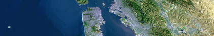
Location map
|

|
|
Bounding Coordinates
|
34.22868
-119.79080 -117.13802
32.58602
|
|
Ports
|
leave Redwood City, CA
arrive Redwood City, CA
|
|
Dates
|
06/05/2000 (JD 157) to 06/29/2000 (JD 181)
|
|
Analog Materials
|
list
|
|
Index map

|
|
|
Information Specialist
|
|
|
Crew
|
|
Chris Gutmacher
|
Chief Scientist, Watchstander, USGS Western Region
|
|
Stephanie Ross
|
Chief Scientist, Watchstander, USGS Western Region
|
|
Brian Edwards
|
Chief Scientist, USGS Western Region
|
|
Larry Kooker
|
Electronics Technician, USGS Western Region
|
|
Kevin O'Toole
|
Mechanical Technician, USGS Western Region
|
|
Ray Sliter
|
Multi-channel Seismic Watchstander, USGS Western Region
|
|
Becky Cooper
|
Watchstander Navigation, USGS Western Region
|
|
Pat Hart
|
Multi-channel Seismic Watchstander, USGS Western Region
|
|
Jon Childs
|
Multi-channel Seismic Watchstander, USGS Western Region
|
|
Dave Gonzales
|
Electronics Technician, USGS Western Region
|
|
Jane Reid
|
Watchstander, USGS Western Region
|
|
Dave Hogg
|
Electronics Technician, USGS Western Region
|
|
Tim Elfers
|
Mechanical Technician, USGS Western Region
|
|
Walt Olson
|
Mechanical Technician, USGS Western Region
|
|
Martin Uyesugi
|
Huntec Engineer Watchstander, Geoforce Consultants
|
|
Annie Douglas
|
Mammal Observer, Cascadia Research
|
|
Lisa Baraff
|
Mammal Observer, Cascadia Research
|
|
Dave Ellifrit
|
Mammal Observer, Cascadia Research
|
|
Todd Chandler
|
Mammal Observer Team Leader, Cascadia Research
|
|
Jr Veldink
|
Mammal Observer, Cascadia Research
|
|
Dick Corrigan
|
Captain, Northwind Shipyards
|
|
Ted Blinkers
|
Captain, Northwind Shipyards
|
|
Jeff Stringer
|
Mate, Northwind Shipyards
|
|
James Stacey
|
Engineer, Northwind Shipyards
|
|
Ricky Labrador
|
Cook, Northwind Shipyards
|
|
Rich Soderblom
|
Deck Hand, Northwind Shipyards
|
|
Brad Scarrott
|
Minisparker Technician, Applied Acoustic Engineering
|
|
|
Equipment Used
|
|
12khz
|
|
Huntec
|
|
uniboom
|
|
Geopulse
|
|
minisparker
|
|
minisparker
|
|
GPS
|
|
YoNav
|
|
24channel
|
|
sparker
|
|
|
Purpose
|
|
leg 1: identify fault and landslide hazards in the offshore
|
|
area of Southern California. The study areas were selected to
|
|
(a) obtain multichannel and high-resolution seismic-reflection data
|
|
inside the 3-mile limit between Port Hueneme and the Mexican border; and
|
|
(b) extend data coverage within a relatively unsurveyed segment of the
|
|
margin seaward of the shelf between Dana Point and San Diego,
|
|
California.
|
|
|
|
leg 2: to obtain multichannel and high-resolution data in
|
|
Los Angeles/Long Beach harbor and adjacent shelf for study of
|
|
salt-water intrusion in local aquifers.
|
|
|
Information to be Derived
|
|
Identify and map active and potentially active faults, folds,
|
|
and submarine slide-prone areas that may threaten densely populated
|
|
areas of Southern California. Map pathways of salt-water intrusion
|
|
into local aquifers critical to the large population of the greater
|
|
Los Angeles metropolitan area.
|
|
|
Summary
|
|
Extensive high-resolution geopulse and huntec data were
|
|
collected within the 3-mile limit and farther seaward in areas
|
|
sparsely surveyed during previous operations, as well as in the
|
|
Los Angeles / Long Beach harbor and adjacent shelf. Problems with
|
|
the minisparker power supplies prevented its use during much of
|
|
the cruise, despite unflagging efforts by the shipboard engineering
|
|
and electronic technicians. In the end, only 36 hours of multichannel
|
|
minisparker data were collected in the harbor/shelf area and an
|
|
additional 10 hours in the shelf and slope area east of Port Hueneme.
|
|
1200 line-km geopulse (960 hazards, 240 aquifers)
|
|
1400 line-km huntec (1300 hazards, 100 aquifers)
|
|
470 line-km minisparker (100 hazards, 370 aquifers)
|
|
|
Publications
|
|
Gutmacher, Christina E., Normark, William R., Ross, Stephanie L., Edwards,
|
|
Brian, Sliter, Ray, Hart, Patrick, Cooper, Becky, Childs, Jon, and Reid,
|
|
Jane, 2000, Cruise report for A1-00-SC Southern California earthquake hazards
|
project, Part A: U.S. Geological Survey Open-File Report 00-516:
|
|
HREF="http://geopubs.wr.usgs.gov/open-file/of00-516">walrus.wr.usgs.gov/reports
|
|
of00-516
|
|
|
Fisher, Michael, Normark, William, Langenheim, Victoria, Calvert, Andrew
|
|
and Sliter, Ray, 2004, Marine geology and earthquake hazards of the San Pedro
|
|
shelf region, Southern California: U.S. Geological Survey Professional Paper
|
1687.
|
|
|
Got Help?
|
For A-1-00-SC, we would appreciate any information on -- contract, days at sea, dive count, funding, kms of navigation, national plan, NGDC Info, notes, owner, project number, scanned materials, seismic description, station count, station description, submersible, tabulated info.
|
|