|
|
|
Metadata
|
|
ID
|
S-6-78-EG
|
|
Abstract
|
Chief Scientists: Bruce Molnia, Paul Carlson. Geological
and Geophysical data (3dot5khz, 12khz, airgunarcer,
gravitycore, VanVeengrab, uniboom, tempsalinometer,
underwatertelevision, minisparker, sparker, underwatercamera,
sidescansonar, integratednavigation, LoranC,
transitsatellite) of field activity S-6-78-EG in Eastern Gulf
of Alaska from 07/10/1978 to 07/20/1978
|
|
Chief Scientist
|
Bruce Molnia
Paul Carlson
|
|
Activity Type
|
Geological and Geophysical
|
|
Platform
|
Sea Sounder
|
|
Area of Operation
|
Eastern Gulf of Alaska
|
|
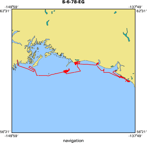
Location map
|

|
|
Bounding Coordinates
|
60.12041
-149.43372 -138.37505
59.02456
|
|
Ports
|
leave Yakutat, AK
arrive Seward, AK
|
|
Dates
|
07/10/1978 (JD 191) to 07/20/1978 (JD 201)
|
|
Analog Materials
|
list
|
|
Index map
|
|
|
Crew
|
|
Bill Levy
|
Watchstander
|
|
Bill Schwab
|
Watchstander
|
|
Bob Wilson
|
Mechanical Technician, USGS Western Region
|
|
Bruce Molnia
|
Chief Scientist, USGS Western Region
|
|
Charlie Fitts
|
Watchstander
|
|
Dennis Thurston
|
Unsp Investigatr
|
|
Edith Stanley
|
Watchstander, Uc Davis
|
|
Glen Barker
|
Mechanical Technician
|
|
John Laingor
|
Chief Mate
|
|
John Saladin
|
Electronics Technician
|
|
K. Simpson
|
Ship Captain
|
|
Mark Wheeler
|
Watchstander
|
|
Mel Rappeport
|
Watchstander
|
|
Paul Carlson
|
Chief Scientist, USGS Western Region
|
|
Paula Quinterno
|
Dafe Curator, USGS Western Region
|
|
Rich Garlow
|
Watchstander, USGS Western Region
|
|
Ron Schmitz
|
Electronics Technician
|
|
Tom Atwood
|
Watchstander
|
|
Bill Soule
|
Chief Engineer
|
|
|
Equipment Used
|
|
3dot5khz
|
|
12khz
|
|
airgunarcer
|
|
gravitycore
|
|
VanVeengrab
|
|
uniboom
|
|
tempsalinometer
|
|
underwatertelevision
|
|
minisparker
|
|
sparker
|
|
underwatercamera
|
|
sidescansonar
|
|
integratednavigation
|
|
LoranC
|
|
transitsatellite
|
|
|
NGDC Overview
|
|
! Converted to time format with year at start.
|
|
!
|
|
DATA COLLECTION OVERVIEW (use NGDC GEODAS CD to retrieve data)
|
|
|
|
MCG Data Collection ID --- S678EG
|
|
Institution Data Collection ID --- S678EG
|
|
NGDC ID --- 06110024
|
|
Funding --- (unspecified)
|
|
Project, Cruise & Leg --- Bruce Molnia
|
|
Study region --- +61.00000,+59.00000,-150.00000,-138.00000
|
|
Chief Scientist(s) --- Paul Carlson
|
|
Name of vessel --- Sea Sounder (surface ship)
|
|
Date field data collection started --- 07/12/78 LV YAKUTAT, AK
|
|
Date field data collection ended --- 07/20/78 AR SEWARD, AK
|
|
Parameters surveyed ---
|
|
Bathymetry: surveyed, contained in data file
|
|
Magnetics: (unspecified)
|
|
Gravity: (unspecified)
|
|
High-resolution seismics: (unspecified)
|
|
Deep penetration seismics: (unspecified)
|
|
Format --- (I1,A8,F5.2,4I2,F5.3,F8.5,F9.5,I1,F6.4,F6.1,I2,i1,3F6.1,I1,F5.1,F6.0,F7.1,F6.1,F5.1,A8,4I1)
|
|
Date of data input to NGDC --- 11/30/90
|
|
Contributing institution --- USGS Branch of Pacific Marine Geology
|
|
Country --- United States
|
|
|
|
Navigation instrumentation --- (unspecified)
|
|
Position determination method --- (unspecified)
|
|
|
|
Bathymetry instrumentation --- 3.5 KHZ BATHYMETRY 12 KHZ BATHYMETRY
|
|
Additional forms of bathymetric data --- (unspecified)
|
|
General rate of bathymetry in file --- 1.2 minutes
|
|
General collection rate of bathymetry --- (unspecified)
|
|
Assumed sound velocity --- 1463.0 m/sec
|
|
Bathymetric datum code --- No correction applied (sea level)
|
|
Bathmetry interpolation scheme --- (unspecified)
|
|
|
|
Magnetics instrumentation --- (unspecified)
|
|
Additional forms of magnetics data --- (unspecified)
|
|
General rate of magnetics in file --- (unspecified)
|
|
General collection rate of magnetics --- (unspecified)
|
|
Magnetic sensor tow distance --- (unspecified)
|
|
Magnetic sensor depth --- (unspecified)
|
|
Two sensor horizontal separation --- (unspecified)
|
|
Residual magnetics reference field --- (unspecified)
|
|
Method of applying residual field --- (unspecified)
|
|
|
|
Gravity instrumentation --- (unspecified)
|
|
Additional forms of gravity data --- (unspecified)
|
|
General rate of gravity in file --- (unspecified)
|
|
General collection rate of gravity --- (unspecified)
|
|
Theoretical gravity formula --- (unspecified)
|
|
Reference system --- (unspecified)
|
|
Corrections applied --- (unspecified)
|
|
Starting land tie --- (unspecified)
|
|
Ending land tie --- (unspecified)
|
|
|
|
Seismic instrumentation --- SINGLE CHANNEL SEISMIC
|
|
Formats of seismic data --- (unspecified)
|
|
|
Publications
|
|
Carlson, P.R., Molnia, B.F., and Wheeler, M.C., 1980, Seafloor geologic hazards in OCS lease
|
|
area 55, eastern Gulf of Alaska: Offshore Technology Conference Proceedings, no. 12, v. 4,
|
p. 593-603.
|
|
|
Molnia, B.F., and Carlson, P.R., 1980, Quaternary sedimentary facies of the northeast Gulf
|
of Alaska Continental Shelf: U.S. Geological Survey Professional Paper 1175, p. 158-159.
|
|
|
Got Help?
|
For S-6-78-EG, we would appreciate any information on -- contract, days at sea, dive count, funding, information specialist, information to be derived, kms of navigation, national plan, notes, organization, owner, project, project number, purpose, scanned materials, seismic description, station count, station description, submersible, summary, tabulated info.
|
|


