|
|
|
Metadata
|
|
ID
|
07031
|
|
Also Known As
|
R-1-07-MA
07031
|
|
Abstract
|
United States Geological Survey, Woods Hole, Massachusetts.
Chief Scientist: Richard Signell. Data (Navigation-GPS,
Navigation-Hypack, Sensor-current, ADCP) of field activity
07031 (R-1-07-MA) in Middle Ground, Vineyard Sound,
Massachusetts, United States,North America, North Atlantic
from 08/10/2007 to 08/10/2007
|
|
Organization
|
United States Geological Survey, Woods Hole, Massachusetts
|
|
Project/Theme
|
Middle Ground
|
|
Chief Scientist
|
Richard Signell
|
|
Platform
|
Rafael
|
|
Area of Operation
|
Middle Ground, Vineyard Sound, Massachusetts, United States,
North America, North Atlantic
|
|
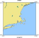
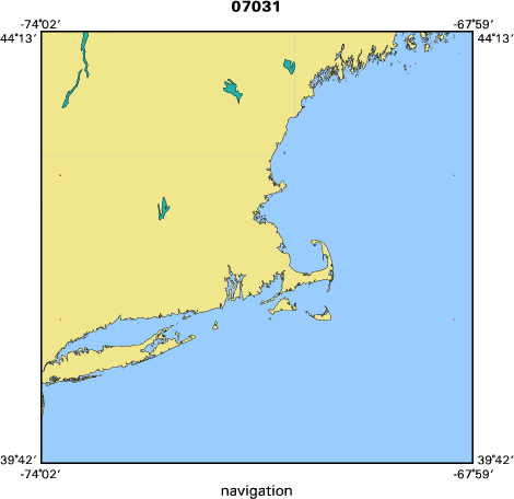
Location map
|
|
|
Bounding Coordinates
|
41.50000
-70.68333 -70.61667
41.43333
|
|
Ports
|
LEAVE Falmouth Harbor, Massachusetts, USA
ARRIVE Falmouth Harbor, Massachusetts, USA
|
|
Dates
|
08/10/2007 (JD 222) to 08/10/2007 (JD 222)
|
|
Analog Materials
|
No analog holdings.
|
|
Index map
|
|
|
Information Specialist
|
|
|
Crew
|
|
Richard Signell
|
Chief Scientist
|
|
Barry Irwin
|
Boat Operator
|
|
Jonathan Borden
|
Chief Technician
|
|
Timothy Driskell
|
WRD, Northboro, MA, ADCP Expert
|
|
|
Equipment Used
|
|
Navigation-GPS
|
|
Navigation-Hypack
|
|
Sensor-current
|
|
ADCP
|
|
|
Purpose
|
|
Shipboard ADCP survey of ebb tidal currents over middle
|
|
ground. We will attempt to document both the cross-bank structure
|
|
of the tidal currents over 800 m long across-bank transects. We
|
|
will also attempt to measure the detailed vertical current structure
|
|
between two large sand waves (amplitude 2-4 m) over two wavelengths
|
|
(~150 m).
|
|
|
Information to be Derived
|
|
Vertical structure of currents and backscatter intensity
|
|
along shiptrack. Surface water temperature along shiptrack.
|
|
|
Summary
|
|
We collected shipboard ADCP tidal currents over the ebb tidal
|
|
cycle (flowing toward SW) on middle ground. We observed strong
|
|
lateral shear in the tidal currents caused by Middle Ground and
|
|
headlands along Martha s Vineyard. We used Teladyne/RDI WinRiver II
|
|
software to collect the data, and this software produced two type of
|
|
files for each of the 6 transects we conducted: (1) a binary file
|
|
*.PD0 that contains raw information in beam/ship coordinates; (2) an
|
|
ASCII file *_GPS.TXT which contains the DGPS nav data. Barry Irwin
|
|
also provided a RTK GPS nav file at 1 s intervals after the cruise.
|
|
|
Notes
|
|
RTK GPS data was not included in the data stream to the RDI
|
|
WinRiver II software. Next time this should be included.
|
|
1 days at sea.
|
|
15 kms. of continuous data.
|
|
|
Funding
|
|
|
Got Help?
|
For 07031, we would appreciate any information on -- activity type, analog materials, contract, days at sea, dive count, kms of navigation, national plan, NGDC Info, owner, project number, publications, scanned materials, seismic description, station count, station description, submersible, tabulated info.
|
|


