www.weather.gov
National Weather Service Forecast Office
New Orleans/Baton Rouge, LA
Local News
SRH Home
Organization
Search
Local weather forecast by
"City, St" or zip code
Search by city or zip code. Press enter or select the go button to submit request
Current Hazards
SE La. - S Miss.
National
Current Conditions
Observations
Satellite Images
Rivers & Lakes AHPS
Hydrology
Radar Imagery
Slidell
Mobile
Nationwide
Forecasts
Activity Planner
SE La. - S Miss.
Aviation
Marine
Fire Weather
Climate
Local
National
More...
Tropical Weather
Katrina & Rita Info
SE La. - S Miss.
Hurricane Center
Weather Safety
Hurricane Preparedness
Weather Radio
SkyWarn
Storm Ready
Prepardness
Additional Info
Education/Outreach
Weather School
Brochures/Presentations
Weather Maps
Emergency-
Managers Page
Fire Weather
Managers Page
Storm Data
Past Weather Events
Bayou Observer
Office Information
Contact us
Office Contacts
Top News of the Day
Sign up for CoCoRaHS
Click on map for
Point Forecast
Submit Your Severe Weather Report
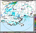
Click on the map below for the latest forecast.
En Español
Last map update: Wed, May. 6, 2009 at 11:55:47 am CDT
Read watches, warnings & advisories.
Zoom
Out
Flood Warning
Hazardous Weather Outlook
Short Term Forecast
Latest River Stages
Latest Satellite Image
Latest LIX Radar
Select Local Product:
Public Forecasts:
ZFPLIX (Zone Forecast)
SFTLIX (State Tabular Forecast)
PFMLIX (Point Forecast Matrix)
CCFLIX (Coded Cities Forecast)
NPWLIX (Non-Precipitation Statement)
NOWLIX (Short-Term Forecast)
AFDLIX (Area Forecast Discussion)
Marine:
CWFLIX (Coastal Waters Forecast)
MVF001 (Marine Verification Forecast)
MWSLIX (Marine Weather Statement)
SMWLIX (Special Marine Warning)
MWWLIX (Marine Weather Warning/Watch/Advisory)
CFWLIX (Coastal Flood)
TIDLIX (Tides)
Tropical:
HLSLIX (Hurricane/Tropical Storm Local Statement)
PSHLIX (Post-Tropical Cyclone Report)
EWWLIX (Extreme Wind Warning)
Winter Weather:
WSWLIX (Winter Weather)
Fire Weather:
FWFLIX (Fire Weather Forecast)
FWMLIX (Fire Weather Matrix)
RFWLIX (Red Flag)
Aviation:
OAVLIX (Incident Report)
TAFBTR (Baton Rouge Terminal Aerodrome Forecast)
TAFMSY (New Orleans Terminal Aerodrome Forecast)
TAFGPT (Gulfport Terminal Aerodrome Forecast)
TAFMCB (McComb Terminal Aerodrome Forecast)
Hazardous Weather:
HWOLIX (Hazardous Weather Outlook)
SVRLIX (Severe Thunderstorm Warning)
TORLIX (Tornado Warning)
SVSLIX (Severe Weather Statement)
SPSLIX (Special Weather Statement)
LSRLIX (Local Storm Report)
WCNLIX (Watch County Notification)
Hydrology:
RVSLIX (River Summary/Forecast)
RVDLIX (Daily River Summary)
RVAORN (Daily River Summary)
ESPORN (Extended River Forecast)
RVFLIX (River Forecast)
FFGLIX (Flash Flood Guidance)
FFALIX (Flood Watch)
FFWLIX (Flood Warning)
FFSLIX (Flood Statement)
FLWLIX (River Flood Warning)
FLSLIX (River Flood Statement)
ESFLIX (Hydrologic Outlook)
Observations:
RTPLIX (Regional Max/Min Temp and Precip)
RWRLA (Regional Weather Summary)
OPULIX (Other Public Product)
OSOLIX (Offshore Observations)
SCDLIX (Supplemental Climate Report)
RRMLIX (Supplemental Rainfall Reports)
RR1LIX (River Stages/Rainfall Reports)
MANLIX (Upper Air Mandatory Levels)
SGLLIX (Upper Air Significant Levels)
FZLLIX (Upper Air Freezing Level)
ABVLIX (Upper Air Above 100hPa)
Climate:
CLIBTR (Baton Rouge Daily Climate)
CLINEW (New Orleans Daily Climate)
CLMBTR (Baton Rouge Monthly Climate)
CLMNEW (New Orleans Monthly Climate)
CF6MSY (New Orleans Intl Climate CF6)
CF6BTR (Baton Rouge Climate CF6)
CF6GPT (Gulfport Climate CF6)
CF6MCB (McComb Climate CF6)
AGOLIX (Agriculture Summary)
RERLIX (Record Report)
Other Products:
PNSLIX (Public Information Statement)
FTMLIX (Free Text Message)
AQALIX (Air Quality Alert)
CAELIX (Child Abduction Alert)
SPWLIX (Shelter In Place Warning)
EVILIX (Immediate Evacuation)
CEMLIX (Civil Emergency)
Select National/Regional Product:
Storm Prediction Center (SPC):
SWOMCD (Mesoscale Discussion)
SWODY1 (Severe Weather Outlook Day 1 Discussion)
SWODY2 (Severe Weather Outlook Day 2 Discussion)
SWODY3 (Severe Weather Outlook Day 3 Discussion)
National Hurricane Center (NHC):
TWOAT (Tropical Weather Outlook)
TWDAT (Tropical Weather Discussion)
CHGHUR (Computer Hurricane Guidance)
CHGQLM (Computer Hurricane Guidance)
TCPAT1 (Public Advisory Storm 1)
TCPAT2 (Public Advisory Storm 2)
TCPAT3 (Public Advisory Storm 3)
TCPAT4 (Public Advisory Storm 4)
TCPAT5 (Public Advisory Storm 5)
TCDAT1 (Discussion Storm 1)
TCDAT2 (Discussion Storm 2)
TCDAT3 (Discussion Storm 3)
TCDAT4 (Discussion Storm 4)
TCDAT5 (Discussion Storm 5)
TCMAT1 (Forecast/Advisory Storm 1)
TCMAT2 (Forecast/Advisory Storm 2)
TCMAT3 (Forecast/Advisory Storm 3)
TCMAT4 (Forecast/Advisory Storm 4)
TCMAT5 (Forecast/Advisory Storm 5)
Hydrometeorolgical Prediction Center (HPC):
PMDSPD (Short Range Public Forecast Discussion)
PREEPD (Preliminary Extended Forecast Discussion)
PMDEPD (Final Extended Forecast Discussion)
QPFEPD (Quantitative Precipitaion Forecast Discussion)
QPFERD (Excessive Rainfall Discussion)
PMDHSD (Heavy Snow Discussion)
Weather Hazards
|
Weather Forecasts
|
Present Weather
Past Weather
|
Tropical Weather
|
Contact Us
National Weather Service
New Orleans/Baton Rouge Forecast Office
62300 Airport Rd.
Slidell, LA 70460-5243
Telephone 8AM-4PM
504.522.7330 985.649.0357
Date modified: February 26, 2009
Disclaimer
Credits
Glossary
Comments/Feedback
Privacy Policy
About Us
Career Opportunities

 National Weather Service Forecast Office
![[HWO]](https://webarchive.library.unt.edu/web/20090506165808im_/http://www.srh.noaa.gov/images/lix/graphicasticon.png)