|
|
|
Metadata
|
|
ID
|
G-2-97-PS
|
|
Abstract
|
Chief Scientists: Shawn Dadisman, Sam Johnson, Jon Childs.
Geophysical data (GPS, uniboom, bubblepulser, airgunmonitor,
multichannel, integratednavigation) of field activity
G-2-97-PS in Puget Sound, Washington from 06/25/1997 to
07/03/1997
|
|
Project/Theme
|
Crustal Earthquake Hazards
|
|
National Plan
|
Earthquake Hazards
|
|
Chief Scientist
|
Shawn Dadisman
Sam Johnson
Jon Childs
|
|
Activity Type
|
Geophysical
|
|
Platform
|
Robert Gray
|
|
Area of Operation
|
Puget Sound, Washington
|
|
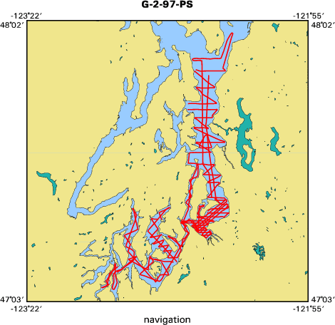
Location map
|

|
|
Bounding Coordinates
|
47.98279
-122.97965 -122.30549
47.08711
|
|
Dates
|
06/25/1997 (JD 176) to 07/03/1997 (JD 184)
|
|
Analog Materials
|
list
|
|
Index map
|
|
|
Crew
|
|
Shawn Dadisman
|
Chief Scientist, USGS Western Region
|
|
Sam Johnson
|
Chief Scientist, USGS Western Region
|
|
Jon Childs
|
Chief Scientist, USGS Western Region
|
|
Larry Kooker
|
Electronic Tech, USGS Western Region
|
|
Fred Payne
|
Electronic Tech, USGS Western Region
|
|
Kevin O'Toole
|
Mechanical Tech, USGS Western Region
|
|
Walter Barnhardt
|
Geologist, USGS Western Region
|
|
Walt Olsen
|
Mechanical Tech, USGS Western Region
|
|
Kurt Johnson
|
Captain
|
|
John or Curtis Lind
|
Chief Engineer
|
|
Dennys Marklight
|
Chief Mate
|
|
|
Equipment Used
|
|
GPS
|
|
uniboom
|
|
bubblepulser
|
|
airgunmonitor
|
|
multichannel
|
|
integratednavigation
|
|
|
Purpose
|
|
High-resolution, seismic-reflection data were collected in
|
|
central and southern Puget Sound and adjacent waterways in an effort to locate
|
|
and characterize active faults within the Puget Sound lowland.
|
|
|
Summary
|
|
Location and characteristics of faults in southern Puget Sound.
|
|
|
Publications
|
|
Dadisman, S.V., Johnson, S.Y., and Childs, J.R., 1997, Marine, High-Resolution,
|
|
Multichannel, Seismic-Reflection Data Collected During Cruise G-3-95-PS, Northwestern Washington, U.S. Geological Survey Open File Report 97-735.
|
|
|
Got Help?
|
For G-2-97-PS, we would appreciate any information on -- contract, days at sea, dive count, funding, information specialist, information to be derived, kms of navigation, NGDC Info, notes, organization, owner, ports, project number, scanned materials, seismic description, station count, station description, submersible, tabulated info.
|
|


