USGS Hydrologic Data and Studies in Support of the State of Kansas Total Maximum Daily Load (TMDL) Program
Introduction
The State of Kansas is required by the Federal Clean Water Act of 1972 to develop a total maximum daily load (TMDL) for impaired waters in the
State. A TMDL is an estimate of the maximum pollutant load (material transported during a specified time period) from point and nonpoint sources that a
receiving water can accept without exceeding water-quality standards. The USGS is providing hydrologic data-collection and studies support to the Kansas
Department of Health and Environment (KDHE), the agency tasked with implementing the TMDL process in Kansas. The specific USGS activities described below
include the estimation of potential runoff-contributing areas, estimation of streamflow-duration curves at ungaged sites, and real-time water-quality
monitoring. These activities are supported in part by the Kansas State Water Plan Fund.
Detailed information about the TMDL process in Kansas is provided on the KDHE TMDL website.
Keynote speech presented by Robert Hirsch, Associate Director of Water for the USGS, at the TMDL Conference in St. Louis, Missouri, March 5, 2001. USGS Technical Assistance for TMDLs .
Hydrologic Data and Studies in Support of the TMDL Program in Kansas, (6.9 MB) - A poster presentation.
Use of Reservoir Sediment Studies for Historical Watershed Loading and TMDL's in Kansas, (16 MB)
- A poster presentation
|
| 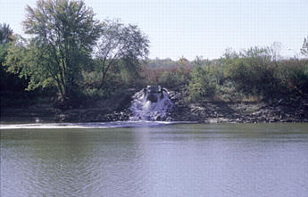 Point-source pollution Point-source pollution
|
|  Nonpoint-source pollution Nonpoint-source pollution
|
REAL-TIME WATER-QUALITY MONITORING
The USGS is developing a real-time water-quality network in Kansas that will provide real-time load estimates for use in determining TMDL's. Specific
objectives of the network are to: (1) develop relations between water-quality parameters that can be measured onsite in real time (water temperature,
specific conductance, pH, dissolved oxygen, and turbidity) and used as surrogates for water-quality constituents of concern to KDHE, the U.S.
Environmental Protection Agency, and others, such as chloride, sulfate, bacteria, suspended sediment, and atrazine; (2) enhance the existing stream-gaging
network with real-time water-quality monitors to provide an alert network for optimizing the frequency of water-quality sample collection and warning
water suppliers so that treatment can be more efficient; (3) develop a relation between fecal coliform and Escherichia coli (E. coli) as a future
water-quality standard replacement for fecal coliform bacteria; and (4) determine cumulative mass load of major ions, dissolved solids, nutrients,
suspended sediment, and bacteria.

Real-time water-quality probe.

For related publications and other information visit our Real-Time Water Quality web page
Completed Reports to Date
- Continuous water-quality monitoring梐 valuable tool for TMDL programs, in Proceedings of National TMDL
Science and Policy 2003 Speciality Conference, Chicago, Illinois, November 16�, 2003: Water Environment Federaton, compact disk, session 11, 17 p.
by Rasmussen, T.J., Ziegler, A.C., Rasmussen, P.P., and Stiles, T.C., 2003
- Continuous Turbidity Monitoring and Regression Analysis to Estimate Total Suspended Solids and Fecal Coliform
Bacteria Loads in Real Time in Proceedings of the Seventh Federal Interagency Sedimentation Conference, March 25-29, 2001, Reno, Nevada:
Subcommittee on Sedimentation--by V.G. Christensen, A.C. Ziegler, and Jian, Xiaodong, 2001, v. 2, p. III-94 to III-101.
- Continuous Monitoring and Regression Analysis to Estimate Bacteria Loads in Proceedings of TMDL
Science Issues Conference, March 4-7, 2001, St. Louis, Missouri: Water Environment Federation--by V.G. Christensen, P.P. Rasmussen, A.C. Ziegler, and
Jian, Xiaodong, 2001, p. 405-411.
- WRIR 00-4126 Regression Analysis and Real-Time Water-Quality Monitoring to Estimate Constituent
Concentrations, Loads, and Yields in the Little Arkansas River, South-Central Kansas, 1995-99--by V.G. Christensen, 2000, 36 p.
- FS 182-99 Real-Time Water-Quality Monitoring for Protection of Wildlife at Quivira National Wildlife
Refuge, South-Central Kansas--by V.G. Christensen, 1999, 4 p.
For additional information, please write or call:
Teresa Rasmussen
U.S. Geological Survey
4821 Quail Crest Place
Lawrence, Kansas 66049-3839
Telephone: (785) 832-3576
Fax: (785) 832-3500
Email: rasmuss@usgs.gov
Top of Page
POTENTIAL RUNOFF-CONTRIBUTING AREAS
Development of TMDL's requires an understanding of potential source areas of storm runoff that are the most likely contributors of nonpoint-source
pollution within a basin. Using available soil, topographic, and land-use digital data, the USGS is estimating potential runoff-contributing areas
statewide. Results of these analyses will compare runoff potential both between and within individual stream basins. Also, such information will provide
guidance for the targeting of best-management practices to reduce runoff and meet TMDL requirements.
The study is proceeding in three phases. In phase one, the U.S. Department of Agriculture's 1:250,000-scale State soils geographic data base (STATSGO)
and the USGS 1-km-resolution digital elevation model (DEM) were used to estimate potential runoff-contributing areas in the Kansas-Lower Republican River
Basin. In phase two, the same digital data sets were used to estimate potential runoff-contributing areas statewide. The first two phases were intended to
provide a means of comparing runoff potential between basins. In phase three, the U.S. Department of Agriculture's 1:24,000-scale soil survey geographic
data base (SSURGO), the USGS 100-m-resolution DEM, as well as digital land-use data from the Kansas Applied Remote
Sensing Program, University of Kansas, will be used to estimate potential runoff-contributing areas statewide. The use of more spatially detailed data
in phase three will enable a comparison of runoff potential between areas within individual basins.
Completed Reports to Date
- The role of reservoir sediment studies in the TMDL process in Kansas, in
Proceedings, National TMDL Science and Policy 2003 Specialty Conference, November 16�, 2003, Chicago, Illinois:
Alexandria, Virginia, Water Environmental Federation--by K.E. Juracek and T.C. Stiles, 2003 12 p., CD朢OM
- Estimation of Potential Runoff-Contributing Areas, in Proceedings of the Seventh Federal
Interagency Sedimentation Conference, March 25-29, 2001, Reno, Nevada: Subcommittee on Sedimentation--by K.E. Juracek, 2001, v. 2, p. VII-26 to
VII-33.
- WRIR 00-4177 Estimation and Comparison of Potential Runoff-Contributing Areas in Kansas Using
Topographic, Soil, and Land-Use Information--by K.E. Juracek, 2000, 55 p.
- WRIR 99-4089 Estimation of Potential Runoff-Contributing Areas in the Kansas-Lower Republican River
Basin, Kansas--by K.E. Juracek, 1999, 24 p.
- WRIR 99-4242 Estimation of Potential Runoff-Contributing Areas in the Kansas Using Topographic and
Soil Information--by K.E. Juracek, 1999, 29 p.
For additional information, please write or call:
Kyle Juracek
U.S. Geological Survey
4821 Quail Crest Place
Lawrence, Kansas 66049-3839
Telephone: (785) 832-3527
Fax: (785) 832-3500
Email: kjuracek@usgs.gov
Top of Page
STREAMFLOW-DURATION CURVES
The KDHE approach to TMDL Curve Methodology is based on the dynamic state of loads. Because
loads vary directly with streamflow as well as pollutant concentration, KDHE has devised a plan to relate TMDL constituent criteria to streamflow
duration. This approach yields the actual design load along with an estimate of the duration, or percentage of time the load can be expected in any given
year.
KDHE develops the TMDL curves for sites with USGS continuous-record stream-gaging sites. For sites without USGS
continuous-record stream-gaging stations that require TMDL curves, the USGS is estimating the streamflow-duration curve. The method for estimating
streamflow duration for ungaged sites relies on regionalized streamflow characteristics to generate five different duration-curve points and the average
regionalized slope of the curve. Several medium- to low-flow measurements are made concurrently with nearby, long-term USGS stream-gaging stations for
verification or adjustment of the estimated duration curve. The figure below shows a test of the estimation method at a long-term continuous-record
stream-gaging site:

Completed Reports to Date
- FS-009-01 Evaluation of Missing Gage-Height Record for Streams and Lakes in Kansas--by S.E. Studley,
2001, 4 p.
- WRIR 00-4113 Estimated Flow-Duration Curves for Selected Ungaged Sites in the Cimarron and Lower
Arkansas River Basins in Kansas--by S.E. Studley, 2000, 43 p.
- WRIR 01-4142 Estimated Flow-Duration Curves for Selected Ungaged Sites in Kansas--by S.E. Studley,
2001, 90 p.
For additional information, please write or call:
Seth Studley
U.S. Geological Survey
4821 Quail Crest Place
Lawrence, Kansas 66049-3839
Telephone: (785) 832-3541
Fax: (785) 832-3500
Email: sstudley@usgs.gov
 WATER DATA & STUDIES