|
|
|
Metadata
|
|
ID
|
F-2-91-CP
|
|
Abstract
|
Chief Scientists: Ledabeth Pickthorn, Dave Drake.
Geophysical data (GPS, 10khz, magnetics, airgunmonitor,
2channelairgun, Gloriasidescan, tempsalinometer, 3dot5khz,
gravity, expendablebatthermograph, integratednavigation,
RhoRho) of field activity F-2-91-CP in Westpac Gloria Leg 3,
Johnston Island, Sector #3 from 01/31/1991 to 02/21/1991
|
|
Chief Scientist
|
Ledabeth Pickthorn
Dave Drake
|
|
Activity Type
|
Geophysical
|
|
Platform
|
Farnella
|
|
Area of Operation
|
Westpac Gloria Leg 3, Johnston Island, Sector #3
|
|
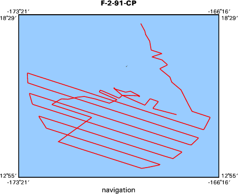
Location map
|

|
|
Bounding Coordinates
|
18.17450
-173.02499 -166.59309
13.23970
|
|
Ports
|
leave Honolulu, HI
arrive Hilo, HI
|
|
Dates
|
01/31/1991 (JD 031) to 02/21/1991 (JD 052)
|
|
Analog Materials
|
list
|
|
Index map
|
|
|
Crew
|
|
Dave Drake
|
Chief Scientist, USGS Western Region
|
|
Ledabeth Pickthorn
|
Chief Scientist, USGS Western Region
|
|
Mike Boyle
|
Electronics Technician, USGS Western Region
|
|
John Barber
|
Watchstander, USGS Western Region
|
|
Michael Hamer
|
Watchstander, USGS Western Region
|
|
Lisa Bader
|
Facs Curator, USGS Western Region
|
|
Yong-Kuk Lee
|
Watchstander, Kordi
|
|
Colin Jacobs
|
Chief Scientist, IOS
|
|
Andrew Lord
|
Computer Analyst, RVS
|
|
Eric Darlington
|
Electronics Technician, IOS
|
|
Derek Bishop
|
Geophysicist, IOS
|
|
Alan Gray
|
Mechanical Technician, IOS
|
|
Amanda Lothian
|
Watchstander, IOS Student
|
|
John Nichols
|
Ship Captain
|
|
Mike Baldwin
|
Chief Engineer
|
|
Ashley Robinson
|
Chief Mate
|
|
|
Equipment Used
|
|
GPS
|
|
10khz
|
|
magnetics
|
|
airgunmonitor
|
|
2channelairgun
|
|
Gloriasidescan
|
|
tempsalinometer
|
|
3dot5khz
|
|
gravity
|
|
expendablebatthermograph
|
|
integratednavigation
|
|
RhoRho
|
|
|
Notes
|
|
|
NGDC Overview
|
|
! Converted to time format with year at start.
|
|
!
|
|
DATA COLLECTION OVERVIEW (use NGDC GEODAS CD to retrieve data)
|
|
|
|
MCG Data Collection ID --- F291CP
|
|
Institution Data Collection ID --- FARN0291
|
|
NGDC ID --- 06780063
|
|
Funding --- USGS
|
|
Project, Cruise & Leg --- MV FARNELLA CRUISE 2, 1991.
|
|
Study region --- +19.00000,+13.00000,-174.00000,-166.00000
|
|
Chief Scientist(s) --- MR C.L. JACOBS, IOSDL
|
|
Name of vessel --- MV FARNELLA (surface ship)
|
|
Date field data collection started --- 02/03/91 HONOLULU, USA
|
|
Date field data collection ended --- 02/18/91 HILO, USA
|
|
Parameters surveyed ---
|
|
Bathymetry: surveyed, contained in data file
|
|
Magnetics: surveyed, contained in data file
|
|
Gravity: surveyed, contained in data file
|
|
High-resolution seismics: (unspecified)
|
|
Deep penetration seismics: (unspecified)
|
|
Format --- (I1,A8,F5.2,4I2,F5.3,F8.5,F9.5,I1,F6.4,F6.1,I2,i1,3F6.1,I1,F5.1,F6.0,F7.1,F6.1,F5.1,A8,4I1)
|
|
Date of data input to NGDC --- 04/25/94
|
|
Contributing institution --- NATURAL ENVIRONMENT RESEARCH COUNCIL
|
|
Country --- UNITED KINGDOM
|
|
|
|
Navigation instrumentation --- GPS
|
|
Position determination method --- SATELLITE
|
|
|
|
Bathymetry instrumentation --- IOS MK3 10KHZ ECHO-SOUNDER
|
|
Additional forms of bathymetric data --- ANALOG RECORDS
|
|
General rate of bathymetry in file --- 2.0 minutes
|
|
General collection rate of bathymetry --- (unspecified)
|
|
Assumed sound velocity --- (unspecified)
|
|
Bathymetric datum code --- No correction applied (sea level)
|
|
Bathmetry interpolation scheme --- (unspecified)
|
|
|
|
Magnetics instrumentation --- (unspecified)
|
|
Additional forms of magnetics data --- (unspecified)
|
|
General rate of magnetics in file --- 2.0 minutes
|
|
General collection rate of magnetics --- (unspecified)
|
|
Magnetic sensor tow distance --- (unspecified)
|
|
Magnetic sensor depth --- (unspecified)
|
|
Two sensor horizontal separation --- (unspecified)
|
|
Residual magnetics reference field --- (unspecified)
|
|
Method of applying residual field --- (unspecified)
|
|
|
|
Gravity instrumentation --- (unspecified)
|
|
Additional forms of gravity data --- (unspecified)
|
|
General rate of gravity in file --- 2.0 minutes
|
|
General collection rate of gravity --- (unspecified)
|
|
Theoretical gravity formula --- (unspecified)
|
|
Reference system --- (unspecified)
|
|
Corrections applied --- (unspecified)
|
|
Starting land tie --- (unspecified)
|
|
Ending land tie --- (unspecified)
|
|
|
|
Seismic instrumentation --- (unspecified)
|
|
Formats of seismic data --- (unspecified)
|
|
|
Got Help?
|
For F-2-91-CP, we would appreciate any information on -- contract, days at sea, dive count, funding, information specialist, information to be derived, kms of navigation, national plan, organization, owner, project, project number, publications, purpose, scanned materials, seismic description, station count, station description, submersible, summary, tabulated info.
|
|