
 Feeds & Data
Magnitude 4.9 - TONGA
2009 May 05 03:20:05 UTC
Earthquake Details
| Magnitude | 4.9 |
|---|---|
| Date-Time |
|
| Location | 17.471°S, 173.363°W |
| Depth | 35 km (21.7 miles) set by location program |
| Region | TONGA |
| Distances | 145 km (90 miles) NNE of Neiafu, Tonga 175 km (110 miles) SSE of Hihifo, Tonga 450 km (280 miles) NNE of NUKU'ALOFA, Tonga 2445 km (1520 miles) NNE of Auckland, New Zealand |
| Location Uncertainty | horizontal +/- 18.4 km (11.4 miles); depth fixed by location program |
| Parameters | NST= 51, Nph= 51, Dmin=429.3 km, Rmss=1.11 sec, Gp=133°, M-type=body wave magnitude (Mb), Version=Q |
| Source |
|
| Event ID | us2009ggaj |
- This event has been reviewed by a seismologist.
- Did you feel it? Report shaking and damage at your location. You can also view a map displaying accumulated data from your report and others.
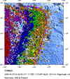
Earthquake Maps


Scientific & Technical Information
 Historic Moment Tensor Solutions
- Preliminary Earthquake Report
- U.S. Geological Survey, National Earthquake Information Center:
World Data Center for Seismology, Denver
