
 Feeds & Data
Magnitude 6.9 - KURIL ISLANDS
2009 April 07 04:23:33 UTC
Earthquake Details
| Magnitude | 6.9 |
|---|---|
| Date-Time |
|
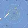
| Location | 46.112°N, 151.483°E |
| Depth | 31 km (19.3 miles) set by location program |
| Region | KURIL ISLANDS |
| Distances | 300 km (185 miles) ENE of Kuril'sk, Kuril Islands 615 km (380 miles) SW of Severo-Kuril'sk, Kuril Islands, Russia 1515 km (940 miles) NE of TOKYO, Japan 7155 km (4440 miles) NE of MOSCOW, Russia |
| Location Uncertainty | horizontal +/- 4.3 km (2.7 miles); depth fixed by location program |
| Parameters | NST=334, Nph=334, Dmin=500 km, Rmss=0.93 sec, Gp= 29°, M-type=teleseismic moment magnitude (Mw), Version=Q |
| Source |
|
| Event ID | us2009fdak |
- This event has been reviewed by a seismologist.
- Did you feel it? Report shaking and damage at your location. You can also view a map displaying accumulated data from your report and others.


Earthquake Maps


Scientific & Technical Information

- Preliminary Earthquake Report
- U.S. Geological Survey, National Earthquake Information Center:
World Data Center for Seismology, Denver
