|  |
| |
|
|
||||||||||||||||||||
|
About LANDFIRE
 Data Products
Schedule
How to Participate
Documents
Training & Technology Transfer

 National Schedule 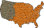 |
Data Products »» LANDFIRE Rapid Assessment Data Available
LANDFIRE Rapid Assessment data products for the lower 48 states are now available through the National Map LANDFIRE. The LANDFIRE Rapid Assessment (RA) was a regional-scale effort that produced maps and models of potential natural vegetation groups, reference fire regimes, and fire regime condition class for the conterminous United States. The LANDFIRE Rapid Assessment data products can be used for national- to regional-scale strategic planning, broad ecological assessments, and resource allocation. Rapid Assessment data products are designed to fill data needs ahead of the incremental release of LANDFIRE National products across the U.S., and RA data will be replaced by LANDFIRE National data as they become available. For more information about the Rapid Assessment's relationship to LANDFIRE National, click here. |
|||||||||||||||||||
|
||||||||||||||||||||