Land Remote Sensing Program
NOTE: Links and contacts within this release are valid at the time of publication.
2013
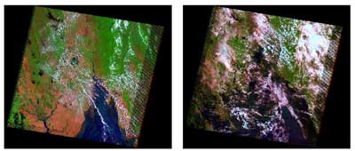
 Landsat satellites provide decision makers with key information about the world's food, forests, water and how these and other land resources are being used. The Landsat Application Book, Landsat: Continuing to Improve Everyday Life (PDF, 101 Mb), explores a number of important everyday uses of Landsat that benefit us as a society. The launch of the LDCM satellite ensures that Landsat data will continue to enable these applications.
2012
 Across the country, people in many different sectors of the working world use Landsat imagery. But exactly who these users are, how they use the imagery, and the value and benefits derived from the information that the imagery provides were largely unknown-until now...
 Video: Interior Department Plays
Role in President's National Space
Policy
Video: Interior Department Plays
Role in President's National Space
Policy2011

The White House has initiated a year-long study called The Future of Land Imaging to explore options for United States operational use of satellites to better serve society. The USGS serves on the leadership team of this Federal interagency working group.


To view and print the PDF you must obtain and install the Acrobat® Reader, available at no charge from Adobe Systems.
Document Accessibility: Adobe Systems Incorporated has information about PDFs and the visually impaired. This information provides tools to help make PDF files accessible. These tools convert Adobe PDF documents into HTML or ASCII text, which then can be read by a number of common screen-reading programs that synthesize text as audible speech. In addition, an accessible version of Acrobat Reader 7.0 for Windows (English only), which contains support for screen readers, is available. These tools and the accessible reader may be obtained free from Adobe at Adobe Access.

![]() U.S. Department of the Interior |
U.S. Geological Survey
U.S. Department of the Interior |
U.S. Geological Survey
URL: http://remotesensing.usgs.gov/science_archive.php
Page Contact Information: Contact Land Remote Sensing
Page Last Modified: February 08, 2013


