
Maps and Publications
Geological Survey Program | Land Survey Program | The Geologic Column of Missouri
Missouri Geologic Maps | USGS 7.5-minute Topographic Maps of Missouri
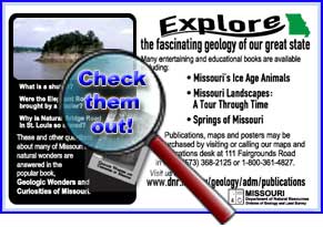 |
You may order online, or call 573-368-2125 or or 800-361-4827, or you may drop by our Rolla office at 111 Fairgrounds Road in Rolla, Missouri. For directions, please see our online map. When ordering or submitting correspondence, please make note of our new email address: geopubs@dnr.mo.gov. Please refer to the online catalog for tax and shipping fees. |
Featuring our newest items and four all-time favorites:
Full-color Posters Suitable for Framing |
||||
 |
 |
 |
 |
 |
 |
Only |
 |
$12.50 |
||
each |
||
22x28
|
$18 each if you want them laminated |
|
Missouri Environmental Geology Atlas
It is often said that information is power, and the second edition of the Missouri Environmental Geology Atlas CD-ROM, or MEGA 2007, puts a significant amount of power at users' fingertips.
The MEGA 2007 CD-ROM is a collection of interactive computer maps that allows users access to more than 30 statewide geographic information system (GIS) data layers, all from their computer desktops. Significant improvements and additions have been made since MEGA's debut in 2003. New data layers have been added and many of the existing data layers updated. Layers Listing 151K PDF Among the additions is a water table map showing static water levels. Other new data layers include drill areas depicting requirements for well construction area boundaries and a mine and mineral occurrence layer. A significant addition to the existing well log layer is a simplified well log that lists various materials encountered during drilling. Missouri House and Senate district boundaries are also part of the collection. Because the state has been collecting geologic data since the mid-1800s, vast amounts of data are available. This information enables users to apply earth science data to real-world issues. Many of the data layers allow for better decisions related to the use and protection of our state's water. Landowners, developers, engineers, geologists, planners, consultants, first responders, researchers, teachers and students will find this tool particularly helpful. An easy-to-follow manual will be included along with free software to enable viewing. The price of the MEGA CD is $45. Please refer to the online catalog below for tax and shipping fees. You may order online, or call 573-368-2125 or or 800-361-4827, or you may drop by our Rolla office at 111 Fairgrounds Road, Rolla, MO, 65401. For directions, please see our online map. |
Paleozoic Succession
Part 5 Released on CD-ROM, this 1225-page reference is the definitive work on the stratigraphy of the Pennsylvanian Subsystem in Missouri. The work includes detailed descriptions and discussions of over 200 individual Pennsylvanian stratigraphic units, as well as type sections and reference sections, illustrations, color photographs, and index maps. The CD can be ordered with an optional stratigraphic poster that graphically summarizes the entire Pennsylvanian Subsystem in Missouri. The Paleozoic Succession in Missouri, Part 5--Pennsylvanian Subsystem of Carboniferous System, Report of Investigations 70, was written by Richard J. Gentile, Professor Emeritus, University of Missouri-Kansas City, and Thomas L. Thompson, Principal Geologist (retired), Division of Geology and Land Survey, Missouri Department of Natural Resources. This work is certainly the most comprehensive analysis of the Pennsylvanian bedrock of the state of Missouri that has ever been completed. It will prove vital to those using Pennsylvanian bedrock as a resource and to those interested in scientific endeavors as well. The price of the book on CD-ROM is $26 and the stratigraphic poster is $12.50. Please refer to the online catalog below for tax and shipping fees. You may order online, or call 573-368-2125 or 800-361-4827, or you may drop by our Rolla office at 111 Fairgrounds Road, Rolla, MO 65401. For directions, please see our online map. |


Geologic Map Of Missouri 2003
Listed under Wall Maps in the catalog below, this Sesquicentennial Edition of the Geologic Map of Missouri was published in 2004 to recognize the agency's 150th anniversary. It is a colorful, poster-sized, 1:500,000 scale map created with digital mapping technology. It measures 42 3/4 by 54 3/4 inches. The map incorporates over 25 years of new geologic work. Various inset maps show earthquake epicenters in southeast Missouri, subdrift and modern drainage patterns in northwestern Missouri, principal tectonic features of Missouri and the location of unusual circular structures caused by meteorite or comet impact or explosive volcanism. Suitable for framing, it is printed on UV protected, heavy weight glossy paper and displays 36 different geologic units in vivid colors. The price of the map is $9.25 if mailed folded and $10.75 if mailed rolled. Please refer to the online catalog below for tax and shipping fees. You may order online, or call 573-368-2125 or 800-361-4827, or you may drop by our Rolla office at 111 Fairgrounds Road, Rolla, MO 65401. For directions, please see our online map. |
This colorful set of 80 cards highlights the Missouri River’s outstanding natural resources as it follows the path taken by Meriwether Lewis and William Clark's Corps of Discovery Expedition two hundred years ago. Read about Missouri state parks, conservation areas, sites of interest and scenic river towns. See riverside statues and monuments honoring Lewis and Clark's journey, murals within the Capitol building, portraits of the explorers, along with numerous breath taking river scenes. Additional trading card sets highlighting Missouri's natural resources are also available. The price of this set is $8. Please refer to the online catalog below for tax and shipping fees. You may order online, or call 573-368-2125 or 800-361-4827, or you may drop by our Rolla office at 111 Fairgrounds Road, Rolla, MO 65401. For directions, please see our online map. |


Additional Maps and Publications:
General Interest Publications about Missouri Geology
Publications listed can be requested by filling out the Publication Order Form.
When ordering or submitting correspondence, please make note of our new email address:
geopubs@dnr.mo.gov
2009-2010 Publications Catalog 2.5MB PDF |