| Latest
Drought Information |
| |
Synopsis | Summary
of Impacts | Climate Summary | Temperature
and Precipitation Outlook
Hydrologic Summary and Outlook | Related
Web Sites |
| |
|
|
| |
...Severe Drought
in South Central New Mexico and Moderate Drought Elsewhere across
the southern third of the State...
...Abnormally Dry Conditions Expanding in Northern New Mexico... |
| |
| |
| Synopsis |
Precipitation during the first three weeks of April 2009 was generally
above normal north of Interstate 40 in New Mexico, but near zero south
of a line from Carlsbad to Roswell to Las Cruces and back toward Quemado.
Precipitation across New Mexico during March 2009 was
well below normal across much of the central and west, while several
eastern border
counties received near normal rainfall. For the southern third of New
Mexico, March was the third consecutive month of well below normal precipitation.
Snowpack water content in the northern New Mexico Mountains
as of late April ranged from near normal in the Rio Chama
Basin and Sangre de Cristo Mountains to less
than 5 percent of normal in the Jemez River Basin.
The lack of moisture associated with storm systems passing
through New Mexico through the first third of 2009 resulted in
generally dry, warm,
and breezy to windy conditions that have parched much of the south while
gradually diminishing the extent and depth of the snowpack in the mountains.
As of late April, drought concerns continue
to focus on southern New Mexico.
The current U.S. Drought Monitor map depiction of drought
for New Mexico can be found at: the
Drought Monitor web site.
|
| Summary
of Impacts |
The Mountainair Ranger District initiated Stage 1 fire restrictions
on March 9th due to recent prolonged dry conditions across the Manzano
and Gallinas Mountain regions.
The Kiowa National Grasslands in northeast New Mexico
prohibits open fires as of March 4th, except in developed campgrounds.
The Navajo Nation retains fire restrictions on the reservation in
northwest New Mexico where campfires are permitted only in developed
recreation areas.
|
| |
|
| |
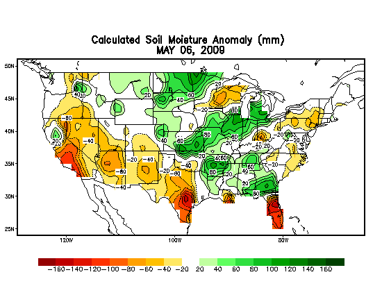
CPC Most Recent Day Soil Moisture
Anomaly Map |
| |
| Climate
Summary |
| |
March 2009 was the third consecutive drier-than-normal
month for much of the southern two thirds of New Mexico. Some sites with
significant three month precipitation deficits to start 2009 (January
through March) included:
3 Month Total Deficit
|
Observed
|
Deficit
|
Las Vegas |
0.42 inches
|
0.94 inches
|
Santa Rosa |
0.45
|
0.95
|
Roswell |
0.26
|
1.08
|
Carlsbad |
0.29
|
0.92
|
Las Cruces |
0.03 |
1.06 |
Ruidoso |
0.93 |
2.61 |
Albuquerque |
0.31 |
0.99 |
Water year 2009 precipitation (October 2008 – March 2009) is below normal
for a statewide average (76 percent). The Northern Mountains climate division
averaged 101 percent of normal precipitation while the Southern Desert climate
division precipitation averaged only 36 percent of normal, and the Southeastern
Plains reported 61 percent of normal.
|
The near-uniformly dry conditions in the spring
of 2008 left several regions with significant precipitation deficits
through
the
first
six months
of last year. Drought conditions extended across much of the southeast
two-thirds of the state by early July. Despite the near normal to
abundant summer precipitation in most areas of the state, parts of
Union County and far northeast Colfax County still reported moderate
precipitation deficits as of the end of August. Persistent dry conditions
in the northern portions of the state through November resulted in
the continuation of a abnormally dry classification across
north central and northeast New Mexico. By late November abnormally
dry conditions spread to the northwest corner of the state. A snowy
December over the northwest and north central areas eased the dry conditions,
while the dry weather persisted in the northwest. The abnormally dry
conditions spread south over most of the eastern plains by January
and over southern portions of the state in February. The abnormally
dry conditions continued over the east and south through March.

Animation of the drought status in New Mexico from
March 2008
through March 2009
|
| |
|
| |

|
 |
| |
Precipitation Estimates
and departures from normal can be generated for a variety of time periods
including the current day, archived days, the previous month and the
calendar year to date. |
2009 Precipitation through March |
| |
| Precipitation
and Temperature Outlooks |
Generally dry conditions are likely to prevail across New Mexico through
the end of April. Chances for spotty showers and thunderstorms should
be limited to the eastern border counties through the remainder of
April.
The precipitation outlook for May to mid June ranges
from near normal conditions to drier than normal conditions for New
Mexico.
For the latest weather forecast for the northern
two thirds of New Mexico, please see the NWS
WFO Albuquerque Forecast Map.
|
|

|
| One- Month CPC Outlooks |
| |
|
| |

|
3-Month CPC Outlooks
|
| |
| Hydrologic
Summary and Outlook |
Reservoir storage is above normal at Abiquiu Lake, El Vado Lake, and
Costilla Lake, while water levels were near normal at Heron
Lake and Navajo Lake. Well below normal storage persists at Conchas
Lake, Elephant Butte Lake, Bluewater Lake, Santa Rosa Lake, Sumner
Lake and Caballo Lake.
|
| |
 |
| |
New Mexico Water Watch from USGS |
| |
| Related
Web Sites |
| |
| |
Drought
Indices |
| |
Drought
Indices Explained |
| |
Crop
Moisture Index |
| |
Palmer
Drought Severity Index |
| |
Percent
of Normal Precipitation |
| |
SPI
(Standardized Precipitation Index) | Alternate |
| |
|
| |
External
Links and Sites |
| |
New
Mexico State Engineer Drought Task Force |
| |
Water
Supply Forecast |
| |
|
| |
|
| |
Additional
Information |
| |
NM
Drought Map Archive - April '06 - February '08 |
| |
New
Mexico Precipitation Summaries |
| |
Climatology
and Paleoclimatology |
| |
Western
Region Climate Center |
| |
|
 |
|
| US Seasonal Drought Outlook from the
Climate Prediction Center |
| |
|
This
product will be updated in early May or sooner if necessary
in response to significant changes in weather, water supply or drought
conditions.
|
| |
| Acknowledgements |
The
U.S. Drought Monitor is a multi-agency effort involving the NOAA National
Weather Service and National Climatic Data Center, the USDA, State and
Regional Climate Centers and the National Drought Mitigation Center.
Information for this statement has been gather from the NWS and FAA observations
sites, state cooperative extension services, the U.S. Geological Survey
and other government agencies.
|
| |
| If you have any
questions or comments about this drought information statement, please
contact: |
National Weather Service
2341 Clark Carr Loop SE
Albuquerque NM 87106
Phone...505-244-9147
sr-abq.webmaster@noaa.gov
|

 National
Weather Service Weather Forecast Office
National
Weather Service Weather Forecast Office
