|
|
|
|
Metadata
|
|
ID
|
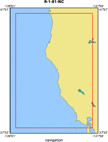
R-1-81-NC
|
|
Abstract
|
United States Geological Survey, Menlo Park, California.
Chief Scientist: Jim Gardner. Geological data (VanVeengrab,
VanDornbottle) of field activity R-1-81-NC in Garcia River,
Navarro River, Big River, Noyo River, Ten Mile River,Mattole
River, Centerville Beach, Eel River, Mad River, Redwood
Creek, KlamathRiver, Smith River, CA from 07/06/1981 to
07/10/1981
|
|
Organization
|
United States Geological Survey, Menlo Park, California
|
|
Project/Theme
|
Climate
|
|
Chief Scientist
|
Jim Gardner
|
|
Activity Type
|
Geological
|
|
Platform
|
Raft
|
|
Area of Operation
|
Garcia River, Navarro River, Big River, Noyo River, Ten Mile River,
Mattole River, Centerville Beach, Eel River, Mad River, Redwood Creek, Klamath
River, Smith River, CA
|
|
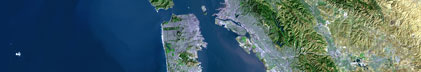
Location map
|

|
|
Bounding Coordinates
|
41.75000
-125.75000 -122.25000
37.75000
|
|
Ports
|
leave Garcia River, CA
arrive Mad River, CA
|
|
Dates
|
07/06/1981 (JD 187) to 07/10/1981 (JD 191)
|
|
Analog Materials
|
list
|
|
Index map
|
|
|
Information Specialist
|
|
|
Crew
|
|
Jim Gardner
|
Chief Scientist, USGS Western Region
|
|
Dave Klise
|
Scientist, USGS Western Region
|
|
Bob Hall
|
Scientist, USGS Western Region
|
|
|
Equipment Used
|
|
VanVeengrab
|
|
VanDornbottle
|
|
|
Purpose
|
|
Sediment and water sampling.
|
|
|
Summary
|
|
Garcia River sampled one mile upstream from mouth. Navarro River
|
|
sampled 1 mile upstream from mouth - 3 samples and mid-river water sample. Big
|
|
River sampled 1 mile upstream from mouth - 3 samples and mid-river water sample.
|
|
Noyo River sampled 1 mile upstream from mouth - 2 samples and mid-river water
|
|
sample. Ten Mile River sampled near freeway bridge - 1 outcrop sample, 1 bottom
|
|
sample, and 1 water sample. Mattole River sampled 1.5 miles upstream from mouth
|
|
- 3 samples and water sample at south bank. Centerville Beach geologic
|
|
observations. Eel River sampled above bridge at Fernbridge - 2 samples and
|
|
mid-river water sample. Mad River sampled 1 mile from mouth - 3 samples and
|
|
mid-river water sample. Redwood Creek sampled 2.5 miles from mouth - sample W of
|
|
101 Bridge and mid-stream water sample. Klamath River sampled 2.75 miles from
|
|
mouth - 2 bags from south shore station and mid-river water sample. Smith River
|
|
sampled upstream from mouth - 2 samples (N and S shores) and water sample from
|
|
shore.
|
|
|
Notes
|
|
Inflatible raft and canoe were used.
|
|
|
Publications
|
|
Wong, F.L. and Klise, D.H., 1986, Heavy mineral, clay mineral, and geochemical
|
|
data of surface sediments from coastal northern California rivers: U.S.
|
Geological Survey Open-File Report 86-57.
|
|
|
Got Help?
|
For R-1-81-NC, we would appreciate any information on -- contract, days at sea, dive count, funding, information to be derived, kms of navigation, national plan, NGDC Info, owner, project number, scanned materials, seismic description, station count, station description, submersible, tabulated info.
|
|