|
|
|
Metadata
|
|
ID
|
06037
|
|
Also Known As
|
R-1-06-BZ
06037
|
|
Abstract
|
United States Geological Survey, Woods Hole, Massachusetts.
Chief Scientist: John Crusius. Data of field activity 06037
(R-1-06-BZ) in West Falmouth Harbor, Snug Harbor, Falmouth,
Massachusetts,United States, North America, North Atlantic
from 07/03/2006 to 07/07/2006
|
|
Organization
|
United States Geological Survey, Woods Hole, Massachusetts
|
|
Project/Theme
|
Ground water coastal aquifers
Coastal Change Hazards
|
|
Chief Scientist
|
John Crusius
|
|
Platform
|
Raft
|
|
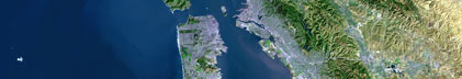
Area of Operation
|
West Falmouth Harbor, Snug Harbor, Falmouth, Massachusetts,
United States, North America, North Atlantic
|
|
Location map
|

|
|
Bounding Coordinates
|
41.61000
-70.63700 -70.63600
41.60700
|
|
Ports
|
LEAVE West Falmouth Harbor, MA
ARRIVE West Falmouth, MA
|
|
Dates
|
07/03/2006 (JD 184) to 07/07/2006 (JD 188)
|
|
Analog Materials
|
No analog holdings.
|
|
Index map

|
|
|
Information Specialist
|
|
|
Crew
|
|
John Crusius
|
Chief Scientist
|
|
Laura Erban
|
|
|
Dirk Koopmans
|
|
|
Max Nepstad
|
|
|
|
Purpose
|
|
Anchored platform for Rad7 detector in West Falmouth Harbor.
|
|
|
Information to be Derived
|
|
|
Summary
|
|
Between July 3 and 7, an anchored raft was deployed in Snug
|
|
Harbor as a platform for a RAD7 and attached water sampling gear
|
|
(41.60712N, -70.63678W). This setup provided continuous
|
|
measurements (twice per hour) of water-column radon activity over
|
|
the course of many tidal cycles.
|
|
|
Notes
|
|
Related field activities:
|
|
http://quashnet.er.usgs.gov/data/2006/06020/,
|
|
http://quashnet.er.usgs.gov/data/2006/06021/,
|
|
http://quashnet.er.usgs.gov/data/2006/06025/,
|
|
http://quashnet.er.usgs.gov/data/2006/06026/
|
|
5 days at sea.
|
|
|
Got Help?
|
For 06037, we would appreciate any information on -- activity type, analog materials, contract, days at sea, dive count, equipment used, funding, kms of navigation, national plan, NGDC Info, owner, project number, publications, scanned materials, seismic description, station count, station description, submersible, tabulated info.
|
|