|
|
|
Metadata
|
|
ID
|
M-2-94-EG
|
|
Abstract
|
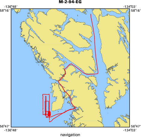
Chief Scientist: Gary Greene. Geophysical data
(sidescansonar) of field activity M-2-94-EG in Mt. Edgecumbe
lava field, Eastern Gulf of Alaska from 07/26/1994 to
07/29/1994
|
|
Chief Scientist
|
Gary Greene
|
|
Activity Type
|
Geophysical
|
|
Area of Operation
|
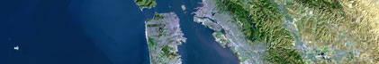
Mt. Edgecumbe lava field, Eastern Gulf of Alaska
|
|
Location map
|

|
|
Bounding Coordinates
|
58.19291
-136.06551 -134.78860
56.85241
|
|
Dates
|
07/26/1994 (JD 207) to 07/29/1994 (JD 210)
|
|
Analog Materials
|
No analog holdings.
|
|
Index map
|
|
|
Crew
|
|
Gary Greene
|
Chief Scientist, USGS Western Region
|
|
|
Equipment Used
|
|
|
Purpose
|
|
The object of the cruise was to map the seafloor morphology of rockfish habitats that had been observed on earlier submersible dives.
|
|
|
Summary
|
|
The survey successfully delineated the geometry and extent of the
|
|
offshore lava field, a 30 X 20 sq. km. area, and also highlighted substrate
|
|
habitats that are attractive to different rockfish. Two favorite fishing spots
|
|
lie on partially eroded volcanic cones. Side-scan imagery indicated the
|
|
shallowest cone has shear vertical walls that drop to a angular rubble apron on
|
|
one side; this cone attracts high concentrations of rockfish and lingcod. The
|
|
deeper cone had a more gentle morphology and significantly fewer rockfish and
|
|
lingcod, probably because less habitat shelter exists on the smooth surface of
|
|
the cone. NURP and Alaska Fish and Game anticipate that this type of surveying
|
|
to define fish habitats will be needed in the future in many areas of Alaska and
|
|
on fishing grounds in the lower 48 too].
|
|
|
Notes
|
|
(modified from USGS bulletin dated Aug.12,1994 and August GD News) -
|
|
ALASKA FISHERIES WORK. Gary Greene, John Gann and Mike Boyle spent 2 days
|
|
side scan surveying near Sitka as part of a cooperative program with USGS,
|
|
Moss Landing, NURP and Alaska Department of Fish and Game. Initially widely
|
|
spaced swaths were run to determine the character and extent of the Mt.
|
|
Edgecumbe lava field, which covers the shallow seafloor west of the Mt.
|
|
Edgecumbe volcano. Then overlapping side-scan survey were run over the
|
|
offshore extension of the southwest rift of the volcano; this survey will be
|
|
mosaicked at USGS. On both the widely spaced and detailed swaths, a variety
|
|
of volcanic features were seen including cones, vents, plugs, collapsed lava
|
|
tubes, lava flow fronts, pressure ridges, and the like.
|
|
|
Got Help?
|
For M-2-94-EG, we would appreciate any information on -- analog materials, contract, days at sea, dive count, funding, information specialist, information to be derived, kms of navigation, national plan, NGDC Info, organization, owner, platform, ports, project, project number, publications, scanned materials, seismic description, station count, station description, submersible, tabulated info.
|
|