
|
|
|
|
Metadata
|
|
ID
|
00SCC02
|
|
Also Known As
|
G-1-00-LA
|
|
Abstract
|
University of New Orleans,United States Geological Survey,
St. Petersburg, Florida,Louisiana Department of Natural
Resources,Army Corps of Engineers. Chief Scientist: Jack
Kindinger. Chirp and High-Resolution Seismic data
(subbottomprofiler, Chirp, computer, hydrophone, GPS,
computer, computer, computer) of field activity 00SCC02
(G-1-00-LA) in Barataria Basin, Northern Gulf of Mexico -
Louisiana from 05/12/2000 to 05/31/2000
|
|
Organization
|
University of New Orleans
United States Geological Survey, St. Petersburg, Florida
Louisiana Department of Natural Resources
Army Corps of Engineers
|
|
Project/Theme
|
Louisiana Sand Resources
|
|
Chief Scientist
|
Jack Kindinger
|
|
Activity Type
|
Chirp and High-Resolution Seismic
|
|
Platform
|
Gilbert
|
|
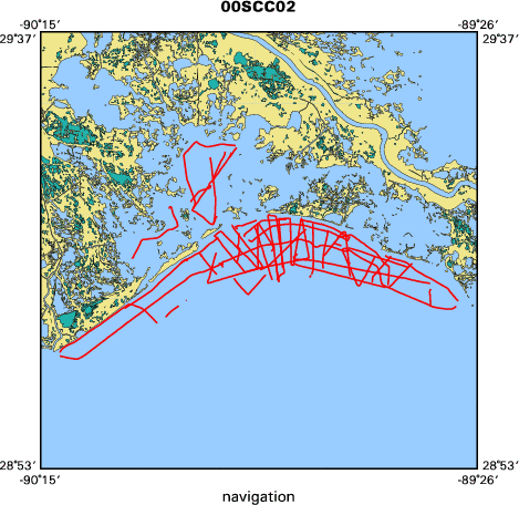
Area of Operation
|
Barataria Basin, Northern Gulf of Mexico - Louisiana
|
|
Location map
|

|
|
Bounding Coordinates
|
29.43135
-90.21247 -89.46292
29.07283
|
|
Ports
|
leave
arrive
|
|
Dates
|
05/12/2000 (JD 133) to 05/31/2000 (JD 152)
|
|
Analog Materials
|
list
|
|
Index map
|
|
|
Information Specialist
|
|
Gina M. Peery (FACS Coordinator)
|
|
|
Crew
|
|
Jack Kindinger
|
Chief Scientist, USGS - St. Petersburg
|
|
Dana Wiese
|
Electronics Technician, USGS - St. Petersburg
|
|
Jim Flocks
|
Geologist, USGS - St. Petersburg
|
|
Mark Kulp
|
Geophysicist, University of New Orleans (UNO)
|
|
Shea Penland
|
Geologist (5/15/00-5/22/00, 5/31/00), University of New Orleans (UNO)
|
|
Allison Peters
|
Student (5/31/00), University of New Orleans (UNO)
|
|
Carlos Alonzo
|
Student (5/23/00-5/25/00), University of New Orleans (UNO)
|
|
Rich Young
|
Boat Captain (5/12/00-5/22/00), USGS - St. Petersburg
|
|
Keith Ludwig
|
Boat Captain (5/23/00-5/31/00), USGS - St. Petersburg
|
|
Gina Peery
|
(POST CRUISE), Geologist/FACS Coordinator, USGS - St. Petersburg
|
|
|
Equipment Used
|
|
subbottomprofiler
|
|
Chirp
|
|
computer
|
|
hydrophone
|
|
GPS
|
|
computer
|
|
computer
|
|
computer
|
|
|
Purpose
|
|
Characterization of the Geological Framework, Mapping sediment
|
|
distribution, and locating offshore sand resources.
|
|
|
Information to be Derived
|
|
Geophysical data is being used to determine sediment distribution and
|
|
thickness, and to locate sand deposits to be used in Louisiana beach
|
|
renourishment projects.
|
|
|
Summary
|
|
Collected 50 single-channel boomer seismic lines. Characterized the
|
|
geological framework.
|
|
|
Notes
|
|
These FACS logs were generated by Gina M. Peery in August of 2001,
|
|
using the handwritten logbooks and personal accounts of the scientist and crew
|
|
members.
|
|
|
Publications
|
|
Calderon, Karynna, Dadisman, Shawn V., Kindinger, Jack L., Peery, Gina M.,
|
|
Flocks, James G., Wiese, Dana S., Kulp, Mark, Penland, Shea, Britsch, Louis
|
|
D., and Brooks, Gregg R., 2003, Archive of boomer seismic reflection data
|
|
collected during USGS cruises 00SCC02 and 00SCC04, Barataria Basin,
|
|
Louisiana, May 12 - 31 and June 17 - July 2, 2000: U.S. Geological Survey
|
|
Open-File Report 03-402:
|
|
http://pubs.usgs.gov/of/2003/of03-402/
|
|
|
|
publication metadata
|
|
|
Calderon, Karynna, Dadisman, Shawn V., Kindinger, Jack L., Flocks, James G.,
|
|
Wiese, Dana S., Kulp, Mark, Penland, Shea, Britsch, Louis D., and Brooks,
|
|
Gregg R., 2003, Archive of CHIRP seismic reflection data collected during
|
|
USGS cruises 00SCC02 and 00SCC04, Barataria Basin, Louisiana, May 12-31
|
and June 17 - July 2, 2000: U. S. Geological Survey Open-File Report 03-156.
|
|
|
Got Help?
|
For 00SCC02, we would appreciate any information on -- contract, days at sea, dive count, funding, kms of navigation, national plan, NGDC Info, owner, project number, scanned materials, seismic description, station count, station description, submersible, tabulated info.
|
|


