|
|
|
Metadata
|
|
ID
|
05008
|
|
Also Known As
|
D-1-05-GK
05008
|
|
Abstract
|
United States Geological Survey, Woods Hole, Massachusetts.
Chief Scientists: Page Valentine, R. Reid, NOAA Fisheries, J.
Collie, URI. Data (navigation, SEABOSS, dredge, ottertrawl,
beamtrawl, CTD) of field activity 05008 (D-1-05-GK) in
Georges Bank, United States, Canada, North America, North
Atlantic from 08/22/2005 to 09/02/2005
|
|
Organization
|
United States Geological Survey, Woods Hole, Massachusetts
|
|
Project/Theme
|
Georges Bank Habitats
|
|
Chief Scientist
|
Page Valentine
R. Reid
J. Collie
|
|
Platform
|
Delaware II
|
|
Area of Operation
|
Georges Bank, United States, Canada, North America, North Atlantic
|
|
Location map
|

|
|
Bounding Coordinates
|
42.13000
-67.55000 -66.50000
41.66000
|
|
Ports
|
LEAVE Woods Hole, MA
ARRIVE Woods Hole, MA
|
|
Dates
|
08/22/2005 (JD 234) to 09/02/2005 (JD 245)
|
|
Analog Materials
|
No analog holdings.
|
|
Index map
|
|
|
Information Specialist
|
|
|
Crew
|
|
Page Valentine
|
Chief Scientist
|
|
R. Reid
|
NOAA Fisheries, Chief Scientist
|
|
J. Collie
|
URI, Chief Scientist
|
|
Dann Blackwood
|
|
|
Erin Heffron
|
|
|
Robert Reid
|
NMFS
|
|
|
Equipment Used
|
|
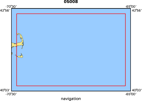
navigation
|
|
SEABOSS
|
|
dredge
|
|
ottertrawl
|
|
beamtrawl
|
|
CTD
|
|
|
Purpose
|
|
Benthic habitat studies and sea floor mapping
|
|
|
Information to be Derived
|
|
Grain size analysis;Habitat maps;
|
|
|
Summary
|
|
USGS SEABOSS video/photo transects: 133 stations; URI beam
|
|
trawl: 11 stations; NMFS otter trawl: 6 stations; URI Naturalist
|
|
dredge: 21 stations; NMFS CTD profiles: 16 stations.
|
|
|
Notes
|
Navigation technique: Pcode GPS.
|
|
Mobilize in Woods Hole on Friday, Aug. 19, 2005; demobilize
|
|
in Woods Hole on Friday, Sept 2, 2005.
|
|
11 days at sea.
|
|
0 kms. of continuous data.
|
|
187 stations occupied.
|
|
|
Funding
|
|
|
Contract
|
|
|
Got Help?
|
For 05008, we would appreciate any information on -- activity type, analog materials, days at sea, dive count, kms of navigation, national plan, NGDC Info, owner, project number, publications, scanned materials, seismic description, station count, station description, submersible, tabulated info.
|
|


