|
|
|
Metadata
|
|
ID
|
08005
|
|
Also Known As
|
S-1B-08-SC
08005
|
|
Abstract
|
United States Geological Survey, Woods Hole, Massachusetts.
Chief Scientists: Tom Lorenson, USGS, Menlo Park, Ira Leifer,
UCSB. Bathymetric and ROV data (ROV, Bathymetry - Swath
System, Nav) of field activity 08005 (S-1B-08-SC) in Santa
Barbara Channel, Goleta, California, United States, North
America, North Pacific from 03/17/2008 to 03/19/2008
|
|
Organization
|
United States Geological Survey, Woods Hole, Massachusetts
|
|
Chief Scientist
|
Tom Lorenson
Ira Leifer
|
|
Activity Type
|
Bathymetric and ROV
|
|
Platform
|
Zephyr
|
|
Area of Operation
|
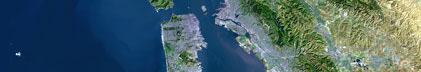
Santa Barbara Channel, Goleta, California, United States, North America, North Pacific
|
|
Location map
|

|
|
Bounding Coordinates
|
34.40109
-119.88082 -119.84448
34.39369
|
|
Ports
|
LEAVE Santa Barbara, CA
ARRIVE Santa Barbara, CA
|
|
Dates
|
03/17/2008 (JD 077) to 03/19/2008 (JD 079)
|
|
Analog Materials
|
No analog holdings.
|
|
Index map

|
|
|
Information Specialist
|
|
|
Crew
|
|
Jonathan Borden
|
USGS, ROV Pilot
|
|
Chuck Worley
|
Bathymetry
|
|
Ray Davis
|
Design/Fabrication
|
|
Tom Lorenson
|
USGS/MP, Chief Scientist
|
|
Gerry Hatcher
|
USGS/MP, Engineer
|
|
Ira Leifer
|
UCSB
|
|
Chris Stubbs
|
grad student
|
|
Brayton Pointer
|
captain
|
|
Ryan Braget
|
first mate
|
|
|
Equipment Used
|
|
ROV
|
|
Bathymetry - Swath System
|
|
Nav
|
|
|
Purpose
|
|
Calibrate bubble emission from natural gas vents offshore Coal Oil Point with the SwathPlus sidescan. ROV Survey of Coal Oil Point Seeps to sample oil and gas from natural
|
|
seeps and to document unusual seafloor features that turned out to be newly
|
|
discovered tarmounds on the oceanfloor.
|
|
|
Information to be Derived
|
|
Samples and Chemical Analysis;
|
|
|
Summary
|
|
Digital Video from ROV, Tar samples taken with grab, gas
|
|
samples taken with sampler designed and built by Gerry Hatcher
|
|
|
Notes
|
Navigation technique: XXXXX / Omnistar.
|
|
ROV work was a successful trial
|
|
9 days at sea.
|
|
7 stations occupied.
|
|
|
Got Help?
|
For 08005, we would appreciate any information on -- analog materials, contract, days at sea, dive count, funding, kms of navigation, national plan, NGDC Info, owner, project, project number, publications, scanned materials, seismic description, station count, station description, submersible, tabulated info.
|
|