|
|
|
Metadata
|
|
ID
|
A-3-02-HW
|
|
Abstract
|
United States Geological Survey, Menlo Park, California.
Chief Scientist: Mike Field. Geological data (ADP,
opticalbackscattersensor, wavepressure, ADV, currentmeter) of
field activity A-3-02-HW in Maui, Hawaii from 08/12/2002 to
08/19/2002
|
|
Organization
|
United States Geological Survey, Menlo Park, California
|
|
Project/Theme
|
Coral Reefs
|
|
Chief Scientist
|
Mike Field
|
|
Activity Type
|
Geological
|
|
Platform
|
Alyce C
|
|
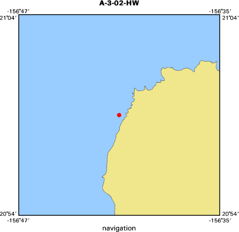
Area of Operation
|
Maui, Hawaii
|
|
Location map
|

|
|
Bounding Coordinates
|
20.98252
-156.68112 -156.68112
20.98252
|
|
Ports
|
leave Lahaina, Maui
arrive Lahaina, Maui
|
|
Dates
|
08/12/2002 (JD 224) to 08/19/2002 (JD 231)
|
|
Analog Materials
|
No analog holdings.
|
|
Index map
|
|
|
Information Specialist
|
|
Curt Storlazzi
|
|
Bruce Jaffe
|
|
Andrea Ogston
|
|
Josh Logan
|
|
|
Crew
|
|
Mike Field
|
Chief Scientist, USGS Western Region
|
|
Bruce Jaffe
|
Oceanographer, USGS Western Region
|
|
Curt Storlazzi
|
Oceanographer/Geologist, USGS Western Region
|
|
Andrea Ogston
|
Oceanographer, Univ. Washington, School of Oceanography
|
|
Josh Logan
|
GIS Specialist, USGS Western Region
|
|
Susie Cochran
|
Project Coordinator, USGS Western Region
|
|
Rebecca Stamski
|
Graduate Student, UC Santa Cruz, Earth Science Dept.
|
|
Kathy Presto
|
Graduate Student, Univ. Washington, School of Oceanography
|
|
Joe Reich
|
Boat Captain,
|
|
|
Equipment Used
|
|
ADP
|
|
opticalbackscattersensor
|
|
wavepressure
|
|
ADV
|
|
currentmeter
|
|
|
Purpose
|
|
Collect measurements of currents, waves and suspended sediment in coral
|
|
reef environments using both tripod and backpacked mounted instrument packages
|
|
to assist in determining physical constraints on coral distribution.
|
|
|
Information to be Derived
|
|
Current speed and direction, suspended sediment concentration,
|
|
salinity, wave height and period.
|
|
|
Summary
|
|
Maui instrument tripod will be recovered from location using
|
|
the vessel Alyce C. Data from the previous deployment will be
|
|
downloaded and the instruments will be refurbished at the Maui Ocean
|
|
Center. The instrument will be redeployed at the same location for
|
|
further measurements. An additional instrument package designed to
|
|
collect the same measurements will be deployed in-shore from the
|
|
current tripod location.
|
|
|
Notes
|
|
This activity was given two IDs: one for the data gathered on the vessel Alyce C (A302HW), and another for the backpack mounted instrument work on the Molokai reef flat (AL02HW).
|
|
|
Publications
|
|
|
Got Help?
|
For A-3-02-HW, we would appreciate any information on -- analog materials, contract, days at sea, dive count, funding, kms of navigation, national plan, NGDC Info, owner, project number, scanned materials, seismic description, station count, station description, submersible, tabulated info.
|
|