Local forecast by "City, St" or zip code |
Search by city or zip code. Press enter or select the go button to submit request
|
Rivers & Hydrology
|
![](https://webarchive.library.unt.edu/web/20090115225856im_/http://www.srh.noaa.gov/lmrfc/images/transparent.gif) |
Precip & Weather |
![](https://webarchive.library.unt.edu/web/20090115225856im_/http://www.srh.noaa.gov/lmrfc/images/transparent.gif) |
Climate & History |
![](https://webarchive.library.unt.edu/web/20090115225856im_/http://www.srh.noaa.gov/lmrfc/images/transparent.gif) |
Additional Info |
![](https://webarchive.library.unt.edu/web/20090115225856im_/http://www.srh.noaa.gov/lmrfc/images/transparent.gif) |
About The LMRFC |
![](https://webarchive.library.unt.edu/web/20090115225856im_/http://www.srh.noaa.gov/lmrfc/images/transparent.gif) |
|
Home
: |
![](https://webarchive.library.unt.edu/web/20090115225856im_/http://www.srh.noaa.gov/lmrfc/images/transparent.gif) |
Precipitation
Data |
![](https://webarchive.library.unt.edu/web/20090115225856im_/http://www.srh.noaa.gov/lmrfc/images/transparent.gif) |
Current
Precipitation Data |
![](https://webarchive.library.unt.edu/web/20090115225856im_/http://www.srh.noaa.gov/lmrfc/images/transparent.gif) |
|
New
Experimental National Precipitation Graphics Suite |
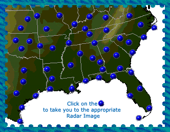
![](https://webarchive.library.unt.edu/web/20090115225856im_/http://www.srh.noaa.gov/lmrfc/images/transparent.gif) |
Individual
Radar Data in the LMRFC Area |
|
|
|
Multi-Sensor
Precipitation Estimates (MPE)
- Graphical Radar & Gage Data |
![](https://webarchive.library.unt.edu/web/20090115225856im_/http://www.srh.noaa.gov/lmrfc/images/transparent.gif) |
Hourly
MPE Data PLUS latest 3, 6, 12, 24 hour and since 12Z totals
- A graphical representation of latest hourly
rainfall |
6,
12, & 24 Hour Totals |
2,
3, 5, &, 7 Day Totals |
1,
2, 3, &, 6 Month Totals |
Month
to Date and Year to Date Totals |
|
|
|
|
|
|
|
Precipitation
Frequency Data |
![](https://webarchive.library.unt.edu/web/20090115225856im_/http://www.srh.noaa.gov/lmrfc/images/transparent.gif) |
![](https://webarchive.library.unt.edu/web/20090115225856im_/http://www.srh.noaa.gov/lmrfc/images/newspin.gif) |
As
part of the National Weather Service, the Hydrometeorologic Design
Studies Center (HDSC), a component of the Office of Hydrologic Development
(OHD), is responsible for updating the NOAA Atlas precipitation
frequency maps. These mapping results can be found at http://www.weather.gov/oh/hdsc/
|
|