|
MOD Home
Other Areas of
Interest
About Maps
How To Order
MOD Order Form
Search
Historical Maps
|
Utah
Geologic Investigations | Miscellaneous Field Investigations | Other States

|
 0 0
(164 Kb)
Actual Size: 55" x 30" |
ID: I-0591A
Title: Geology of the Salina Quadrangle, Utah
Authors: Paul L. Williams and Robert J. Hackman
This map reprint was created from electronically scanned paper originals. Maps plotted through the map-on-demand process may not meet the same quality and accuracy standards as lithographically printed products.
|

(234 Kb)
Actual Size: 46" x 33" |
ID: I-0736
Title: Geologic and Structure Map of the Grand Junction Quadrangle, Colorado and Utah
Author: William B. Cashion
This map reprint was created from electronically scanned paper originals. Maps plotted through the map-on-demand process may not meet the same quality and accuracy standards as lithographically printed products.
|

(221Kb)
Actual Size: 34.5" x 57" |
ID: I-0744 Sheet 1 of 2
Title: Geology, Structure, and Uranium Deposits of the Escalante Quadrangle, Utah and Arizona
Authors: Robert J. Hackman and Donald G. Wyant
This map reprint was created from electronically scanned paper originals. Maps plotted through the map-on-demand process may not meet the same quality and accuracy standards as lithographically printed products.
|

(335Kb)
Actual Size: 35" x 23" |
ID: I-0744 Sheet 2 of 2
Title: Structure and Uranium Deposits:Geology, Structure, and Uranium Deposits of the Escalante Quadrangle, Utah and Arizona
Authors: Robert J. Hackman and Donald G. Wyant
This map reprint was created from electronically scanned paper originals. Maps plotted through the map-on-demand process may not meet the same quality and accuracy standards as lithographically printed products.
|

(457 Kb)
Actual Size: 51" x 34" |
ID: I-1526
Title: Geologic Map of the Vernal 1° X 2° Quadrangle, Colorado, Utah, and Wyoming
Authors: Peter D. Rowley, Wallace R. Hansen, Ogden Tweto, and Paul E. Carrara
Maps plotted through the map-on-demand process may not meet the same quality and accuracy standards as lithographically printed products.
|
(106 Kb)
Actual Size: 27.9" x 30.8" |
ID: I-2667
Title: Correlation of Jurassic San Rafael Group and Related Rocks from Blanding, Utah to Dove Creek, Colorado
Author: Robert B. O'Sullivan

Maps plotted through the map-on-demand process may not meet the same quality and accuracy standards as lithographically printed products.
|

|
(519 Kb)
Actual Size: 35.5" x 38" |
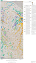
ID: MF-0141
Title: Preliminary Geologic Map and Sections of the Mount Peale 2 NE Quadrangle, San Juan County, Utah
Authors: G.W. Weit and W.P. Puffett
This map reprint was created from electronically scanned paper originals. Maps plotted through the map-on-demand process may not meet the same quality and accuracy standards as lithographically printed products.
|

(109 Kb)
Actual Size: 34.5" x 40.5" |
ID: MF-2351
Title: Correlation of Middle Jurassic San Rafael Group and Related Rocks from Bluff to Monticello in Southeastern Utah
Author: Robert B. O'Sullivan
Maps plotted through the map-on-demand process may not meet the same quality and accuracy standards as lithographically printed products.
|
(519 Kb)
Actual Size: 29" x 50" |
ID: MF-2411
Title: Surficial Geologic Map of the The Loop and Druid Arch Quadrangles, Canyonlands National Park, Utah
Authors: G.H. Billingsley, D.L. Block, and T.J. Felger
Maps plotted through the map-on-demand process may not meet the same quality and accuracy standards as lithographically printed products.
|

|

(143 Kb)
Actual Size: 42" x 57" |
ID: SIM-2890, Sheet 1 of 2
Title: Surficial Geologic Map of the Upper Bear River and Bear Lake Drainage Basins, Idaho, Utah, and Wyoming, Scale - 1:150,000
Author: Marith C. Reheis
This map reprint was created from electronically scanned paper originals. Maps plotted through the map-on-demand process may not meet the same quality and accuracy standards as lithographically printed products.
|

(138 Kb)
Actual Size: 54" x 66" |
ID: SIM-2890, Sheet 2 of 2
Title: Surficial Geologic Map of the Upper Bear River and Bear Lake Drainage Basins, Idaho, Utah, and Wyoming, Scale - 1:50,000
Author: Marith C. Reheis
This map reprint was created from electronically scanned paper originals. Maps plotted through the map-on-demand process may not meet the same quality and accuracy standards as lithographically printed products.
|
| AK | AL |
AR | AZ |
CA | CO |
CT | DE |
FL | GA |
HI | IA |
ID | IL |
IN | KS |
KY | LA |
MA |
| MD |
ME | MI |
MN | MO |
MS | MT |
NC | ND |
NE | NH |
NJ | NM |
NV | NY |
OH | OK |
OR |
| PA |
RI | SC |
SD | TN |
TX | UT |
VA | VT |
WA | WI |
WV | WY |
DC | CZ |
GU | PR |
VI |
| American Samoa | Federated States of Micronesia | Northern Mariana Islands | Republic of Palau |
Other Areas of Interest
|

Products Beyond
Maps on Demand
USGS Store
Pubs Warehouse
Earth Explorer
Ordering USGS
Products
Library
Sources
for USGS products
Recent Publication
Additions (in Pubs
Warehouse)
Minerals
Periodicals
Information:
1-888-ASK-USGS
|


