
National Information |
National Priorities List (NPL) HistoryProposed Date Final Date |
Superfund Program
Midvale Slag
|
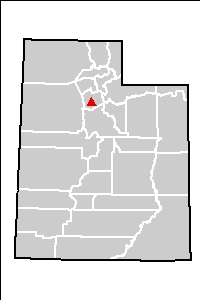
Site Type: Final NPL City: Midvale County: Salt Lake Street Address: 6400 South 700 West 7800 Zip Code: 84027 EPA ID#: UTD081834277 Site ID#: 0800641 Site Aliases: Midvale, Tailings, Sheridan Hill Smelter Congressional District(s): 02 |
Site Status & Updates
What's NewThe U.S. Environmental Protection Agency (EPA) and the Utah Department of Environmental Quality (UDEQ) are currently conducting a five-year review at the Midvale Slag Superfund Site. This type of review is required every five years to determine if the selected remedy remains protective of human health and the environment. This will be the second five year review for Operable Unit 1 (OU1) and the first for Operable Unit 2 (OU2). A Five-Year Review Report will be finalized and available for public review by the end of 2008.
Jordan River Riparian Improvements
EPA is working with UDEQ, Midvale City, Salt Lake County, community members,
and others to improve 6,800 feet of the Jordan River riparian corridor adjacent
to the Midvale Slag Superfund Site. The project is aimed at minimizing soil
cover erosion that could release mine waste from the site into the river. Work
began in fall 2008. View the Riparian Improvement Fact Sheet in the Site Documents section.
Redevelopment Activities
EPA adapted the remedy at the Midvale Slag Superfund Site to anticipate residential, recreational, commercial, and industrial future land uses. In 1998, the site became the pilot program for EPA Region 8’s Superfund Redevelopment Initiative. Today, the Midvale Slag Superfund Site is being successfully redeveloped into a large-scale, mixed-use development.
The image below is of an EPA Riparian Improvement Project that will stabilize the degraded Sheet Pile Dam in the Jordan River:

Site Description
The 446-acre Midvale Slag Superfund Site is located 12 miles south of Salt Lake City in the city of Midvale, with a small portion extending into the adjacent city of Murray. The site is a former smelting facility on the Jordan River. Five separate smelters were located on or near the site from 1871 to 1958. An adjacent mill continued operating until 1971. The smelters treated ores from Bingham Canyon and other mines. Investigations at the site showed groundwater and soils are contaminated with heavy metals.EPA listed the Midvale Slag Superfund Site on the National Priorities List (NPL), commonly known as the list of Superfund Sites, in 1991. After EPA listed the site on the National Priorities List, the site was divided into two Operable Units. Operable Unit 1 (OU1) is the northern 266 acres of the site. Operable Unit 2 (OU2) is the remainder of the site to the south. The dividing boundary between OU1 and OU2 is 7200 South, which runs through the site.
Today, the bulk of the cleanup at the site is complete and redevelopment activities are currently underway. EPA and UDEQ coordinated with the city of Midvale, as well as property owners and a local citizens' group, to consider redevelopment possibilities and to integrate redevelopment opportunities into the Superfund remedy. EPA awarded Midvale City an EPA Pilot Redevelopment Grant in 1999. The pilot grant is part of EPA's nationwide effort to move Superfund sites back into economic usefulness. A reuse plan entitled The Bingham Junction Reuse Assessment and Master Plan was developed in conjunction with the city of Midvale and landowners. Today, a large-scale, mixed-use development is being constructed on both OU1 and OU2. Midvale City passed ordinances that implement institutional controls for the site; these institutional controls will help to ensure the ongoing protectiveness of the site's remedy.
Midvale Slag Superfund site before:

Midvale Slag Superfund site after:

Site Risk
Studies conducted in 1984 found that groundwater and soil were contaminated with heavy metals. Potential human health threats included drinking contaminated shallow groundwater or swallowing, inhaling, or handling contaminated soil and wastes.
| Media Affected | Contaminants | Source of Contamination |
| Soils, air, ground water, surface water, sediment, solid waste | Lead, arsenic, chromium, and cadmium | Smelting wastes |
Cleanup Progress
In 1990, EPA initiated cleanup actions to address immediate threats at the site. Chemicals found in an abandoned lab were removed, and some 20 pounds of explosives were detonated. Also, the site was fenced to prevent public access.In 1996, EPA issued a Record of Decision (ROD) for OU1 that included removing and replacing yard soils at Winchester Estates, a small, residential development at the northern end of the site. The ROD also called for groundwater monitoring and institutional controls meant to protect people from coming into contact with exposed mining wastes or drinking shallow groundwater at the site. Cleanup at OU1 is complete.
Also in 1996, contaminated soil was excavated from the Butterfield Lumber portion of OU2 and from the small, unmarked Pioneer Cemetery.
In May 1998 and February 2006, EPA and UDEQ issued Explanations of Significant Differences (ESDs) effectively changing the remedy called for in the 1995 OU1 ROD. The 1998 ESD required the excavation of contaminated soils on one parcel of land, rather than capping, and thus eliminated the need for institutional controls governing use of that parcel. In 2006, the ESD changed land use restrictions to accommodate multiple land uses and created a consistent approach for both operable units in riparian management (both sides of the river) and a comprehensive groundwater monitoring plan.
EPA issued the ROD for OU2 in 2002 that divided the work into three parts: the smelter waste and slag, the groundwater, and the riparian zone. The smelter waste and slag remediation is complete. The groundwater monitoring is beginning, and the riparian zone planning is underway.
The riparian zone planning involves designing and implementing improvements to 6,800 feet of the Jordan River riparian corridor adjacent to the site. The project is aimed at minimizing soil cover erosion that could release mine waste from the site into the river.
Community Involvement
A concerned group, Citizens for a Safe Future for Midvale, has received Technical Assistance Grants (TAGs) from EPA to hire a technical advisor to study and inform the community about issues related to site cleanup. In 1999, the TAG group hired an advisor to review issues relating to site redevelopment. Bi-monthly TAG group meetings are open to the public.
Occassionally, EPA and the State hold a community forum to provide timely updates of cleanup activities to elected officials and interested citizens.
In the summer of 2007, EPA brought together a group of interested citizens and agency representatives to form the Jordan River Stakeholder Group. This group meets bi-monthly to work together on the design plans for the Jordan River riparian restoration project. These meetings are open to the public.
Site Documents
Note: some of the files below are Adobe Acrobat PDF files (about PDF files)Riparian Improvement Project Fact Sheet, October 2008
Midvale OU1 ROD April 1995
Midvale OU1 ESD May 1998
Midvale OU1 ESD February 2006
Midvale OU2 ROD October 2002
5-Year Review, October 2003 (PDF, 119 K)
5-Year Review Annual Update December 2007 (PDF, 43 K, 3 pages)
Contacts
For more information, feel free to contact one of the following representatives:
Jennifer Chergo
EPA Office of Communication and Public Involvement
U.S. Environmental Protection Agency
1595 Wynkoop Street
Denver, CO 80202
(303) 312-6601
1 (800) 227-8917, ext. 3126601
chergo.jennifer@epa.gov
Erna Waterman
Remedial Project Manager
U.S. Environmental Protection Agency
1595 Wynkoop Street
Denver, CO 80202
(303) 312-6762
1 (800) 227-8917, ext. 3126762
waterman.erna@epa.gov
Dave Allison
Community Involvement Coordinator
Utah Department of Environmental Quality
168 North 1950 West
Salt Lake City, UT 84116
(801) 536-4479
dallison@utah.org
Tony Howes
Environmental Scientist
Utah Department of Environmental Quality
168 North 1950 West
Salt Lake City, UT 84116
(801) 536-4283
thowes@utah.org
Ray Limb
Development Site Coordinator
655 West Center Street
Midvale, Utah 84047
(801) 567-7287
rlimb@midvale.com
Or, visit the Midvale Slag Information Repositories at:
Tyler Branch Library
315 South Wood
Midvale, UT 84047
Utah Department of Environmental Quality
Division of Environmental Response and Remediation
1950 West North Temple
Salt Lake City, UT 84114
Superfund Records Center
Environmental Protection Agency, Region 8
1595 Wynkoop Street
Denver, CO 80202