Front Range Infrastructure Resources
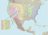
The Front Range (Colorado) Infrastructure Resources was a USGS research project in the Rocky Mountains and Great Plains Region focusing on urban expansion issues, landuse impacts, and sustainability of resources in the Denver Metropolitan area. The primary study area includes the Front Range of Colorado and urban corridor extending from Fort Collins to Colorado Springs.
Infrastructure such as roads, airports, water and energy transmission facilities, and sewage treatment plants are vital to a region's economic viability. They also require large amounts of resources to build, maintain, and to sustain them. Infrastructure in the Denver urban corridor, built during the 1950's and 60's, have deteriorated to a point that extensive repair, replacement, and expansion are required. Infrastructure replacement and expansion affects the local economy and seriously impacts the balance between natural resource supply and the environment.
USGS scientists developed an interdisciplinary approach to:
1) evaluate the status and quality of the region's infrastructure resources;
2) identify issues affecting availability of resources;
3) communicate and collaborate with State, local, and regional representatives to enhance decision-making. Scientists characterized impacts on the numerous topics including:
- Aggregate Resources
- Energy Resources
- Saline Soils
- Water Resources
- Biological Resources
- Land resources
- Materials Flow
For additional information on the Front Range (Colorado) Infrastructure Project, please visit: http://rockyweb.cr.usgs.gov/frontrange/
Top of Page
|

