| 3150 |  |
Base camp at Kotzebue, Alaska, before the field work began. |
1950 |
3151 |  |
Stinson Gullwing with broken landing gear following hitting a pothole when landing on the beach. |
1950 |
3152 |  |
Another view of the Gullwing. |
1950 |
3153 |  |
Harbor office at the port of Santa Monica. |
1950 |
3154 |  |
Hoover Dam on the Colorado River near Las Vegas, Nevada. |
1950 |
3155 |  |
Stinson Gullwing on floats at Kotzebue. |
1950 |
3156 |  |
Kotzebue oceanfront property with seal meat drying on racks. |
1950 |
3157 |  |
Upper right windows were location of Paulson apartment in Kotzebue. |
1949 |
3158 |  |
Caterpillar caravan heading to a new camp over the frozen Bering Sea in March. |
1951 |
3159 |  |
Framing the quanset hut - party living quarters - in -30 Fahrenheit temperatures . |
1951 |
3160 |  |
A little bit of snow drift. Wonder how they got out in the first place. |
1951 |
3161 |  |
Main street on an Arctic Field Party Camp somewhere. |
1951 |
3162 |  |
Marvin Paulson on the left and Francis Popper on the right. |
1951 |
3163 |  |
Just another day with near white-out conditions. This wasn't pleasant at 30 below zero. |
1951 |
3164 |  |
Just another day with near white-out conditions. This wasn't pleasant at 30 below zero. |
1951 |
3165 |  |
Marvin Paulson's traveling home with two Eskimos doing triangulation reconnaissance work. |
1951 |
3166 |  |
Recording angles for a triangulation observer at 10 below zero. |
1951 |
3167 |  |
After the ice receded, these boats were used for hydrography in the Beaufort Sea . |
1951 |
3168 |  |
Checking tide gauge. |
|
3169 |  |
Leveling to tide gauge. |
|
3170 |  |
Canadian Hydrographic Service launch checking NOAA tide gauge during international cooperative charting project on Passamaquoddy Bay. The range of tide is approximately 25-feet on Passamaquoddy Bay. |
Passamaquoddy Bay, Maine Summer 1985 |
3171 |  |
Canadian Hydrographic Service launch checking NOAA tide gauge during international cooperative charting project on Passamaquoddy Bay. The range of tide is approximately 25-feet on Passamaquoddy Bay. |
Passamaquoddy Bay, Maine Summer 1985 |
3172 |  |
Checking tide gauge on dolphin in Passamaquoddy Bay area at low tide. Automatic tide gage is mounted on long stilling well. Stilling well is exceptionally long because the range of tide is approximately 25-feet on Passamaquoddy Bay. |
Passamaquoddy Bay, Maine Summer 1985 |
3173 |  |
Canadian Hydrographic Service launch in picturesque cove on Passamaquoddy Bay. |
Passamaquoddy Bay, Maine Summer 1985 |
3174 |  |
Canadian Hydrographic Service launch at dolphin tending tide gauge. Note tide staff. |
Passamaquoddy Bay, Maine Summer 1985 |
3175 |  |
Canadian Hydrographic Service launch at dolphin tending tide gauge at high tide. |
Passamaquoddy Bay, Maine Summer 1985 |
3176 |  |
Mirrors for electronic distance measurement and light target for triangulation angle measurement. Equipment set up over Station CHAMCOOK Reference Mark. View is looking southwest over St. Croix River into Maine. |
Passamaquoddy Bay, New Brunswick, Canada Summer 1985 |
3177 |  |
Tide gauge with overlapping tide staffs because of high range of tide. The gauge is on the platform in the background and is a gas-bubbler pressure actuated type. |
Maine, Cobscook Bay Summer 1985 |
3178 | 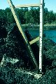 |
A closeup of the upper tide staff of the two overlapping staffs in the previous picture. |
Passamaquoddy Bay, Maine Summer 1985 |
3179 |  |
Anchoring the bubbler tide gauge gas hose to the seaweed covered rocks. |
Passamaquoddy Bay, Maine Summer 1985 |
3180 |  |
Tide flats at low tide on the east side of Cook Inlet. |
Upper Cook Inlet, Alaska Summer 1976 |
3181 |  |
Chief Survey Technician Earl Krick of the NOAA Ship FAIRWEATHER installing a tide gauge in upper Cook Inlet. |
Upper Cook Inlet, Alaska Summer 1976 |
3182 |  |
Digging a trench to bury and anchor gas bubbler tide gauge tubing. |
Upper Cook Inlet, Alaska Summer 1976 |
3183 |  |
Looking northeast from tide gauge location in Upper Cook Inlet. Large rock is a glacial erratic. |
Upper Cook Inlet, Alaska Summer 1976 |
3184 |  |
Deck hand off NOAA Ship FAIRWEATHER assisting in building of tide gauge station in Upper Cook Inlet. |
Upper Cook Inlet, Alaska Summer 1976 |
3185 |  |
Trying to find deep water for Zodiac rubber boat to return to NOAA Ship FAIRWEATHER after installing tide gauge in Upper Cook Inlet. |
Upper Cook Inlet, Alaska Summer 1976 |
3186 |  |
The view towards Cook Inlet showing the Zodiac at low tide. See image 4216. |
Alaska, East side Upper Cook Inlet Summer 1976 |
3187 |  |
The view from the Zodiac back towards the tide gauge installation and orange hydrographic signal in Upper Cook Inlet. The orange signal is to help position survey launches by use of three-point sextant fixes. |
Alaska, East side Upper Cook Inlet Summer 1976 |
3188 |  |
Lt. (j.g.) Robert Crowell operating Wild T-2 Theodolite at Port Etches on the east side of Prince William Sound. |
Port Etches, Alaska Summer 1977 |
3189 |  |
Signal built at Gull Rock for triangulation observations at entrance to Port Etches on the east side of Prince William Sound. |
Alaska, Prince William Sound Summer 1977 |
3190 |  |
Electronics rack on FAIRWEATHER hydrographic survey launch. Upper unit with orange numbers is recording Raydist navigational readings. |
Upper Cook Inlet, Alaska Summer 1976 |
3191 |  |
Hydroplot data acquisition system with controller on top paper tape reader and data punch middle lower unit, and PDP-8 computer with orange and yellow switches on bottom. |
Upper Cook Inlet, Alaska Summer 1976 |
3192 |  |
Survey technician annotating echo-sounder record on FAIRWEATHER hydrographic survey launch. |
Upper Cook Inlet, Alaska Summer 1976 |
3193 |  |
Interior of hydrographic survey launch off NOAA Ship FAIRWEATHER. |
Upper Cook Inlet, Alaska Summer 1976 |
3194 |  |
Motorola Mini-Ranger set up with Wild T-2 Theodolite for use in offshore range-azimuth hydrographic surveying. |
Point Dume, California Spring 1976 |
3195 |  |
Motorola Mini-Ranger set up with Wild T-2 Theodolite for use in offshore range-azimuth hydrographic surveying. |
Point Dume, California Spring 1976 |
3196 |  |
Installing tide gage staff. |
Alaska, East side Upper Cook Inlet Summer 1976 |
3197 |  |
Chief Survey Technician Earl Krick supporting 2X4 while hole being drilled to place mountings to support tide staff. |
Upper Cook Inlet, Alaska Summer 1976 |
3198 |  |
Double exposure of NOAA Ship FAIRWEATHER taken from same location at high and low tide at the pier at Anchorage. Tide range was between 30 and 35 feet. |
Upper Cook Inlet, Alaska Summer 1976 |
3199 |  |
Inshore survey boat running a line. |
Lake Erie, Fairport Harbor, Ohio 1972 ca. |