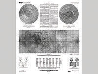
This sheet is one in a series of maps of the Galilean satellites of Jupiter at a
nominal scale of 1:15,000,000. This series is based on data from the Galileo Orbiter
Solid-State Imaging (SSI) camera and the Voyager 1 and 2 spacecraft.
View of a fresh surface of the
martian meteorite ALH84001. Found at Allan Hills in Antarctica shortly after
Christmas in 1984, recent studies of the ALH84001 orthopyroxenite meteorite
suggest that it may contain evidence for life on Mars.
Full-scale Mars Exploration Rover built by graduate students at Cornell University.
Equipped with a variety of science instruments, twin rovers will serve as robotic field
geologists, exploring Mars' climate history and searching for signs of water and life.
Photo courtesy Jim Bell, Cornell.
Mosaic of the Schiaparelli hemisphere of Mars projected into point perspective,
a view similar to that which one would see from a spacecraft. The images were
acquired in 1980 during early northern summer on Mars. The center of this image
is near the impact crater Schiaparelli.
This region is one of the most rugged on Venus. The terrain of this region is made up of
tessera, which are interlacing ridges and valleys. The imagery was collected by the
Magellan mission, which used radar to "see" the surface of Venus beneath its heavy atmosphere.
750 x 566, 197 kB
1500 x 1131, 600 kB
Make your own custom maps of the planets!
Map-a-Planet: NASA Planetary Data System
Moon: Image Captured by the Lunar Orbiter Mission
This image is a digital mosaic made by scanning Lunar Orbiter film strips,
and reassembling them into an image. This frame is from
the Lunar Orbiter IV mission ans shows the central and
southeastern portion of the lunar near side. Prominent in this view
are features such as Copernicus crater and the cratered highlands
(center, left), the southern rims of Imbrium (upper left) and Serenitatis
(upper right) basins, and the pyroclastic mantling deposit of Rima Bode
(upper center).
View (looking north) of the Torfajökull ice cap, a small ice cap north
of Myrdalsjökull. North (above) of Torfajökull is a light-yellow colored
region of Landmannalaugar, an altered rhyolitic volcanic system. Photo
courtesy of M. Chapman
The Valles Marineris is a system of canyons located just south of the Martian
equator. The system is about 4000 km long, and, if on earth, would extend all
the way across the United States. The central individual troughs, generally
50 to 100 km wide, merge into a depression as much as 600 km wide. In places
the canyon floor reaches a depth of 10 km, 6 to 7 times deeper than the Grand
Canyon. This computer generated image features the central region of Valles
Marineris.
This is a computer generated image of the lunar surface that enhances our ability
to see the shape and texture of the terrain.
The texture of the surface is enhanced by simulating sunlight shining from the
right side of the image to create shadows and highlights.
This is a color-coded shaded relief map of the Martian surface with major
regions labeled on the map. The shadows and highlights of the shaded relief
(similar to the shaded relief of the Moon to the left) gives the map a
sense of texture. The colors differentiate the elevation -- violet and blue
being low elevations, tan and white being high elevations. The map base
was created using data from the Mars Orbiter Laser Altimeter.
This enhanced-color, 360-degree "Gallery Panorama" of the Pathfinder landing
site was obtained July 11-13, 1997 by the IMP camera. The Sojourner rover is
shown next to the large rock nicknamed "Yogi," with the Alpha-Proton X-ray
spectrometer (APXS) deployed onto the rock surface.
more details...
(link opens in a new window)
![[USGS Banner]](https://webarchive.library.unt.edu/web/20081107082110im_/http://astrogeology.usgs.gov/assets/banners/default.jpg)

![[Martian meteorite found in Antarctica]](thumbs/ALH84001_20.gif)
![[Mars Exploration Rover]](thumbs/maddog1.jpg)


