
 Feeds & Data
Magnitude 1.7 - UTAH
2008 September 13 23:55:46 UTC
Earthquake Details
| Magnitude | 1.7 |
|---|---|
| Date-Time |
|
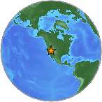
| Location | 37.853°N, 113.305°W |
| Depth | 2 km (1.2 miles) (poorly constrained) |
| Region | UTAH |
| Distances |
|
| Location Uncertainty | horizontal +/- 0.4 km (0.2 miles); depth +/- 16.1 km (10.0 miles) |
| Parameters | Nph= 9, Dmin=13.9 km, Rmss=0.12 sec, Gp=101°, M-type=duration magnitude (Md), Version=2 |
| Source | |
| Event ID | uu09132355 |
- This event has been reviewed by a seismologist.
- Did you feel it? Report shaking and damage at your location. You can also view a map displaying accumulated data from your report and others.
Earthquake Maps
Earthquake Location
Location Maps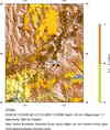
Historical Seismicity
Seismic Hazard Map
Google Map
Google Earth KML
(Requires Google Earth)- Did you feel it? Report shaking and damage at your location. You can also view a map displaying accumulated data from your report and others.
Scientific & Technical Information
 Historic Moment Tensor Solutions
- Preliminary Earthquake Report
- University of Utah Seismograph Stations
