|
|
 |
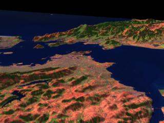
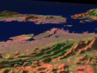
San Francisco with elevation (542), x 3 exaggeration.
|
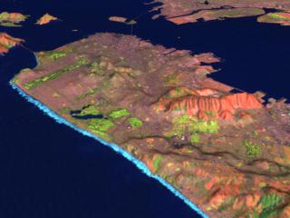
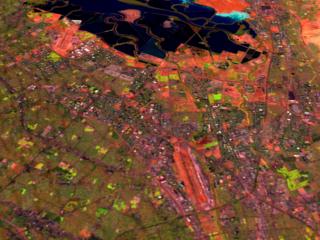
These scenes shows Landsat Thematic Mapper data of the cities of Oakland and Berkeley, as well as the San Francisco Bay Area. The first image, which is predominately brown in color, is a 'natural color' image which uses the Thematic Mapper bands 3, 2, and 1 displayed as red, green, and blue respectively. This yields a color scheme approximately the same as those seen by the human eye. The other two scenes use data from the infrared portions of the electromagnetic spectrum to maximize the range of wavelengths shown. These images use the shortwave infrared (TM band 5), infrared (TM band 4), and visible green (TM band 2) channels. Digital elevation data was used in the two city scenes to create three dimensional terrain, which is vertically exaggerated by a factor of three to show the relief of the land. The city in the foreground and slightly to the left is Oakland, with Alameda on the island seperated from Oakland by the narrow strip of water. The island south (left) of Alameda is filled land on which the Oakland International Airport has been built. The Bay Bridge carries Interstate 80 across the Bay and into downtown San Francisco to the right of the image center. Berkeley sits between the hills and bay to the north (right) of the Bay Bridge. San Francisco, Angel Island, Tiburon, Marin County, and the Golden Gate are all visible on the far side of the bay. The strong brown/gray tone of the natural color image is a result of the data being taken during the early autumn when ground cover is very dry and the land tends to appear somewhat barren. In the TM 542 scenes, barren exposed land appears red to pink, vegetation appears green, and water is dark blue.
|
|
|
|
San Francisco Bay flyby, using Landsat imagery from September 27, 1997.
Duration: 1.7 minutes
Available formats:
1920x1080 (30 fps)
MPEG-2
68 MB
352x240 (29.97 fps)
MPEG-1
13 MB
320x240
JPEG
13 KB
320x242
JPEG
9 KB
How to play our movies
|
|
|
|
Flight around the San Francisco Bay area (TM 542) (September 27, 1997)
Available formats:
2560 x 1920
TIFF
9 MB
320 x 240
JPEG
14 KB
80 x 40
PNG
6 KB
|
|

|
|
Flight around the San Francisco Bay area (TM 542) (September 27, 1997)
Available formats:
2560 x 1920
TIFF
8 MB
320 x 240
JPEG
13 KB
80 x 40
PNG
6 KB
|
|
|
|
Flight around the San Francisco Bay area (TM 542) (September 27, 1997)
Available formats:
2560 x 1920
TIFF
9 MB
320 x 240
JPEG
13 KB
80 x 40
PNG
6 KB
|
|

|
|
Flight around the San Francisco Bay area (TM 542) (September 27, 1997)
Available formats:
2560 x 1920
TIFF
9 MB
320 x 240
JPEG
13 KB
80 x 40
PNG
5 KB
160 x 80
PNG
21 KB
|
|
|
|
Flight around the San Francisco Bay area (TM 542) (September 27, 1997)
Available formats:
2560 x 1920
TIFF
11 MB
320 x 240
JPEG
19 KB
80 x 40
PNG
7 KB
|
|
|
Back to Top
|
|
|
|

