
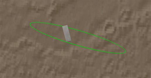
Click on the image for movie of
Zooming in on Landing Site
This animation zooms in on the area on Mars where NASA's Phoenix Mars
Lander will touchdown on May 25, 2008. The image was taken by the High
Resolution Imaging Science Experiment (HiRISE) camera on NASA's Mars
Reconnaissance Orbiter.
The first shot shows the spacecraft's landing ellipse in green, the area
where Phoenix has a high probability of landing. It then zooms in to show
the region's arctic terrain. This polar landscape is relatively free of
rocks, with only about 1 to 2 rocks 1.5 meters (4.9 feet) or larger in an
area about as big as two football fields.
NASA's Jet Propulsion Laboratory, a division of the California
Institute of Technology in Pasadena, manages the Mars Reconnaissance
Orbiter for NASA's Science Mission Directorate, Washington. Lockheed
Martin Space Systems, Denver, is the prime contractor for the project and
built the spacecraft. The High Resolution Imaging Science Experiment is
operated by the University of Arizona, Tucson, and the instrument was
built by Ball Aerospace & Technologies Corp., Boulder, Colo.
