- Original Caption Released with Image:
-
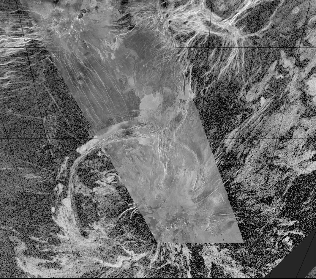
This composite image was created by inserting approximately 70 orbits of Magellan data into an image obtained at the Arecibo, Puerto Rico radiotelescope and shows a geologically complex region in the southern hemisphere of Venus. The region is centered on 65 degrees south, 359 degrees east and is about 1500 x 1500 km (900 x 900 miles) in extent. The large oval feature in the lower half of the image is Quetzalpetlatl Corona, approximately 700 km (420 miles) in diameter. Coronae are circular to oval regions defined by an annulus of ridges and are centers for tectonic and volcanic activity. Tectonic activity is largely observed in a relatively narrow rim region, which in this image is defined by a complex lineated terrain that surrounds much of the corona. Bright and dark volcanic flows are seen throughout the corona and surrounding terrain. Small shield volcanoes, 1-20 km (0.6-12 miles) in diameter, are seen near the southern limit of the Magellan data image. Narrow linear troughs (seen in the image as bright lines) trend to the north-northwest of Quetzalpetlatl.
- Image Credit:
-
NASA/JPL
Image Addition Date: -
1997-01-16
|