MODIS Data May Aid EPA Air Quality Predictions (Wide)
This visualization shows how MODIS data from NASA's Terra and Aqua spacecraft may be able to help EPA in producing air quality index forecasts.
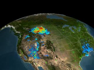
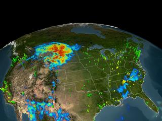
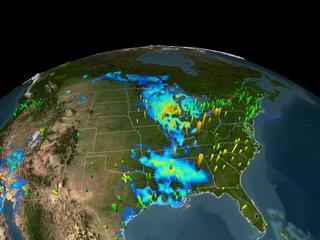
Currently, most air quality forecasts are generated from ground based measuring stations; however, these stations generally only exist in heavily populated areas. MODIS data may help EPA provide air quality forcasts over much wider areas and with higher accuracy. In this visualization, the EPA air quality data shows as the thin colored boxes sticking out from the surface. The MODIS data is represented by the colored overlay. An event that began over the northwestern US in September 2003 is shown propagating across the US and into the Midwest. Notice that the movement of the air mass is evident only from the MODIS data.
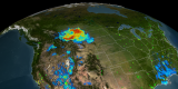
This version of the animation shows a narrow view of the US. This animation was inspired by a similar animation created at the Langley Research Center.


