
Magnitude 4.0 WESTERN KENTUCKY
2003 June 06 12:29:34 UTC
Preliminary Earthquake Report
U.S. Geological Survey, National Earthquake Information Center
World Data Center for Seismology, Denver

|
Magnitude | 4.0 | |
| Date-Time |
Friday, June 06, 2003 at 12:29:34 (UTC) - Coordinated Universal Time Friday, June 06, 2003 at 07:29:34 AM local time at epicenter Time of Earthquake in other Time Zones |
||
| Location | 36.89N 89.01W | ||
| Depth | 0.1 kilometers | ||
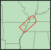
| Region |
|
||
| Reference |
20 km (10 miles) SE of Cairo, Illinois 40 km (25 miles) WSW of Paducah, Kentucky 215 km (135 miles) NNE of Memphis, Tennessee 330 km (205 miles) S of SPRINGFIELD, Illinois |
||
| Location Quality | Error estimate not available, held by USGS NEIC to another agency's solution | ||
|
Location Quality Parameters |
not available | ||
| Source | Center for Earthquake Research and Information, Memphis, Tennessee, USA | ||
| Remarks | Slight damage (VI) at Bardwell. Felt (V) at Arlington; (IV) at Clinton, Fulton and Wickliffe; (III) at Cunningham, Kevil, Paducah and West Paducah. Felt in western Kentucky and in parts of Arkansas, Illinois, Indiana, Missouri and Tennessee. |

|
EARTHQUAKES IN THE NEW MADRID SEISMIC ZONE
 The New Madrid seismic zone of southeast Missouri and adjacent States is the most
seismically active in North America east of the Rockies. During the winter of 1811-1812,
three very large earthquakes devastated the area and were felt throughout most of the
Nation. Hundreds of aftershocks, some severely damaging by themselves, continued for
years. Prehistoric earthquakes similar in size to those of 1811-1812 occurred in the
middle 1400's and around 900 A.D. Strongly damaging earthquakes struck the
southwestern end of the seismic zone near Marked Tree, Arkansas in 1843 (magnitude
6.3), and the northeastern end near Charleston, Missouri in 1895 (magnitude 6.6). Since
1900, moderately damaging earthquakes have struck the seismic zone every few decades.
About twice a year people feel still smaller earthquakes that do not cause damage.
The New Madrid seismic zone of southeast Missouri and adjacent States is the most
seismically active in North America east of the Rockies. During the winter of 1811-1812,
three very large earthquakes devastated the area and were felt throughout most of the
Nation. Hundreds of aftershocks, some severely damaging by themselves, continued for
years. Prehistoric earthquakes similar in size to those of 1811-1812 occurred in the
middle 1400's and around 900 A.D. Strongly damaging earthquakes struck the
southwestern end of the seismic zone near Marked Tree, Arkansas in 1843 (magnitude
6.3), and the northeastern end near Charleston, Missouri in 1895 (magnitude 6.6). Since
1900, moderately damaging earthquakes have struck the seismic zone every few decades.
About twice a year people feel still smaller earthquakes that do not cause damage.
Earthquakes in the central and eastern U.S. are typically felt over a much broader region than in the western U.S. East of the Rockies, an earthquake can be felt over an area as much as ten times larger than a similar magnitude earthquake on the west coast. A magnitude 4.0 eastern U.S. earthquake typically can be felt at many places as far as 100 km (60 mi) from where it occurred, and it infrequently causes damage near its source. A magnitude 5.5 eastern U.S. earthquake usually can be felt as far as 500 km (300 mi) from where it occurred, and sometimes causes damage out to 40 km (25 mi).
FAULTS
The network of faults in the seismic zone is buried beneath hundreds to thousands of feet of sand and mud. Four of the largest faults are recognized as alignments of abundant small earthquakes, and movements along two of these faults dammed rivers and created lakes during the earthquakes of 1811-1812. A few more deeply buried faults were detected during oil and gas exploration, and a few small faults are known from geologic mapping. However, many earthquakes occur away from the few known faults, so there must be additional, unknown faults that can generate earthquakes in the seismic zone. Accordingly, the best overall guide to seismic hazard in the New Madrid seismic zone is the earthquakes themselves.
|
|
Did You Feel It?
Theoretical P-Wave Travel Times
Earthquake Information for Kentucky
Current information about the rate at which earthquakes occur in different areas, and on how far strong shaking extends from the earthquake source. Earthquakes: Frequently Asked Questions
|
News Links |
NB: The region name is an automatically generated name from the Flinn-Engdahl (F-E) seismic and geographical regionalization scheme. The boundaries of these regions are defined at one-degree intervals and therefore differ from irregular political boundaries. More->
