

Images & Animations
-
Credit
Provided by the SeaWiFS Project, NASA/Goddard Space Flight Center, and ORBIMAGE
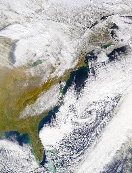
Snowfall from the January 3, 2002 storm in the mid-Atlantic states is clearly evident in this SeaWiFS image collected on January 4, 2002. The snow covered area stretches from central eastern Alabama to southern Delaware.
Metadata
-
Sensor
OrbView-2/SeaWiFS -
Visualization Date
2002-01-04