
Images & Animations
-
Credit
Image courtesy NASA/GSFC/LaRC/JPL, MISR Team.
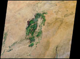
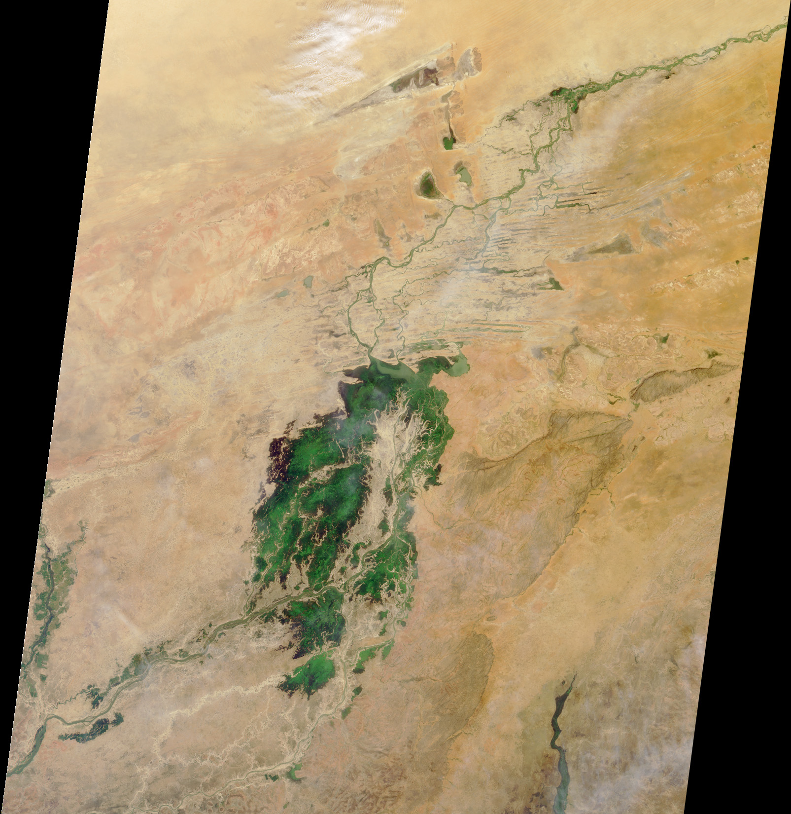
Here’s another chance to play geographical detective! This Multi-angle Imaging SpectroRadiometer (MISR) image covers an area measuring about 400 kilometers x 450 kilometers, and was captured by the instrument’s vertical-viewing (nadir) camera on October 29, 2000. Use any reference materials you like and answer the following three questions:
- <LI>The prominent green area is a seasonal wetland associated with what river?
<LI>To the east of this river is an escarpment included on the United Nations World Heritage List. Which one of the following statements cannot be applied to the people who live there?
- <LI>They live in dwellings constructed from the surrounding sandstone cliffs. <LI>They stopped making ceremonial masks at the end of the 19th century. <LI>Some writers attribute them with detailed knowledge about a binary star system. <LI>Among their major crops are onions and millet.
- <LI>Only one <LI>Exactly two <LI>All three
E-mail your answers, name (initials are acceptable if you prefer), and your hometown by Tuesday, November 6, 2001 to suggestions@mail-misr.jpl.nasa.gov.
Answers will be published on the MISR web site in conjunction with the next weekly image release. The names and home towns of respondents who answer all questions correctly by the deadline will also be published in the order responses were received. The first 3 people on this list who are not affiliated with NASA, JPL, or MISR and who did not win a prize in the last quiz will be sent a print of the image.
A new “Where on Earth...?” mystery appears as the MISR “image of the week” approximately once per month. A new image of the week is released every Wednesday at noon Pacific time on the MISR home page, http://www-misr.jpl.nasa.gov. The image also appears on the Atmospheric Sciences Data Center home page, http://eosweb.larc.nasa.gov, though usually with a several-hour delay.
Metadata
-
Sensor
Terra/MISR -
Visualization Date
2001-11-01