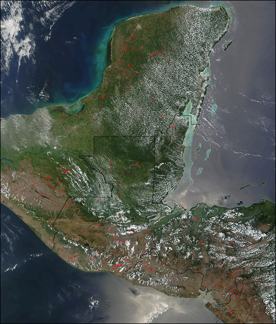
As can be seen in this true-color scene acquired on April 2, 2002, many fires dot the landscape across portions of Central America. This image spans from Mexico?s Yucatan Peninsula across Guatemala and into El Salvador and Honduras.
This image was acquired by the Moderate-resolution Imaging Spectroradiometer (MODIS), flying aboard NASA?s Terra satellite. The red boxes (click on the image above to see it at 250-meter resolution) indicate where active fires were burning.
Image courtesy Jacques Descloitres, MODIS Land Rapid Response Team at NASA GSFC
