Skip all navigation and jump to content Jump to site navigation Jump to section navigation.
NASA Logo - Goddard Space Flight Center + Visit NASA.gov
HOME PROJECTS RESOURCES SEARCH MAP

+ Advanced Search
Home
Home
View Most Recently Released Imagery
View Gallery of Imagery: A topical collection of SVS Imagery
Search Imagery by the keywords assigned to it
Search Imagery by the instruments that supplied data for a visualization product
Search Imagery by the series of visualizations that have been produced
Search Imagery by the scientist providing the data used in a visualization product
Search Imagery by the animator that created the product
Search Imagery by the identification number assigned to the visualization product
See other search options
Learn about the SVS Image Server
  + About the Server
  + Animation List
  + How to Use the Server


  + RSS Feeds
  + Podcasts


  + Opportunities
blank image
Previous Animation
Next Animation
Aqua MODIS: Snow Cover designed for Science on a Sphere (SOS) and WMS

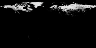
The Moderate Resolution Imaging Spectroradiometer (MODIS) provides data in 36 spectral bands, some of which are used to map global snow cover. However, MODIS can only take measurements of the surface in daylight, cloud-free areas. For this animation, valid snowcover measurements are retained over time during darkness or cloudy days until a subsequent valid measurement is found. This animation shows the dynamic advance and retreat of MODIS daily snow cover from September 1, 2002 through September 20, 2008.

This animation shows a time series of global snow cover from 2002/09/01 through 2008/09/20.    This animation shows a time series of global snow cover from 2002/09/01 through 2008/09/20.

Available formats:
  4000x2000 (30 fps) Frames
  320x160     PNG           43 KB
  160x80       PNG           12 KB
  80x40         PNG           3 KB
How to play our movies

Animation Number:3565
Completed:2008-12-18
Animators:Cindy Starr (GST) (Lead)
 Horace Mitchell (NASA/GSFC)
Editor:Vicky Weeks (HTSI)
Producer:Michael Starobin (HTSI)
Scientist:Dorothy Hall (NASA/GSFC)
Platforms/Sensors/Data Sets:Aqua/MODIS
 Terra and Aqua/MODIS/Blue Marble Land Cover
Data Collected:2002/09/01 - 2008/09/20
Series:Science-on-a-Sphere
 SoS Production - FROZEN
Keywords:
DLESE >> Cryology
GCMD >> EARTH SCIENCE >> Cryosphere >> Sea Ice >> Ice Temperature
GCMD >> EARTH SCIENCE >> Cryosphere >> Snow/Ice >> Snow Cover
GCMD >> EARTH SCIENCE >> Hydrosphere >> Snow/Ice >> Snow Cover
 
 
Please give credit for this item to
NASA/Goddard Space Flight Center Scientific Visualization Studio


Back to Top

USA.gov logo - the U.S. Government's official Web portal. + Privacy Policy and Important Notices
+ Reproduction Guidelines
NASA NASA Official:
Content Contact:
Curator: